The Dukes Cut...
The Bridgewater Canal
A unique portrait of the
Bridgewater Canal, both past and present, in words and photographs
complete with an
accurate, up to date set of linear maps plus navigational information.
An
expanded
version of the History Press (formally Tempus) book by Cyril J Wood published here in eBook format


Introduction
I have been
interested in canals and inland waterways since a child when my parents
hired canal cruisers on the Shropshire Union and
Llangollen Canals
before having a boat of their own built. I followed their example, bought my
first boat in 1983 and moored it on the
Shropshire Union
Canal at Beeston Iron Lock
before moving to the
Bridgewater
Canal in 1985. I was already aware
of the historical impact that this canal had made on inland navigation in
this country having attended
a meeting of the Manchester Branch of the I.W.A. in
1967 which
featured a talk given by the late
Frank Mullineux... the well known Bridgewater Canal Historian, on the
Worsley Mines. The information that I gained at this lecture was to sow the
seed for my appreciation and love of the Bridgewater Canal.
The more I cruised the
Bridgewater Canal
the more I appreciated its history
and
diversity.
I started to
photograph the canal and give audio/visual presentations about it to various
interested societies. In 1987 I decided to write a commentary for the A/V
presentation. This graduated into relating the canal's history as well as
describing the route and its features. I then mapped the whole canal and
combined them with the photographs and text with a view to having the finished work published
as "The Bridgewater Book" the front cover of which is illustrated below. For
various reasons this project was shelved and resurrected in 2000 as "The
Duke's Cut - The Bridgewater Canal". It was subsequently published by Tempus
Publishing the following year. It would
be very pretentious of me to say that this is the definitive publication on
the canal as each book has its own individuality and focuses on different
aspects of the canal. I have tried to produce a book that concentrates of
the “mechanics” of the canal’s history and geography concisely and without
the encumbrance of facts that the reader usually skips.
I hope that
you, the reader, gain as much enjoyment out of reading this book as I have
had producing it and that you find it a readable, informative and
entertaining piece of work that relates the canal’s history, describes it’s
route, gives invaluable information to those wishing to use it and documents
the canal with photographs of features are familiar, that have disappeared
and places that have changed beyond recognition.
I have
tried to keep abreast of changes to the canal but I apologize for any
mistakes or inaccuracies that (inevitably) may have crept into the text,
maps or photographs in this book.
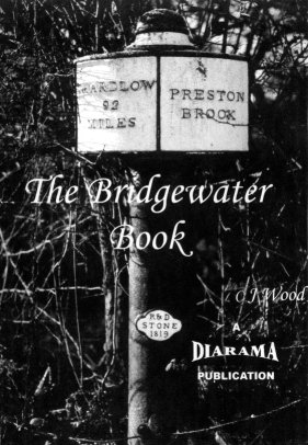
The front cover of "The Bridgewater Book"... precursor to "The Duke's Cut -
The Bridgewater Canal"
Preface to the eBook Version
Producing
an eBook (and web) version of "The Duke's Cut - The Bridgewater Canal" provides me
with the luxury of laying out the manuscript
in the
way
that I first envisaged it. That is to say having the text, photographs and
maps in the places that I would like rather than the publisher's
preferences (who I have to say have done a good job of it anyway). I have
not had to make many up-dates or changes to this book since the Second
Edition was released in June 2009. The only significant differences between
this and the preceding editions
are the layout, some additional photographs of the canal,
up-dating the original maps plus the inclusion of maps and photographs of the
Runcorn Locks Restoration Project, the River Irwell and
Upper Reaches of the Manchester Ship Canal. I have included them due to the
on-going restoration of the Manchester, Bolton and Bury Canal which is
accessed via the River Irwell. Accordingly, the Bridgewater Canal Company
Limited have relaxed regulations relating to the passage of Pomona Lock, navigation of the River Irwell
and the Upper Reaches of the Manchester Ship Canal (Salford Quays from
Lowry Footbridge going upstream). With having
the book in an electronic format (plus not
working to a publishing dead-line) also gives me the opportunity to make
the smaller corrections and modifications to the manuscript;
keeping it up-to-date, that would
previously require completely re-typesetting the book. With not being
limited to the number of photographs also allows me to reinstate some of the
previously deleted images.
The
History of the Bridgewater Canal
The first
inland navigations in
England
can be attributed to the Romans. They constructed navigable cuts known as
“Fosses” or “Dykes” in some of our rivers to bypass navigational hazards.
Three of the better known of these cuts are the Caer Dyke, the Fosse Dyke
and the Itchen Dyke. The
Carr (or Caer) Dyke ran from the River Witham at
Lincoln
to Peterborough
and the Fosse Dyke also ran from the Witham at Lincoln but connected the town with the River
Trent. The Itchen Dyke ran from Winchester to the sea. No doubt, these
artificial waterways were monumental in the development of the
Lincoln area.
Another fosse that is often overlooked in the history of our Inland
Waterways was built in the Castlefield area of Manchester to connect the
Rivers Irwell and Irk. This particular fosse was built around A.D. 84 and in
building this waterway, the Romans laid the foundation stone for a series of
waterways, the development of which, was to have a profound effect on
transport in this country at the start of the Industrial Revolution and
beyond. Unfortunately, no remains of the Castlefield Fosse can be found.
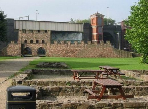
Remains of the Roman Fort at Castlefield in Manchester
Over
the successive centuries there have been a few other attempts to produce
workable navigations. The erroneously named
Exeter
Ship Canal
(which could only accommodate barges)
was constructed in
1566 by John Trew ran alongside the
River Exe in Devon. It was originally constructed to by-pass a section of the River
Exe notorious for shoals and scours, connecting Exeter to the sea. This navigation featured
the first pound locks (as against flash locks) in England. Pound locks are often
attributed to Leonardo Da Vinci but there have been locks of this type in
Holland since the
Fourteenth Century, well before Da Vinci’s birth. One of the
busiest natural waterways in the country was the River Severn. It is only
natural that it should figure somewhere in the development of the Inland
Waterways system. Two notable navigations connected to the
Severn
are the Dick Brook and the River Stour Navigation, both built by Andrew
Yarrington.
The Exeter Ship Canal in Devon
Scroop Egerton, the first Duke of Bridgewater, owned mine
workings at Worsley near Manchester,
and required a reliable means of transporting his coal not dependent on
pack horses and carts via the notoriously unreliable roads. In 1737, the Duke
commissioned Thomas Steers to investigate the practicality of making the mine’s
drainage soughs and the Worsley Brook navigable as far as the River Irwell.
Steers had considerable experience in civil engineering. He was responsible for
Liverpool’s
first dock and a survey to make the River Irwell navigable to
Manchester.
The Duke’s plan was dropped when improvements were made to the nearby River
Douglas and he died in 1745.
The Worsley Brook
The history of inland waterways navigation in this area is
complex and many schemes overlapped each other both in the historical and
geographical context. For instance, the plans to make the River Douglas
navigable caused the plans for the
Bridgewater
Canal
to be
postponed
but figured in the development of the
Leeds and
Liverpool
Canal
many years later. The River Irwell and subsequently the
Mersey and Irwell
Navigation were, one hundred and fifty years later, to be absorbed into one of
the most ambitious canal projects in England…
the Manchester
Ship Canal.
Mode Wheel
Lock on the Mersey and Irwell Navigation
1754 saw a survey to make another brook, the Sankey Brook,
navigable from Saint Helens
to the River Mersey. A local engineer, Henry Berry, carried out the survey. Work
soon started and by 1757, the
Saint Helens (or
Sankey) canal was partly open. Whilst
being called canals, all of these early works utilised an existing watercourse,
whether it be a brook, stream or river and, as such, are not canals in the
truest sense of the word but “navigations” or to use the French description…
“collaterals”. The general consensus of opinion in inland waterway circles is
that the first canal built was the
Saint Helens Canal.
This is not strictly true and open to conjecture. The definition of a canal is
of a waterway constructed independent to any existing watercourses except for
the water supply. As the St Helens
Canal
is mostly the canalised Sankey Brook, it is classed as a navigation and cannot
be called a canal in the truest sense of the word. The first true canal in Britain built
independent of a watercourse was the
Bridgewater
Canal or, as it is more
affectionately known… “The Duke’s Cut”.
The St Helens Canal - the Sankey Viaduct
Francis Egerton was the sixth son of Scroop and became the
Third Duke of Bridgewater at the age of eight when his father died. He was
sickly child and suffered an unhappy childhood, being brought up by his mother
and stepfather who showed little interest in the young Francis, and punctuated
by episodes of tuberculosis. He was educated at Eaton until the age of sixteen
when Robert Wood was appointed the young Duke’s tutor. Wood agreed to take the
young Duke on a “Grand Tour” of
Europe where he
would be exposed to the sights and different cultures of a world outside that of
England.
Francis showed an interest in the transportation system of France and visited
the Canal du Languedoc (later known as the Canal du Midi) which, with the Canal
du Lateral connects the Atlantic Ocean at Bordeaux with Sète on the shores of
the Mediterranean.
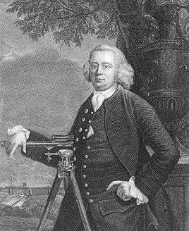
Francis Egerton... the Third Duke of Bridgewater, in later years
The Canal du Midi at Homps as Francis Egerton
may have seen it
Once the Grand Tour was over, the young Duke returned to
England
and was absorbed into
London’s
social life. It was here that he met the widowed Lady Elizabeth Hamilton (one of
the Gunning sisters, well known in
London’s
social circles) with whom he had a love affair and was to become engaged to. The
Duke dissolved the engagement due to a scandal in the Gunning family concerning
Elizabeth’s
sister, a decision that caused him much heartache.
Dismayed with London life he decided to dedicate his life
to commerce. In 1757 he left London
and headed for his mines at Worsley near
Manchester
where he took up residence in the family estate at Worsley Hall. The
relationship with his mother plus his affair with Lady Hamilton had scarred him
emotionally and he became a misogynist; hating women to such an extent that he
would not even allow female servants at the Hall.
Lady Elizabeth Hamilton (nee Gunning)
After settling in to his new life, he consulted with John
Gilbert, the mine’s agent and engineer to discuss problems associated with the
mines. It transpired that the two main problems were that of transportation of
the coal and mine drainage. At that time, the coal was carried by cart or
packhorse to the River Irwell where exorbitant charges were made to transport
the coal to
Manchester,
its main market.
Pack horses and carts transporting coal
Egerton had seen the success of the Grand
Languedoc
Canal
(Canal du Midi) and other Continental waterways on his Grand Tour of Europe and
was, no doubt, aware of the fledgling
Saint Helens
Canal
nearby. Together, he and Gilbert resurrected Scroop Egerton’s idea for a canal,
expanded upon it to incorporate an elaborate drainage system for the mines and
started to survey the route. The proposed canal would not only solve the
transportation problem and alleviate that of the mine’s drainage, it would bring
down the price of Worsley coal in Manchester, thus, making it more competitive
and an affordable commodity for the less affluent members of society. The following year, Egerton was introduced to a millwright
called James Brindley by John Gilbert. Brindley travelled to Worsley and stayed
as the Duke’s guest for six days discussing mine drainage and the proposed
canal. Five years earlier, Brindley had been involved in extensive mine drainage
works at the not too distant Wet Earth Colliery near
Clifton
(adjacent to where the disused
Manchester,
Bolton
and Bury
Canal
is today). No doubt, the success of this scheme helped to make up the Duke’s
mind when he decided to engage Brindley to make complete the survey for the
canal already started by John Gilbert.
An engraving of James Brindley
Brindley soon completed the survey and in 1759, an Act of
Parliament was passed enabling the canal to be built. The proposed route was to
run from the mines at Worsley to the River Irwell at Salford Quay with a branch
to Hollins Ferry also on the Irwell, 9.6 km (6 miles) below
Barton
Bridge.
On 1st
July 1759, work on the canal commenced,
but in November of that year the Salford Quay terminus was dropped in favour of
Dolefield and an additional Act of Parliament obtained. There is an interesting offshoot to the early history of
the
Bridgewater
Canal.
Francis Egerton’s brother-in-law was Lord Gower, who owned coalmines and
limestone quarries in the rapidly expanding industrial area of
Shropshire. His
land agent was John Gilbert’s brother… Thomas Gilbert. It is obvious that
communication had taken place between the two families that lead to the
foundation of the canal system in
Shropshire which
lead to the area being christened “The Cradle of the Industrial Revolution”. Around this time, another canal was being proposed. This
was the Grand Trunk or, as it was later to be known, the
Trent
and Mersey
Canal.
This canal was the brainchild of Josiah Wedgwood the potter and would bring clay
to his potteries, transport the finished pottery in addition to serving the
Cheshire
salt industry. It is interesting to note that two of the main promoters of the
canal were none other than Lord Gower and Thomas Gilbert. Wedgwood had also
secured the services of James Brindley to survey and build the canal. Brindley
saw the Grand Trunk as the foundation stone for a system of canals connecting
the Rivers Trent, Mersey, Severn and Thames, with other canals branching off to
serve various towns and cities. Hence the name… “Grand Trunk”, like a tree with
branches spreading out to various parts of the country.
Wedgewood's Etruria Works at Stoke on Trent
The mines at Worsley were constantly being expanded
downwards and outwards in order to reach the seams of coal that ran throughout
the area. Trips were even arranged for the adventurous to view the workings
first hand for a nominal fee. Meanwhile, construction on the Bridgewater
Canal
had been progressing from both ends. Several engineering hurdles had been
crossed and the canal had reached a major obstacle, the River Irwell. Initially,
a flight of locks were planned to lower the canal to the Irwell with another
flight to raise it up on the other side. This would have used too much of the
canal’s water resources so Brindley planned to bridge the river using a masonry
aqueduct (the stone being waste, obtained from the Worsley Mines) lined with
puddled clay (wet clay kneaded like dough) to make it waterproof.
When the Act for the aqueduct was proposed, MPs reading the
proposal called Brindley into their Chambers at the House of Commons in order
for him to demonstrate how he expected to make the bridge waterproof. Brindley
was semi-literate and often resorted to drawing diagrams with whatever was at
hand. In addition to drawing on the polished floor of the Parliamentary Chambers
he demonstrated how the aqueduct would work with the aid of a large cheese,
which he carved to represent the aqueduct, filling it with water when the model
was completed.
Worsley Delph circa 1770
Brindley
also demonstrated the theory of clay puddling by bringing buckets of water and
wet clay into the chambers. He then gave a practical demonstration of how clay
could be made waterproof by puddling and then applied to the masonry to make it,
in turn, waterproof. Needless to say,
the Act was passed and on 17th
July 1761, water was admitted to the
completed Barton Aqueduct, which opened the
Bridgewater
Canal
from Worsley to Stretford
on the outskirts of Manchester. Barton
Aqueduct was a three arched masonry structure, 183 mtrs (600 ft) long, 11 mtrs
(36 ft) wide and 12 mtrs (39 ft) high. Scepticism was rife prior to it’s
opening. It was given the nickname “Castle in the Air” and many people thought
that it would surely collapse when water was admitted. Needless to say, Brindley
proved the sceptics wrong although there was a problem when one of the arches
started to bulge. This necessitated the drainage of the aqueduct after the
opening ceremonies but was soon rectified and the canal was open to through
traffic. When posed with a problem, Brindley would often retire to his bed and
ponder the best course of action. On this particular occasion, when he rose from
his deliberations, John Gilbert had already solved it for him, completed the
remedial work, and refilled the aqueduct. Brindley’s comments on this action are
not documented.
Brindley's original Barton Aqueduct over the River Irwell
The building of the remainder of the proposed route was
progressing well and in 1763 the terminus was changed yet again making
Castlefield, near Deansgate, the eventual terminus. Also in this year, a
connection at Cornbrook was made with the
Mersey and Irwell
Navigation. This connection was known as “The Gut”, but could only be used when
there was sufficient water in the river to overcome the silting and low river
water levels. Castlefield was reached in August 1765 and, in doing so, marked
the completion of the first canal in England
to be constructed independent of a watercourse.
During the period of construction (and afterwards) the Duke
had amassed a considerable debt. He borrowed money from many people to finance
the building of the canal. When not in residence at Worsley, he was constantly
visiting possible contributors in an effort to raise extra funding. It was to be
many years before his financial labours bore fruit, the debts were satisfied and
the canal returned a profit.
Meanwhile, Brindley had not been idle. In addition to his
work on the
Trent
and Mersey
section of his Grand Trunk scheme, he had started work on the Staffordshire and
Worcestershire
Canal,
which would connect the
Trent
and
Mersey Canal
at Great Heywood Junction near Cannock Chase to the River Severn at Stourport.
In September 1761, he started the survey on another venture for the Duke of
Bridgewater. This was a canal running from a junction with his existing canal at
Stretford
to join the River Mersey at Runcorn. This line of the canal would prevent the
Mersey
and Irwell Navigation’s monopoly in this area. The locks at Runcorn would also
provide a connection to the proposed Duke’s Dock at
Liverpool,
which was not to be completed until 1774. At
this time it was decided to abandon the branch at Hollins Ferry even though two
miles of it had already been cut from Worsley. March 1762 saw the Act of Parliament for the Runcorn Line
passed on which work started immediately. Another Act of Parliament, which
concerned the
Bridgewater
Canal
directly, was the Trent and Mersey Canal Act of 1766. In addition to allowing
construction of the canal, it also contained a change to the
Bridgewater’s
original line, allowing the two canals to link up at Preston Brook near Runcorn.
Waters Meeting at Preston Brook looking towards Runcorn
In the following year, 1767, passenger traffic commenced
on the
Bridgewater
Canal
in specially constructed “Packet” boats. The boats were of lighter construction
than conventional craft to facilitate greater speed and even possessed a sharp
knife on the bows to cut the towropes of any other craft that dared to get in
their way. This service proved to be very popular and, as the canal was extended
in length, so was the service.
After
various challenges such as the aqueduct over the Infant River Mersey and the
crossing of the marshy Sale Moor, Lymm was reached in 1768. However, in the
following year, construction at the Runcorn end came to an abrupt standstill
when Sir Richard Brook, a local landowner, objected to the canal’s presence on
his estate at Norton Priory. This held up construction for a few years.
Meanwhile, at the other end of the canal, Stockton Heath had been reached. When
overseeing construction of the Runcorn end of the canal, the Duke and Brindley
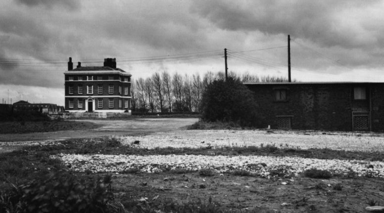
both stayed at the imposing “Bridgewater House”. This was a residence that the
Duke had built at Runcorn, situated adjacent to the flight of locks connecting
the canal to the River Mersey.
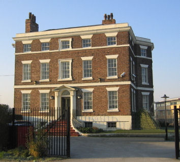
Bridgewater House in Runcorn adjacent to the Manchester Ship Canal
Brindley was a diabetic and his health was suffering. He
was continually commuting between his other canal projects; the Staffordshire
and Worcestershire,
Oxford,
Coventry,
Chester,
Calder and Hebble, and many more. His mode of transport was by horseback,
spending nights at inns and travelling in all weathers. He caught a chill, which
added to his diabetes and died on
27th
September 1772 at the age of 56.
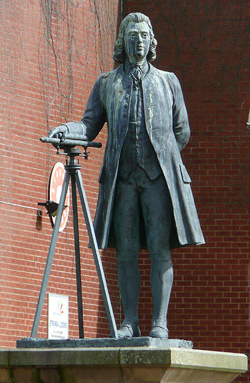
James Brindley's Statue at Etruria Junction, Stoke on Trent
1772 also saw the completion of the flight of ten locks
leading down to the River Mersey at Runcorn. They could not be used though,
until the disagreement with Sir Richard Brook had been resolved. This
disagreement lasted until 1775 when Parliament intervened and a settlement was
reached. The impact on the canal of this settlement still remains with us to
this day. This is the deviation of the canal’s route in the shape of an “s” bend
around Sir Richard Brook’s land and the changing sides of the towpath between
Old
Astmoor
Bridge
and
Norton Bridge.
The only other place on the Bridgewater
Canal
where the towpath changes sides is in
Manchester
between Old Trafford and Castlefield.
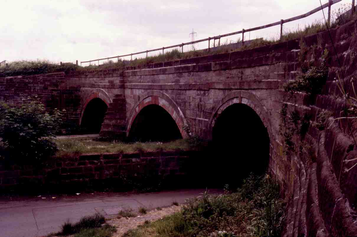
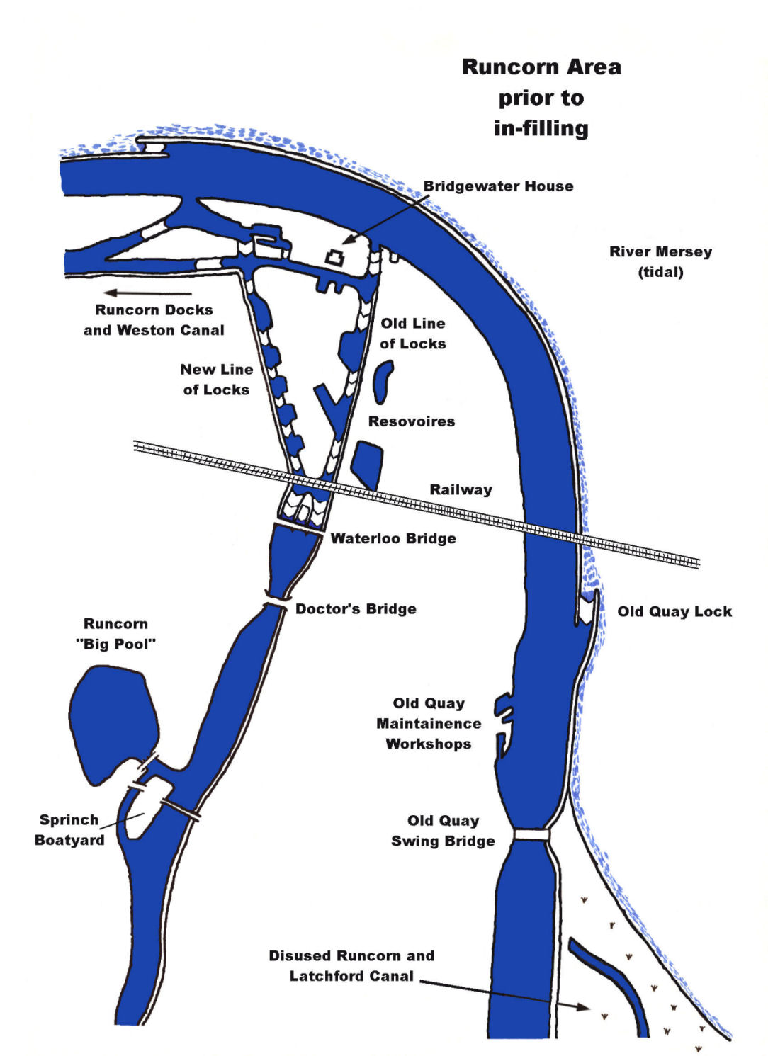
Runcorn New Line of Locks prior to infilling
Another memorable happening in 1772 was the linking of the
Bridgewater with the
Trent
and
Mersey Canal.
The actual place where the two canals meet is 10 mtrs (11 yds) inside Preston
Brook Tunnel. The spot is marked by a
Trent
and Mersey
Canal
milepost on the horse path (as the tunnel does not possess a towpath, boats were
originally “legged” through until a steam tug service was introduced) that goes
over the top of the tunnel.
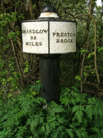
The first Trent and Mersey Canal milepost on top of Preston Brook Tunnel
Today, the entire length of the tunnel comes under
the jurisdiction of British Waterways, the
Bridgewater
Canal
commencing at the stop boards at the northern portal.

The northern portal of Preston Brook Tunnel in the 1930s
The northern portal of Preston Brook Tunnel as it is today
In January 1776, the final mile through Norton Priory was
cut and the canal opened for through traffic on the 21st March of
that year. It was a pity that James Brindley was not alive to see his canal
completed. The latter part of the Eighteenth Century saw Acts of
Parliament for two canals that would eventually link with the northern end of
the
Bridgewater
Canal.
They were the Leeds
and
Liverpool
Canal
in 1791 and the Rochdale
Canal
in 1794. It seems coincidental that two of the three cross-Pennine waterways
should be directly connected to the
Bridgewater
Canal,
and the third, the Huddersfield
Narrow
Canal,
connected via the Rochdale
and Ashton
Canals.
The Leeds
and Liverpool
Canal
was started in 1791 but it wasn’t until 1799 that part of the
Bridgewater’s
abandoned 1759 Hollins Ferry extension was extended to make an end-on junction
with the Leeds
and Liverpool
at Leigh. The part of the Hollins Ferry extension not used in the Leigh Branch
was to be used as a dump for dredgings, the remains of which, can still be seen
to this day just outside Worsley.
1795 must be mentioned for a much sadder reason, the death
of John Gilbert, agent and engineer for the Bridgewater Mines and Canal since
1757 and who, we must give some credit to, as one of the major inspirations
behind the
Bridgewater
Canal
along with Francis Egerton and James Brindley.
Right from the beginning of the canal’s history, horses had
been the prime motive force, but in 1796, an experimental steamboat was
commissioned by the Duke in an attempt to speed-up transport along the canal. By
1799 the craft was completed and sailed along the canal for the first time. The
boatmen along the canal looked upon the experimental tug with scorn, fearing
that this technological wonder would make their jobs redundant. They had little
to worry about as the stern-mounted paddle-wheel of the craft produced a large
wash that would have eroded the canal banks over a period of time. The craft was
withdrawn and broken up although it’s engine was used to power a water pump.
Even though not a success, it was to herald the change to steam propulsion that
took place over the next forty years.
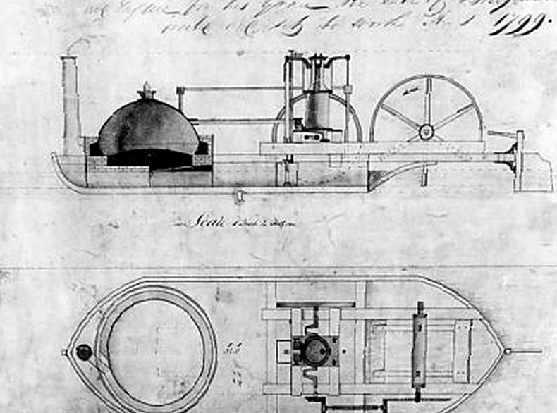
Illustration of the 1799 experimental steam boat used
on the Bridgewater Canal
By 1799, the Leigh Branch had reached Pennington and in
1800, the Rochdale
and Ashton
Canals
were opened to Castlefield. The
Rochdale,
however, was not completed and did not cross the
Pennines until
1804, the year after the Duke’s death.
The Third Duke was well liked and treated his workers with
kindness and (on the whole) respect. Even so, he was prone to eccentric
behaviour. He swore profusely, seldom washed and wore the same clothes day in
and day out. Concerned about his employees’ timekeeping, he arranged for the
clock in a turret of the works (later moved to Worsley Church) to strike
thirteen at one o’ clock signalling the end of lunch hour. On one occasion he
met a miner that was late for work and questioned him. The worker informed him
that his wife had given birth to twins during the night to which the Duke said…
“Ah well, we must accept what the Lord sends us”, to which the miner replied…
“Aye, but I notice he sends all the babies to our house and all the brass to
yours”! This reply may have pricked the Duke’s conscience as well as making him
laugh. He consequently gave the miner a guinea. As wages were paid monthly, he
arranged for employees wives to buy their groceries etc. on account at a local
shop, the bill being deducted from the workers’ salaries and the balance given
in cash, thus preventing the wages from being squandered in local hostelries.
The duke also formed a “sick club” for his workers to contribute to.
The Duke saw a demonstration of the “Charlotte Dundas”
experimental tug in 1801 and was so impressed that he ordered eight similar
craft to be built. Unfortunately the order was cancelled after the Duke’s death
in 1803 before any of the craft had been delivered.
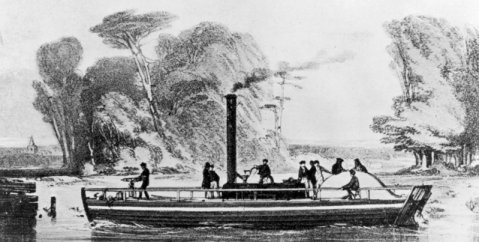
The
experimental steam tug "Charlotte Dundas"
The Duke died on the eighth of March 1803.
His will of the laid down that the main beneficiary of the canal would be his
nephew… Earl George Gower, later to become the Duke of Sutherland. It also
stated that a Board of Trustees was to be formed to look after the interests of
the Duke’s estate. The Trustees were prominent national figures, many of which
had a vested financial interest in the well being of the Bridgewater Canal
overseen by George Gower. Later on, the Trustees of the Canal were to be Local
Councils, whose provinces the Canal passed through, and remained in place until
1903. On the death of George Gower in 1833, the profits from the Bridgewater
Estate went to his second son, Lord Francis Leveson-Gower, on the understanding
that he changed his name to Lord Francis Egerton.
In 1819, the
Leeds and
Liverpool Canal Act to build a branch that joined the
Bridgewater
Canal
was passed. The two canals were to meet at a “head-on” junction at Leigh, which
was completed two years later. The following year, 1822 saw a proposal for a
railway from
Manchester
to Liverpool.
Right from the outset, the Bridgewater
Canal
opposed it’s development, seeing the far-reaching repercussions it would have on
canals.
In an effort to make it’s route more comprehensive, two
extension plans were drawn up. The first in 1823 proposed an extension from
Sale
to Stockport
but was thwarted due to oppositions from the Ashton and
Peak
Forest
Canals.
The second plan, two years later, was far more ambitious. It was to be a canal,
possibly of ship canal dimensions, to link Runcorn on the
Mersey with
West Kirby
on the River Dee coast of the Wirral
Peninsula.
This plan was thrown out for many reasons, the major one being cost. It is
possible that the latter plan was to have been carried out by Thomas Telford
who, coincidentally, later carried out a survey to construct a ship canal from
Wallasey Pool to West Kirby
and so by-pass the River Mersey Estuary, which contained navigational hazards.
Telford is reported to have said about
Liverpool… “Look,
they’ve built the docks on the wrong side of the river”, due to Wallasey Pool,
the location of Wallasey and Birkenhead Docks, being a natural harbour. Had his
plan been successful, Liverpool would undoubtedly, not have had the successes
that it ultimately enjoyed.
Wallasey Pool
The Liverpool to Manchester Railway Company went to
Parliament with their Act in 1825, only to have it opposed by a joint objection
from the Bridgewater Canal and the Mersey and Irwell Navigation. However, the
respite was only a temporary one and the Act was successfully passed the
following year. Sensing that a battle was at hand, the Bridgewater
Canal
started a regime of expansion. A new line of locks at Runcorn was built next to
the existing ones in 1827. Along with this, new warehousing facilities at
Runcorn, Preston Brook and at many other locations including Castlefield were
built. The idea behind this regime was to speed up cargo handling and hopefully,
be more competitive when the Liverpool
to Manchester Railway was completed in 1830.
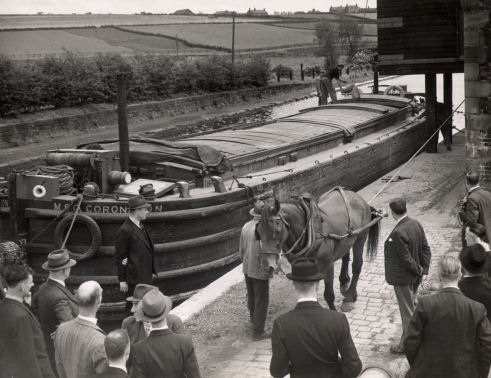
A more recent photograph of the MSC barge "Coronation" at the
Black Shed, Preston Brook
In 1833, amidst of the railway threat and expansion of the
canal’s cargo facilities, George Gower died. His son then (as previously
mentioned) changed his name to Lord Francis Egerton, First Earl of Ellesmere,
and took up residence at Worsley with his wife Harriet in 1837. Lord Egerton was
as concerned about the welfare of the workers as his namesake. His wife was also
concerned and encouraged her husband to abolish the use of children in the
mines.
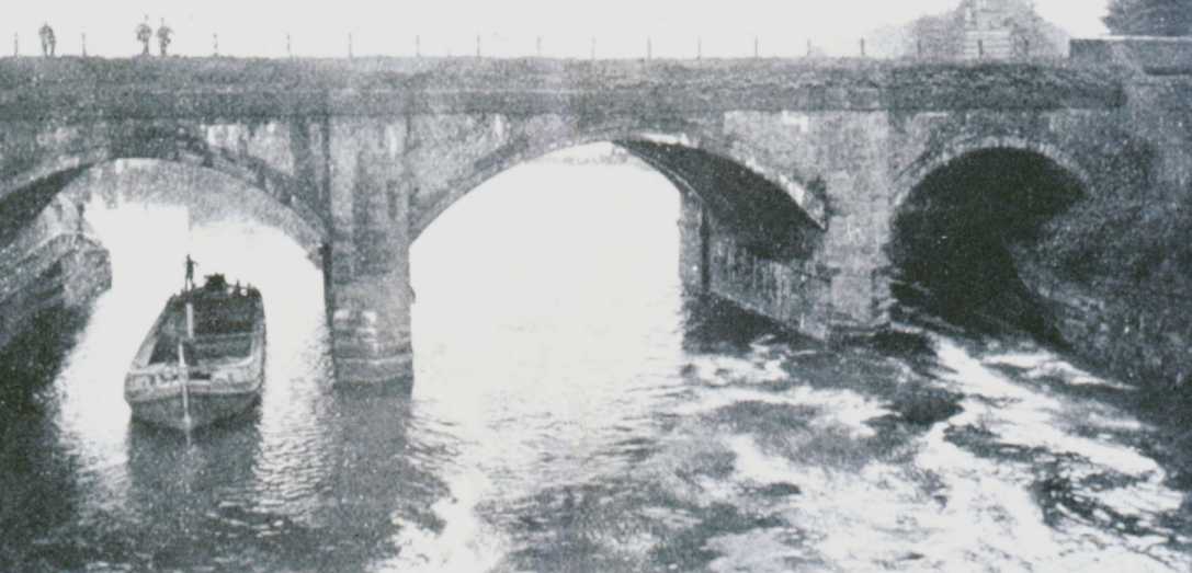
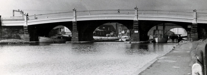
Waterloo Bridge at Runcorn - the centre arch gave access to a dry dock
Over the
years, Castlefield had been modified considerably. The main water supply to this
end of the canal was the River Medlock. At the end of the basins near Deansgate,
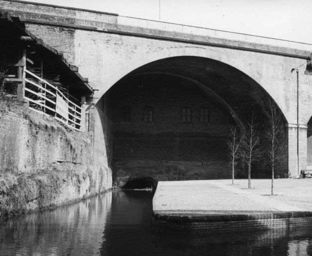
the Medlock plunged into a “siphon”. This is a tunnel that takes the river
beneath the basins to emerge beyond
Potato
Wharf. For unloading, the
boats were steered into a tunnel hewn into the rock face. The river drove a
water wheel that powered a winch used to raise goods from the boats below up to
street level. When the Rochdale
Canal was built, it’s bed
cut across the path of the tunnel, which eventually fell into disuse. The
entrance to the tunnel has been rebuilt, as has the water wheel, whose operation
can be demonstrated by guides showing visitors around the area. Part of the
other end of the tunnel can be seen at
Pioneer
Wharf,
adjacent to Deansgate, as an arch two or three feet above the water level of the
Rochdale
Canal
where
it cut across
the original line of the tunnel.
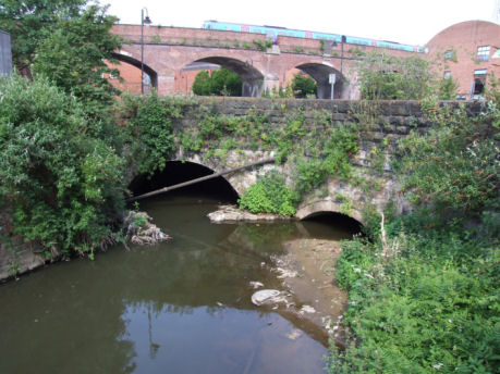
The entrance to the River Medlock Siphon Tunnel
The truncated section of tunnel can be seen to the left of Pioneer Wharf on the
Rochdale Canal
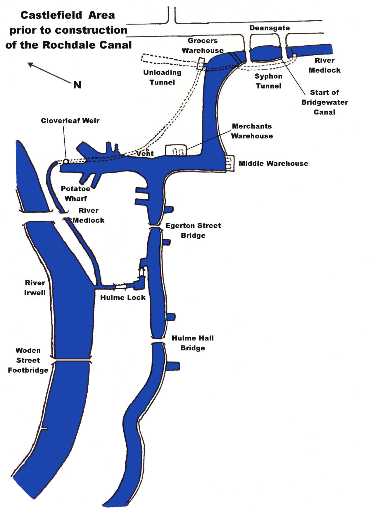
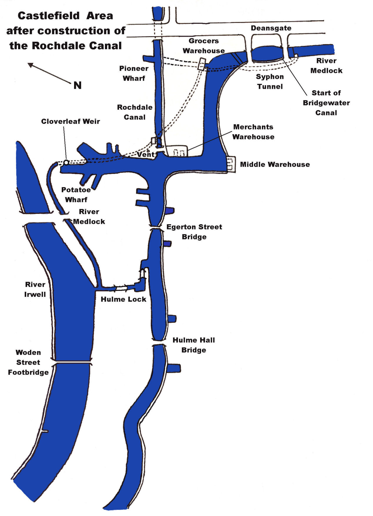
These two maps illustrate how Castlefield Terminus was
modified when the Rochdale Canal was built
The River Medlock emerging from its subterranean journey beneath the Castlefield
Basin Complex
When the
Manchester
Ship Canal
was being constructed in the 1890’s, the siphon method was again utilised to
convey rivers such as the River Gowy at Stanlow and the River Dibbins adjacent
to Mount Manisty beneath the canal. But they were on a much bigger scale than
the one at Castlefield. The Castlefield area is described in greater detail in
the
Castlefield Canal Heritage Walk section of the Canalscape
website.
The River Gowy Siphon on the Manchester Ship Canal under
construction
Another structure that has shrunk in size as the wharves
expanded was Brindley’s original “cloverleaf” weir (so called because of it’s
shape). This weir is located between Potato and Giant's Wharves at Castlefield and returned excess water from the canal to the River Medlock as
it emerged from the siphon. In 1838, most of the weir was removed for two
reasons, one - it frequently blocked, and two - the space was needed for
additional wharves.
A contemporary photograph of Brindley's Cloverleaf Weir at Potato Wharf,
Castlefield
Also in 1838, the Hulme Lock Branch was built. This branch
connected the
Bridgewater
Canal
to the River Irwell adjacent to where the Medlock runs into the Irwell. The
Hulme Lock Branch superseded the previous connection with the
Mersey and Irwell
at Cornbrook known as “The Gut”. The same year also saw the introduction of
experimental steam tugs onto the canal and a proposal for a branch to run from
Altrincham, sixteen miles to Middlewich. It would cross the
Trent
and Mersey
Canal
to join the Middlewich branch of the
Chester
and
Ellesmere Canal
(later to be known as the Shropshire
Union
Canal).
The board of the
Chester
and
Ellesmere Canal
encouraged the Bridgewater Trustees in this proposal but it came to nothing (as
could be expected) due to opposition from the
Trent
and Mersey,
Macclesfield, Peak
Forest
and
Ashton Canals.
A 1930's photograph of the Hulme Lock Branch
Despite the modernisation of cargo handling facilities and
a toll war with the Mersey
and Irwell Navigation, the railways were having a noticeable effect on the
tonnages carried along the
Bridgewater
Canal.
One logical solution to the problem would be to control trade on the
Mersey and Irwell
Navigation. They were having the same difficulties as the
Bridgewater,
as the drop in dividends paid to their shareholders could testify.
Consequently, Parliament was applied to for an Act enabling
the Bridgewater
to purchase the shares of the Mersey and
Irwell. This Act was passed and the transfer of shares took place on 17th January 1846.
The sum paid for the navigation was £550,000.
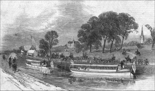
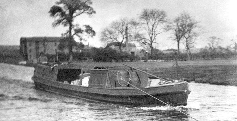
The "V.I.P. Barge" carrying Queen Victoria in 1851
The
Bridgewater
Canal,
being a commercial waterway was navigated twenty four hours a day, and did not
generally allow pleasure craft on it’s waters. However, there are always
exceptions to the rule, the first taking place in 1851 when Queen Victoria took
a trip along the canal from Patricroft to Worsley were she was to be entertained
at Worsley Old Hall. The queen refused to cross Barton Aqueduct saying that it
would be more like flying than sailing. The canal’s normal colour at Worsley is
ochre, caused by iron deposits from the water draining out of the mines. The
canal was dyed royal blue in honour of the queen’s visit. The second exception
was in 1869 when the Prince of Wales took a trip from Worsley to Trafford for
the opening of the Royal Agricultural Show. On both these occasions the craft
used was the “V.I.P.” Barge, later to be used as an inspection launch. The boat
was permanently kept at Worsley in the boathouse adjacent to the dry-docks. The
"V.I.P. Barge" is sometimes referred to as the "Duke's Barge" and the "Royal
Barge". It
was later converted to diesel power and was in use up to 1948, when it was
broken up. In later years, the Duke encouraged his rich landowner friends to
have “gondolas” as he called them, built to use on the canal for leisure
purposes.
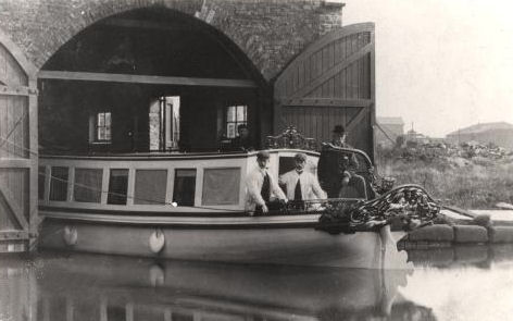
The "V.I.P. Barge" emerging from the Duke's
Boathouse in Worsley circa 1906
Whilst the acquisition of the Mersey
and Irwell Navigation, no doubt, helped to boost the canal’s financial position
in the face of the railways, it still needed to be competitive. By 1860, the
Mersey
and Irwell was so silted-up that it was impossible for all but the shallowest
drafted craft to reach
Manchester.
Consequently, in 1872, a new company was formed to inject capital necessary for
the dredging of the Mersey
and Irwell and increased warehousing, as well as new cargo handling equipment on
the Bridgewater
Canal.
This also included the purchase of the steam tugs after their successful trials
had been completed. The new company was called the “Bridgewater Navigation
Company Limited”. It is ironical that the many of the shareholders also held
shares in railway companies and that the body collecting shares for the trustees
of the company was a collection of railway companies.
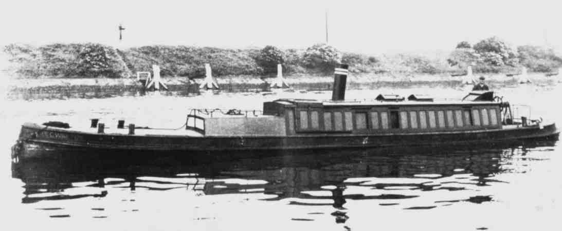
The MSC "Walton"... one of the fames "Little Packets" seen here on
the Manchester Ship Canal
The tugs that were purchased were the famous “Little
Packets”. These were steam-powered vessels, 18.3 mtrs (60 ft) in length, powered
by a single cylinder horizontal engine driving a 1 mtr (3ft) propeller.
Initially, five tugs were ordered and, so successful were they that by 1881
their numbers had risen to twenty six. These vessels were in regular use on the
Bridgewater and adjacent
waterways (hence the 18.3 mtrs/60 ft length) until the 1920’s, when some were
converted to diesel power and the remainder either sold or scrapped. Those
converted to diesel power soldiered on until the 1950’s when more modern
replacements were purchased. For many years, the hull of one of these tugs could
be seen out of the water at one of the “wides” (lakes connected to the canal
caused by salt mining subsidence) on the Trent
and Mersey
Canal
near Middlewich before being bought for restoration. The man behind the
introduction of the tugs was the new General Manager and Engineer of the
Bridgewater Navigation Company Limited, and someone that you will be hearing
more of later… Edward Leader Williams.
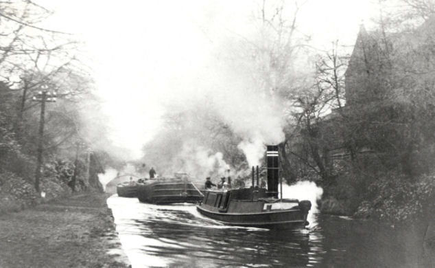
A Bridgewater Tug pulling a train of barges through Walton Cutting
Prior to 1865, craft were “legged” through Preston Brook
Tunnel. This involved a plank laid across the bows of a narrow boat on which two
men would lay on their backs and propel the boat through the tunnel by “walking”
along the tunnel roof. Gangs of men were employed solely for this task. In the early part of 1865, steam tugs similar to the type
used for towing on the canal were introduced for tunnel passage duties. Not long
after their introduction, a tug driver and his stoker were overcome by smoke
caused by the lack of ventilation inside the tunnel. Consequently, Mister
Forbes, the Trent and
Mersey
Canal’s
Resident Engineer, ordered four ventilation shafts to be sunk to ease the
situation. Whilst the shafts were being sunk, traffic (including the steam tugs)
continued to pass through the tunnel. In May of 1865, two maintenance workmen
constructing the vents, hitched a work boat onto the end of a train of boats
being towed through the tunnel by a steam tug. They too were overcome by the
smoke, one of which fell into the tunnel and subsequently drowned. At an inquest
into the workman’s death, the Coroner ordered that the tugs must not be used
until the ventilation shafts were completed.
The Preston Brook Tunnel Tug... note the wheels to ensure the tug stays in the
centre of the tunnel
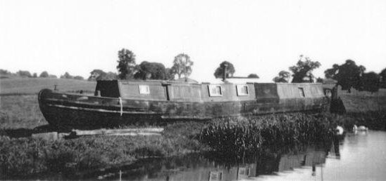
Another type of familiar craft on the
Bridgewater
was the passenger or “Fly” boats that plied the length of the canal daily. One
such craft was the “Duchess Countess” built in 1871.
These specially built light weight narrowboats were pulled
by teams of horses that were regularly changed at the way stations that also
possessed stables. The boats were given priority over other canal traffic and
featured a knife on the bow to sever the tow lines of any boats getting in the
way.
As well as conveying passengers they also carried perishable goods and even
cattle. There was a ring attached to the boat's hold specifically for securing
cattle to.
The "Duchess Countess" on the Bridgewater Canal
The "Duchess Countess" at Lymm in 1927
The
"Duchess Countess" was the last remaining example
of these boats and after retiring from service the home to Mr
Mackey who was a recluse a
recluse before ending her days on the banks of the Llangollen Canal at
Welsh Frankton as a hen house where she was broken up in 1960. There is a
restoration society dedicated to constructing a replica of this historic boat.
The Fly Boat "Duchess Countess" on the canal bank at Welsh Frankton prior
to being broken-up in 1958
The Bridgewater Navigation Company Limited was a fairly
short-lived company. In 1885, the Bridgewater
and Mersey
and Irwell navigations were bought by the newly formed Manchester Ship Canal
Company. The
Manchester
Ship Canal
was proposed by Daniel Adamson, a
Manchester
businessman, in 1882 and was to be a waterway capable of conveying ocean-going
ships from Eastham on the River Mersey to a proposed dock complex close to the
centre of
Manchester.
It would be following the same route as the
Mersey and Irwell
Navigation from Runcorn to
Manchester
with several new cuts and extensions, plus a completely new section from Eastham
on the Wirral to Runcorn, effectively hugging the banks of the River Mersey
Estuary. The plans were very similar to an earlier scheme proposed by Hamilton
Fulton in 1877 and the plan was vigorously opposed by many groups including the
City of
Liverpool who were afraid
that the competition from the Ship Canal would adversely effect the city’s
livelihood. After a long, protracted battle, the Act of Parliament was passed on
the third reading and Lord Egerton cut the first sod of earth on 11th
November 1887. The construction of the Ship canal only directly affected
the
Bridgewater
Canal
in two ways. The first was that at Runcorn, access to the River Mersey could
only be gained by crossing the ship canal to Bridgewater Lock or by sailing down
it’s length to Eastham. The second change was at the famous Barton Aqueduct.
This would have to be demolished due to the limited headroom of Brindley’s
original structure.
The original Barton Aqueduct during demolition with the completed Swing
Aqueduct in the background
Projected schemes for the aqueduct’s replacement included
locks to lower craft to the level of the Ship Canal and up the opposite side (as
in the Bridgewater Canal’s original proposal) and a vertical lift similar to
that at Anderton connecting the Trent and Mersey Canal with the River Weaver.
The lift at Anderton was the brainchild of the engineer for the River Weaver who
was, none other than… Edward Leader Williams (although designed and built by
Edwin Clark), the engineer for the Ship Canal. The design that was eventually
settled on was for a “swing aqueduct”. The Swing Aqueduct and the proposed swing bridges on the Ship
Canal were to be of similar design to the road bridges that spanned the River
Weaver (also designed by Edward Leader Williams). The aqueduct would pivot on an
island built in the centre of the Ship Canal and would swing, full of water, to
allow ships to pass either side. The navigation trough would be sealed at either
end prior to swinging by lock gates to conserve water.
Two different views of
Barton Swing Aqueduct
A rare collectors' card of Barton Swing Aqueduct
Its dimensions are...
Length - 71·6 mtrs (235 feet)
Width - 5·5 mtrs (18 feet)
Depth of water - 1·8 mtrs (6 feet)
Total weight - 1400 tons (800 tons of which is water
Height above Manchester Ship Canal - 11·5 mtrs (38 feet)
A staged photograph showing the aqueduct swung with a boat (complete with
horse and crew) on it
The weight of the aqueduct is supported by 64 steel
rollers, but when swung, a greased hydraulic ram takes some of the weight off
the rollers. The swinging action is achieved hydraulically, being controlled
from a tower on the island that overlooks both the aqueduct and the adjacent
Barton Road
Bridge.
The aqueduct was completed in July 1893 and only then was Brindley’s original
structure demolished in order to maintain
through traffic on the
Bridgewater
Canal.
On the northern bank of the Ship Canal remains part of one of the buttresses and
approach embankments of the original aqueduct in addition to the site of the
Barton Road Aqueduct where the road was spanned by another smaller aqueduct.
Even though Brindley’s original aqueduct was demolished, there remain two similar
structures. The first is adjacent to the Old Watch House at
Stretford. This
is the Hawthorn Lane Aqueduct and even though built on a smaller scale, is
reminiscent of it’s larger brother. With Brindley’s Barton Aqueduct out of the
way, the finishing touches could be made to the Ship Canal in preparation for
it’s opening on
1st
January 1894, having cost £14,347,891 to
construct.
Hawthorn Lane Aqueduct... a scaled down version of the original Barton
Aqueduct
The second is at Prestolee near Bolton on the
Manchester, Bolton and Bury Canal. Whilst not built by James Brindley it was
built in 1796 and is similar in construction except for having four arches plus
an "accommodation Arch" allowing access between fields.
The similarities don't end there... it even carries the Manchester, Bolton and
Bury Canal across the same river... the River Irwell.
The Prestolee Aqueduct carries the Manchester, Bolton and
Bury Canal across the River Irwell
Overshadowed by the excitement of the Ship Canal’s opening
was the closure of the Worsley Mines, the original reason behind the canal’s
construction. The two entrance portals gave access to no less than 74 km (46
miles) of subterranean canals serving coalfaces on several different levels. The
miners travelled to the coalfaces by boat
and
down access shafts.
The mined coal was loaded into wooden or iron boxes or containers. The
containers were then loaded into special boats called “Starvationers”, so called
because of their exposed ribs. They qualify as being the first container boats
in existence. The “starvationers” made their way out of the mines loaded with
containers, negotiating the different levels within the mines by means of
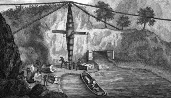
subterranean locks or revolutionary inclined planes, also situated underground.
Subterranean canals inside the mines at Worsley
1890 saw the founding of Sprinch’s Boat Yard at Runcorn
along with the straightening of the canal’s route adjacent to the yard.
Originally, the canal swung around a sharp bend going towards Runcorn and passed
next to the “Big Pool”, a natural lake that Brindley took advantage of when
constructing the canal. After passing by the pool, the canal took another sharp
bend before proceeding towards
Waterloo
Bridge
(the present terminus of the canal at Runcorn). When the boat yard was built,
one of the entrance arms to the pool was filled-in and utilised for the location
of a dry-dock and slipway. Access to the pool was retained by the arm north of
the yard. The straightening out of the bends took the canal to the front of the
yard, as it is today. The dry dock and slipway are still in use today, being
controlled by the Bridgewater Motor Boat Club.
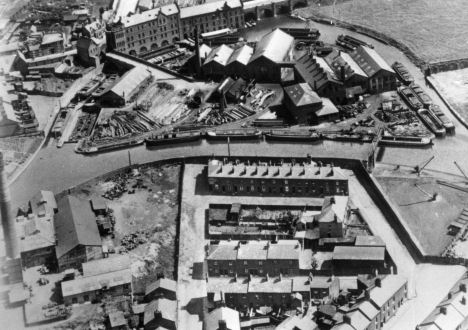
In this 1930's aerial view of the Sprinch Boatyard the original line of the canal
can be seen
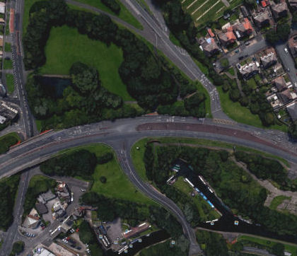
This contemporary aerial photograph shows the line of the Sprinch Arm and the
location of the Big Pool
(Photograph - Google Earth)
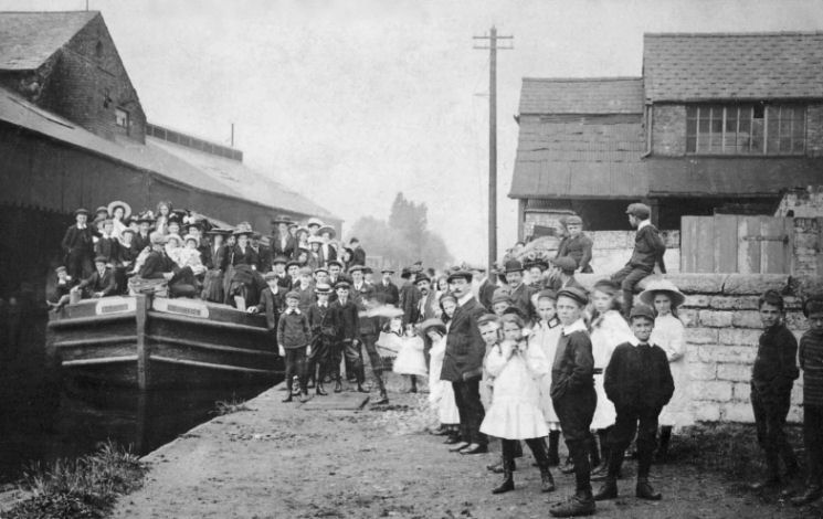
A Sunday School Outing loading at what is now Thorn Marine - Stockton Heath
in the early 1900's
The canal
entered the Twentieth Century uneventfully. Trade was gradually falling and
carried on falling to such a low level that, in 1939, Brindley’s original line
of locks at Runcorn were closed through lack of use, being in-filled in 1948.
Throughout the early part of the twentieth century, the canal between Worsley
and Leigh has been continually affected by mining subsidence. This lead to need
for the canal banks to be reinforced on a grand scale, the work being funded by
the organization responsible for mines at that time - the National Coal Board.
The embanked Bridgewater Canal towering over the subsided landscape near
Leigh
In 1952, new life was injected into the canal by allowing
pleasure craft to use the canal for leisure purposes. Boating clubs started to
spring up along the canal, the first of which was the Bridgewater Motor Boat
Club at Runcorn. Today, their clubhouse stands on the site of Sprinch’s
Boatyard, which burnt down and closed in 1935. Other cruising clubs are situated
at Lymm,
Sale,
Stretford
(The Watch House), Worsley and Preston Brook. Today, most of the clubs have
moorings at more than one location usually of the “linear” variety (along the
side of the canal).
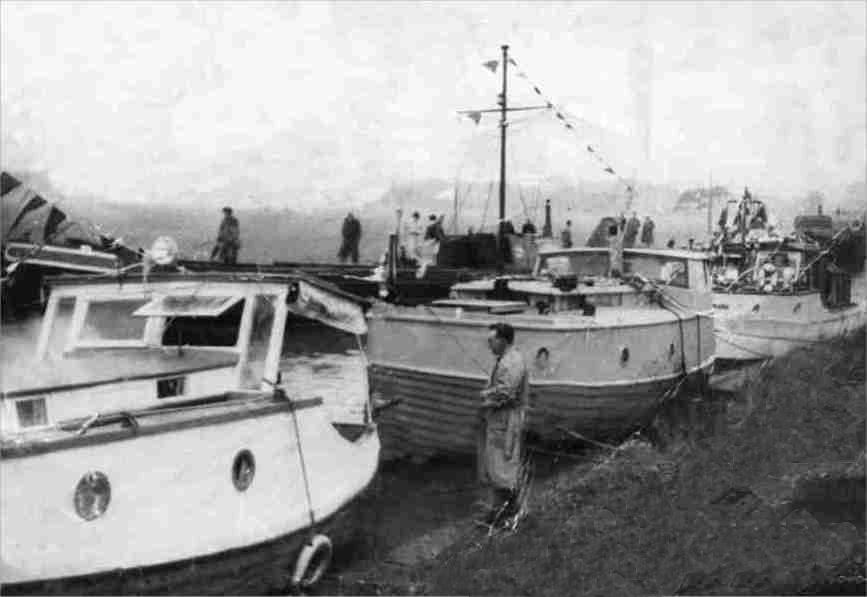
An early boat rally on the Bridgewater Canal in the 1950s
Commercial traffic continued to diminish and in 1966, the
New Line of locks at Runcorn was in-filled, leaving this end of the canal a
cul-de-sac, terminating at
Waterloo
Bridge.
The canal was severed here in preparation for the building of the new Runcorn
Expressway, part of a road network essential to the development of Runcorn New
Town. A little thought from the developers would have enabled the line of the
canal to be retained for possible future restoration.
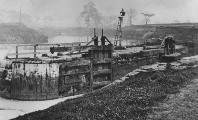
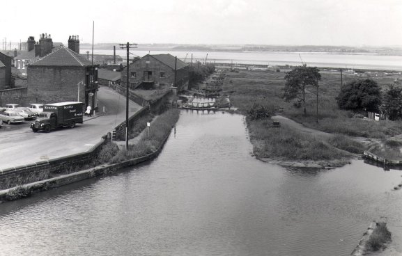
Basin close to the bottom of the
Old Line of Locks probably in the 1930s
A little further up the locks looking downhill
The same location after abandonment in 1966 with Bridgewater
House just visible on the left
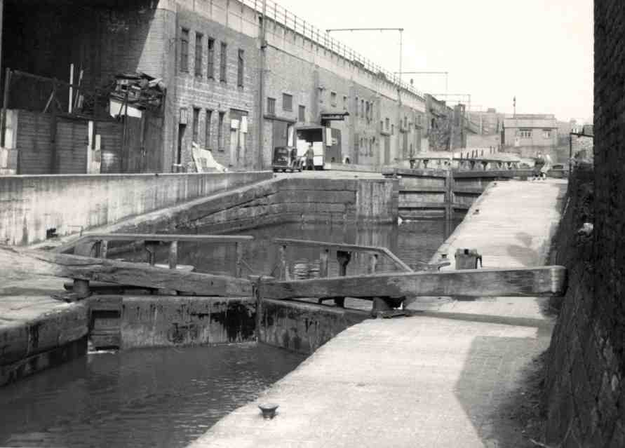
The New
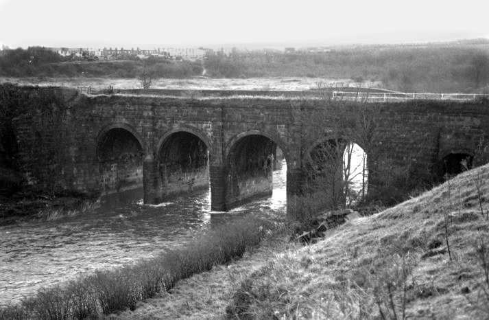
Line of Locks at Runcorn prior to in-filling
Mersey flat being poled through the flight
Looking down the Old Line of Locks
The railway viaduct and lock looking up-hill
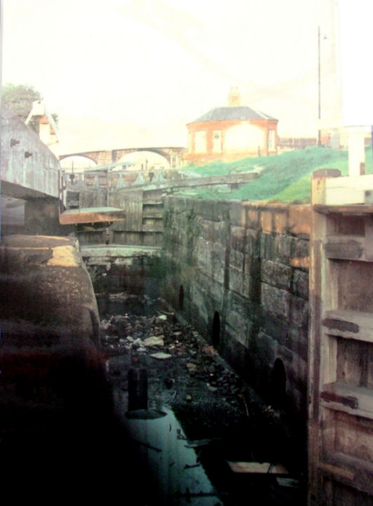
The next lock up towards Waterloo Bridge
Waterloo Bridge pre-1966 prior to the infilling of the Runcorn Locks
The site of the old line of locks is still traceable today.
The area had been landscaped and a footpath passes through the centre of what
were the once busy lock chambers. However, when the Mersey Second Crossing (the
new Runcorn-Widnes Bridge) is completed, the approach roads to the original
bridge will be realigned, allowing the canal to be reopened beneath Waterloo
Bridge and connect with the Manchester Ship Canal adjacent to Bridgewater House
(now a College).
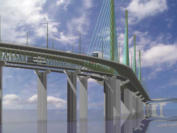
A view of how the proposed new Runcorn/Widnes Bridge aka the Mersey Gateway
should have looked.
Note the double-deck design with a light railway or tram lines beneath the road
deck
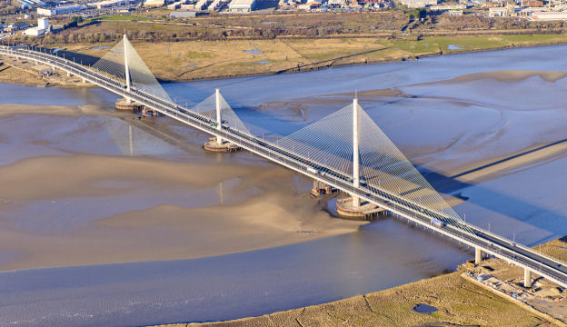
A photograph of the completed Mersey Gateway Bridge
showing the two older bridges
A
photograph of the completed Mersey Gateway Bridge from the Fiddler's Ferry side
Bridgewater House once stared over a forlorn and overgrown
wasteland. Today it is a college and is surrounded by a development area. The
original lock gates that were removed from the canal when it was in-filled had a
new lease of life when they were utilised on the restoration of the
Upper Avon. Maybe
it will not be too long before the canal at the side of it is in use once more.
Bridgewater House in 1986 prior to regeneration or the surrounding area
There is a growing amount of interest and support for the
restoration of the canal leading down to the Manchester Ship Canal (see the
route description of the
Runcorn Arm), allowing access at the Runcorn end of the
canal to the
Manchester
Ship Canal
which also connects with
the Runcorn and Weston
Canal
leading to the River Weaver Navigation. Although this restoration would be a
formidable task, bearing in mind the new canal connecting Liverpool’s
Albert Dock to the Leeds and Liverpool Canal, the construction of the Ribble
Link on the Lancaster Canal, the restoration of the Anderton Lift, Standedge
Tunnel, the Huddersfield Narrow and Rochdale Canals, it would not be an
impossible or impractical project.
Where the preserved route of Runcorn Locks meets the
Manchester Ship Canal
With the depletion of commercial
traffic on the upper reaches of the Ship Canal, the reinstatement of Runcorn
Locks could create three new
cruising routes for pleasure craft. One, up the Ship Canal to Manchester and
onto the Bridgewater Canal at Pomona Lock. the
second, downstream to
the Runcorn and Weston
Canal
leading to the River Weaver Navigation and onto the Trent and
Mersey Canal via the Anderton Boat Lift which was re-opened to boats at Easter of 2002.
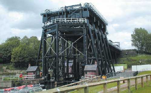
Anderton Boat Lift after restoration
Apart from creating new bridges and closure of the previously
mentioned locks, the Runcorn Expressway also necessitated the filling-in of the
Big Pool. Although part of it still remains, it is not connected to the canal
except by a small drainage culvert. With a little foresight, it could have been
converted into a marina for pleasure craft, but sadly, this was not to be. One
of the arms of the canal that gave access to the Big Pool is used by BMBC for
off-line moorings.
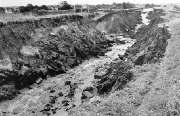
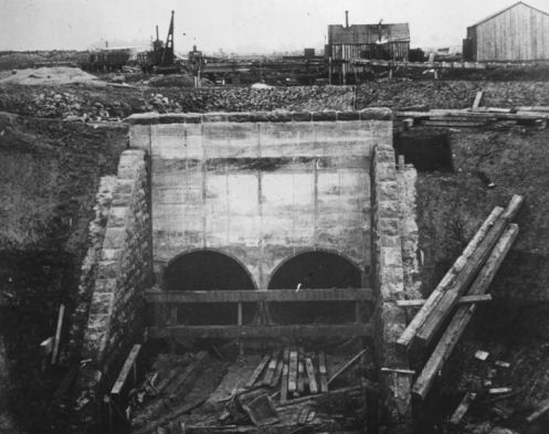
The 1971 breach at Bollington
In 1971, a breach occurred on the embankment over the valley
approaching the River Bollin Aqueduct. As a result, part of the embankment and
aqueduct were swept away. A new channel was constructed using concrete and
steel. The remaining part of the aqueduct was also reinforced and remedial work
closed the canal to through traffic for two years. This was not the only
breach in this area. Earlier in the century there was a breach at Lymm and the
photograph below shows the canal drained where Lymm Cruising Club is today. Note
the entrance to "Lymm Tunnel"... which gave access to the coal wharf beyond.
Breach at
showing where Lymm Cruising Club is today in the early 1900's
Two photographs of coal being unloaded at Barton Power
Station in the 1950's
Commercial traffic ceased on the canal in 1974. This
coincided with the opening of a new marina at Preston Brook, opposite the old
Norton Warehouses. Preston Brook Marina offers secure moorings off the main line
for over 300 craft. There is an exclusive housing development on the canal
opposite the marina known as “Marina
Village”,
which successfully integrates the canal into an urban development scheme and was
the first of many such projects to line the canal.
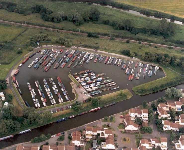
An aerial photograph of Preston Brook Marina
The
occasional commercial narrowboat can still be seen on the canal today,
delivering coal, not to a factory or power station, but for domestic
consumption. These floating coalmen are greatly appreciated by boat owners whose
craft are fitted with solid fuel stoves and enjoy boating out of season.
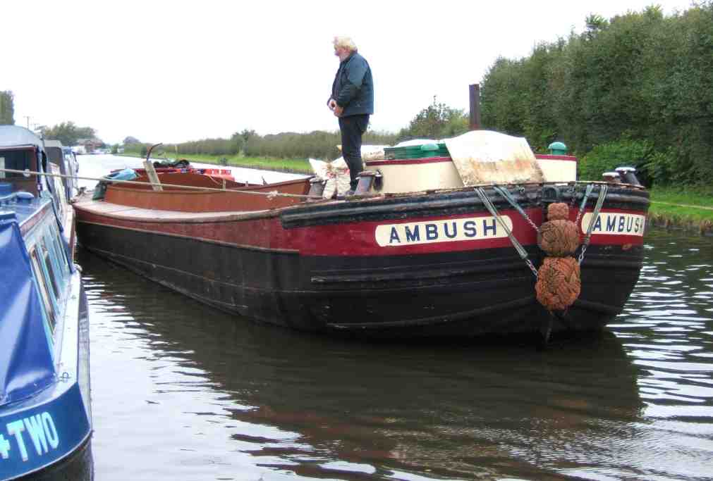
Derek Brent with "Ambush" delivering gas, fuel and coal
Although not strictly part of the Bridgewater
Canal,
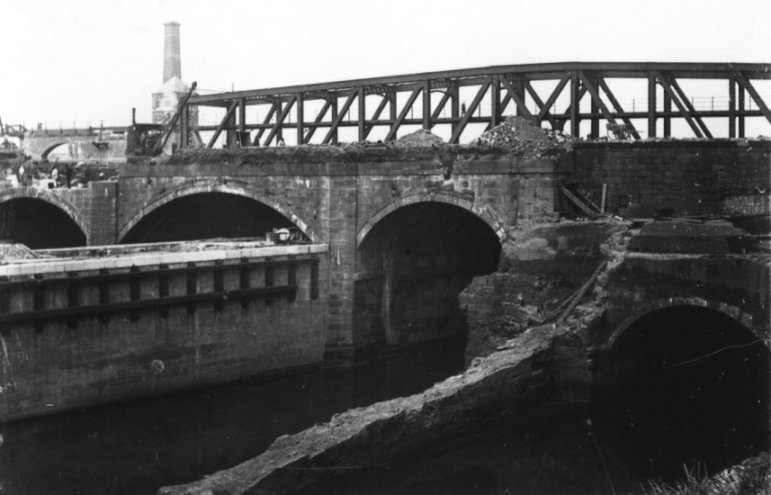
part of Preston Brook Tunnel collapsed in November 1981. A large crater appeared
adjacent to the Post Office above the tunnel. The formation of the crater sent
many tons of debris falling into the tunnel below and damaged a 37 mtrs (121 ft)
long section of the tunnel bore. The Post Office was damaged beyond repair and
demolished, the crater filled-in and the damage to the tunnel was repaired using
concrete sections. The site of the crater is marked on the surface by a round
inspection shaft, the size of which can only be appreciated by looking upwards
whilst passing through the tunnel. The tunnel was re-opened in April 1984, thus
ending two and a half years of isolation for the southern end of the
Bridgewater
Canal
and the northern end of the
Trent
and
Mersey Canal.
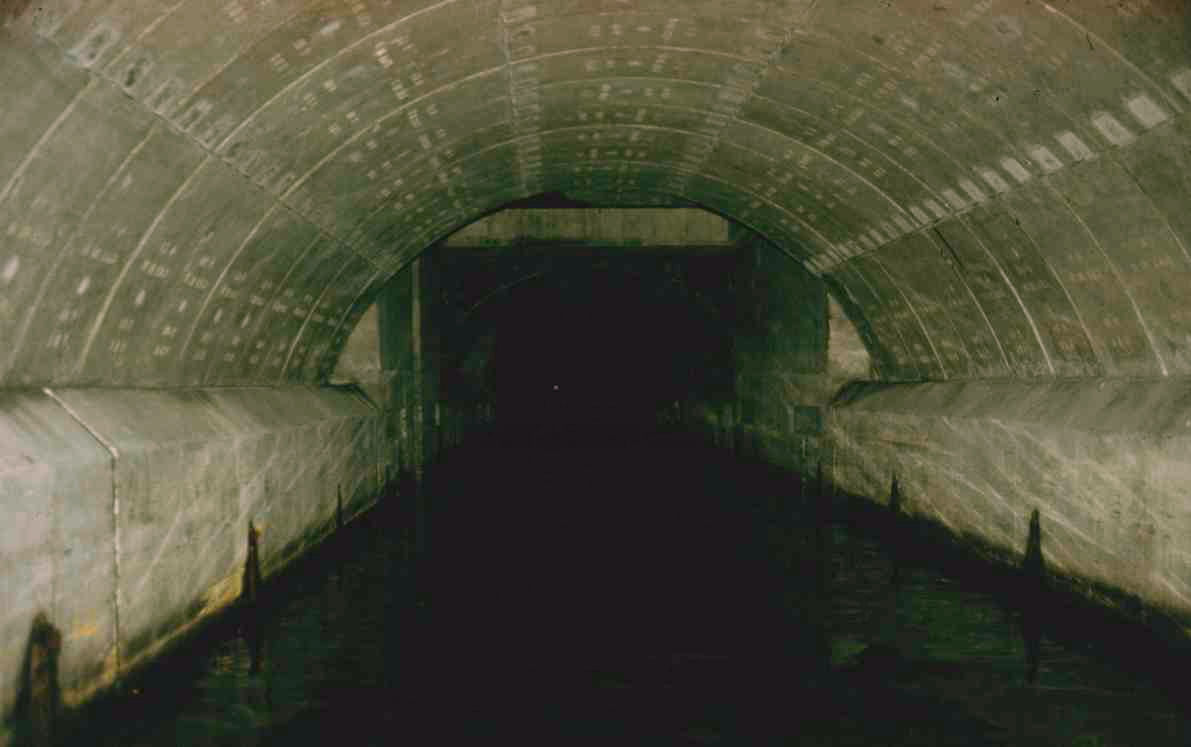
The rebuilt section inside Preston Brook Tunnel nicknamed "The Cathedral"
Also in 1984, Bridgewater Estates were purchased by Peel Holdings plc, the
property development company. They also purchased the Manchester Ship Canal
Company shortly afterwards. The traffic on the Upper Reaches of the Ship Canal
had already diminished, leaving acres of quayside and warehouse land ripe for
development. One of their first projects was the construction of an office
development at what is now Salford Quays, followed by the Trafford Centre. The
latter is a prestige shopping centre built adjacent to
Trafford
Park. It features 1.4 million square feet
of shopping area, 280 shops, 35 restaurants, a 20 screen cinema and car parking
space for 10,000 cars. and also a dedicated mooring place for boats that is
monitored by CCTV. Peel Holdings plc also own Liverpool’s
John
Lennon
Airport
and Doncaster’s Finningly Airport.
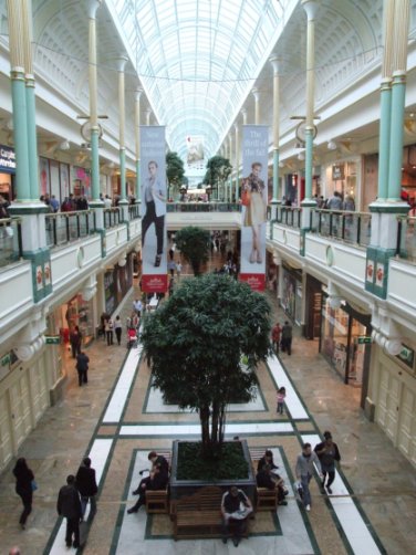
Inside the Trafford Centre
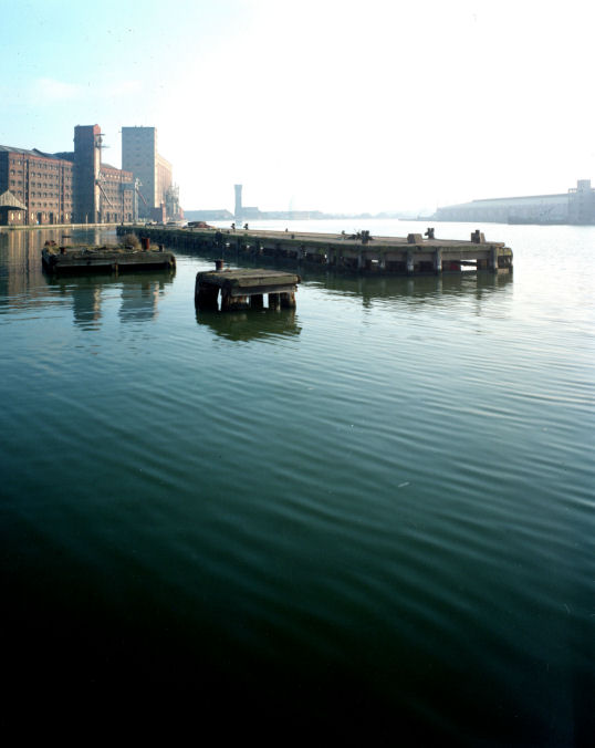
Boats descending Pomona Lock
Today, the
Bridgewater
Canal
is much the same as it was over two hundred years ago. There have been obvious
changes throughout that period, most of which have been previously documented.
The connection with Manchester Docks via Hulme Lock was replaced in 1995 with
the new Pomona Lock. The new lock gives access to the Pomona Number Three Dock
and is the only lock on the
Bridgewater
Canal
(unless the Runcorn Locks are restored). Castlefield has undergone a radical
change since Peel Holdings took over responsibility for the canal. Some of the
old warehouses have been demolished to make way for modern amenity buildings
such as the Y.M.C.A. and new theme pubs. In a more dramatic vein, the Middle
Warehouse has been completely refurbished and is now used for up-market
apartments, flats and offices. The building also houses
Manchester’s
“Key 103” and “1152” radio stations on the ground floor. The wharf area has been
landscaped and new bridges built to continue the towpath around to areas
hitherto inaccessible. Grocer’s Warehouse has been partially rebuilt and houses
a replica of the water wheel and winch driven by the River Medlock.
Modern developments lining
Castlefield
Developments have taken place at Salford Quays and along
the whole of the Manchester Docks complex the warehouses and factories have been
replaced by buildings such as the Lowry Centre and the new Imperial
War
Museum
– North. Looking towards the future, there are plans to build on the area
adjacent to Pomona Dock and to convert Pomona Dock itself into a marina. These
developments could not be further away from the previous occupants of the area
as the theme of the docks has shifted from industry to business, leisure,
tourism and housing. There may also be a development of the canal adjacent to
the Trafford Centre when the extension to the Metrolink line has been completed.
Pomona Dock and the River Irwell (Upper Reaches)
On
3rd July
2005, a sluice gate adjacent to Potato
Wharf
at Castlefield sprang a leak and emptied millions of gallons of water into the
River Medlock. As it was a Sunday evening and there were no engineers available
to stem the flow of water immediately, millions of fish were put at risk not to
mention narrowboats being stranded in the basins. By the time
the leak was stopped on Monday morning, stop boards had been put in place at
Sale,
Oldfield Brow (situated close to Seaman’s Moss Bridge at Altrincham and Barton
Aqueduct
but
even so, water levels had dropped by over a metre on the main line and
Castlefield Basins were completely emptied. Water levels gradually started to
rise by the middle of the week but it was nearly two weeks before the levels
were deemed “normal”.

The location of the breach between Giant's and Potato
Wharves
A drained Castlefield in July 2005
The ochre
or orange colour of the water at Worsley has been one of the canal's features
since its opening. This was due to a concentration of iron oxide in the water
draining from the mines. In 2004 work commenced on a water treatment plant to
help clean up the water. Water was extracted from the Delph and pumped to the
treatment plant located next to the M62 Motorway Viaduct, treated in a series of
filter beds before returning it to the canal. This plant became operational in
2005 and since then the colour of the water has diminished in intensity.
Outfall from the water treatment plant at Worsley - note the
filter beds in the background
The Bridgewater Canal was host to the 2005 National
Waterways Festival... the second time in twenty years the canal has been the
location of this prestigious boat rally. The Festival was held at
Castlefield in 1988 but, for the 2005 rally, Preston Brook was the
location.
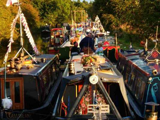
Boats attending the 2005 IWA Rally at Preston Brook
In April of 2009, a new company was formed within Peel
Holdings to look after the administration of the Bridgewater Canal. This company
is known as the Bridgewater Canal Company Limited and operates independently of
the Manchester Ship Canal Company.
The Bridgewater is a deep, broad and (virtually)
lockless waterway that offers a breathing space for the boater before ascending
the Rochdale Nine, Wigan Twenty-One or Heartbreak Hill (the name given to the
climb from Cheshire
into Staffordshire) on the Trent
and Mersey
Canal. The canal is full of contrasts,
from Manchester
to Dunham Massey, or from Runcorn to Walton. These contrasts are enjoyed by many
thousands of people each year and add to the unique character of Britain’s first
waterway to be built independent of a watercourse, Britain’s first true canal… the Bridgewater
Canal.
Return to Contents
|
|
|
84AD
|
Fosse constructed at Castlefield by Romans
|
|
1737
|
Scroop Egerton commissioned Thomas Steers to
investigate making Worsley Brook and mine soughs navigable
|
|
1745
|
Improvements made to River Douglas
|
|
1754
|
Survey to make Sankey Brook navigable by Henry
Berry
|
|
1757
|
Saint Helens
Canal partially open
|
|
1757
|
John Gilbert appointed mine manager at Worsley
|
|
1757
|
Francis Egerton takes up residence at Worsley
|
|
1758
|
James Brindley introduced to Francis Egerton by
John Gilbert and visited Worsley
|
|
1758
|
James Brindley completes survey for
Bridgewater
Canal
|
|
1759
|
First
Bridgewater Canal
Act of Parliament
|
|
01/07/1759
|
Construction commenced on
Bridgewater
Canal
|
|
11/1759
|
Terminus changed from Salford Quay to Dolefield and
the necessary Act of Parliament passed
|
|
17/07/1761
|
Act of Parliament for Barton Aqueduct passed
|
|
1763
|
Terminus changed yet again from Dolefield to
Castlefield
|
|
1763
|
Connection made to Mersey
and Irwell Navigation at Cornbrook (the Gut)
|
|
08/1761
|
James Brindley surveyed the line from
Stretford to Runcorn
|
|
03/1762
|
Act of Parliament passed allowing construction of
line from Stretford
to Runcorn
|
|
07/1765
|
Canal constructed to Castlefield
|
|
1766
|
Act of Parliament passed allowing construction of
the Trent and
Mersey Canal
including deviation of the
Bridgewater
Canal allowing a
junction at Preston Brook
|
|
1767
|
Passenger carrying commenced on the
Bridgewater
Canal
|
|
1768
|
Construction of the new line reached Lymm
|
|
1769
|
Construction at Norton Priory near Runcorn held up
by Sir Richard Brook
|
|
27/09/1772
|
James Brindley died at the age of 56 caused by a
chill aggravating his diabetes
|
|
1772
|
Construction of the locks to the River Mersey at
Runcorn completed
|
|
1772
|
Bridgewater
Canal and Trent and
Mersey Canals
connected at Preston Brook
|
|
1775
|
The disagreement with Sir Richard Brook resolved by
intervention by Parliament, allowing completion of the canal to Runcorn
|
|
01/1776
|
Canal completed at Runcorn
|
|
21/03/1776
|
Canal opened to through traffic
|
|
1791
|
Act of Parliament passed and construction of the
Leeds
and Liverpool
Canal commenced
|
|
1794
|
Act of Parliament allowing construction of the
Rochdale Canal
|
|
1799
|
Old Hollins Ferry branch of the
Bridgewater
Canal at Worsley
extended to Pennington
|
|
1800
|
Rochdale
Canal reaches Castlefield
|
|
1800
|
Ashton
Canal opened
|
|
1801
|
Duke observes experimental tug “Charlotte Dundas”
|
|
08/03/1803
|
Francis Egerton dies, George Gower inherits the
Bridgewater
Estate and a trust set up to look after the
Bridgewater Canal
|
|
1804
|
Rochdale
Canal completed
|
|
1819
|
Act of Parliament allowing extension of the
Leeds
and Liverpool
Canal to be extended to join the Bridgewater
Canal at Leigh
|
|
1821
|
Leeds and Liverpool
and Bridgewater
canals joined at Leigh
|
|
1822
|
Proposal for the Liverpool
to Manchester Railway
|
|
1823
|
Extension of the
Bridgewater
Canal from
Sale to Stockport proposed and objected to by Ashton and Peak
Forest
Canals
|
|
1825
|
Proposal for ship canal from Runcorn to
West Kirby
promoted and subsequently dropped mainly due to cost
|
|
1825
|
Act of Parliament for
Liverpool to Manchester Railway submitted and subsequently
thrown out
|
|
1826
|
Liverpool to Manchester Railway Act of Parliament passed
|
|
1827
|
New line of locks constructed at Runcorn
|
|
1827
|
New warehousing and facilities built at Castlefield
and Preston Brook
|
|
1830
|
Liverpool to Manchester Railway completed
|
|
1833
|
George Gower dies and Bridgewater Estates inherited
by Lord Francis Leveson-Gower, on the understanding that he changed his
name to Lord Francis Egerton.
|
|
1837
|
Lord Francis Egerton and his wife Harriet take up
residence at Worsley
|
|
1838
|
Hulme Lock branch built superseding the previous
connection to the River Irwell… The Gut
|
|
1838
|
Experimental steam tugs introduced into the
Bridgewater
Canal
|
|
1838
|
Proposal for extension from Altrincham to
Middlewich
|
|
17/01/1746
|
Act of Parliament allowing the
Bridgewater
Canal to purchase the
shares of the Mersey and Irwell
Navigation
|
|
1851
|
Queen Victoria travels along
the Bridgewater
Canal from Patricroft
Station to Worsley
|
|
1865
|
Steam tugs introduced for towing through Preston
Brook Tunnel
|
|
1869
|
Prince of Wales travels on the
Bridgewater
Canal from Worsley to
Royal Agricultural Show at Trafford
|
|
1872
|
Bridgewater Navigation Co Ltd formed to raise
capital for investment into Mersey and Irwell Navigation and
Bridgewater Canal
|
|
1877
|
Hamilton Fulton proposes a ship canal to
Manchester
|
|
1882
|
Manchester
Ship Canal proposed by Daniel Adamson
|
|
1885
|
Bridgewater Navigation Co Ltd purchased by newly
formed Manchester Ship Canal Co
|
|
11/11/1887
|
Construction commenced on
Manchester
Ship Canal
|
|
1890
|
Sprinch’s Boatyard opens at Runcorn
|
|
01/01/1894
|
Manchester
Ship Canal opens
|
|
1894
|
Worsley mines close
|
|
1935
|
Sprinch’s Boat Yard burnt down
|
|
1839
|
Old Line of Locks at Runcorn closed
|
|
1948
|
Old Line of Locks in-filled
|
|
1952
|
Pleasure craft allowed on the
Bridgewater
Canal
|
|
1952
|
Bridgewater Motor Boat Club formed at former
Sprinch’s Boat Yard site at Runcorn
|
|
1966
|
New Line of Locks in-filled at Runcorn
|
|
1971
|
Bollin Aqueduct breach
|
|
1974
|
Commercial traffic ceases on
Bridgewater
Canal
|
|
1974
|
Preston Brook Marina opens
|
|
11/1981
|
Preston Brook Tunnel collapses
|
|
04/1984
|
Preston Brook Tunnel re-opens
|
|
1984
|
Bridgewater Estates purchased by Peel Holdings
|
|
1987
|
Development at Castlefield commences
|
|
1988
|
IWA National Rally held at Castlefield
|
|
1995
|
New Pomona Lock replaces Hulme Lock as connection
with the River Irwell and Manchester Docks
|
|
2005
|
Breach at Castlefield on 3rd July. In
August the National Waterways Festival took place at Preston Brook and
the new Water Treatment Plant was completed at Worsley
|
|
04/2009 |
The Bridgewater Canal Company Limited formed within
Peel Holdings to
administer the canal independently from the Manchester Ship Canal
Company Limited |
|
14/10/2019 |
Mersey Gateway Bridge opened for traffic by HM Queen
Elizabeth 2nd |
|
03/2020
|
Jubilee Bridge access road bridge at Waterloo Bridge
removed allowing reinstatement of the canal down to the Manchester Ship
Canal
|
Return to Contents
Description
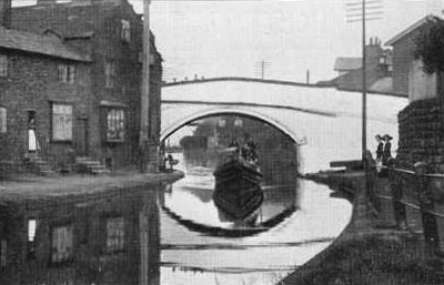
of the Bridgewater Canal’s Route
The first Trent and Mersey Canal milepost above Preston Brook Tunnel
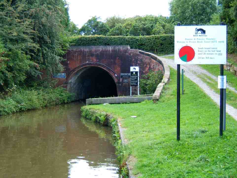
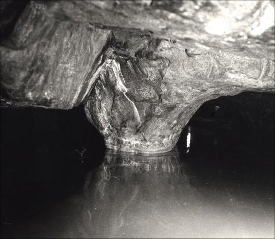
The
northern portal of Preston Brook Tunnel marks the beginning of the Bridgewater
Canal. The tunnel is 1133 metres (1239 yards) in length and navigation at all
times (24 hours a day, 365 days a year) is controlled by a timetable due to not
being able to see one end from the other. Northbound entry is from twenty past
the hour until half past the hour whilst southbound entry is from ten to the
hour until the hour.
The northern portal of Preston Brook Tunnel
The cutting leading from Preston Brook Tunnel
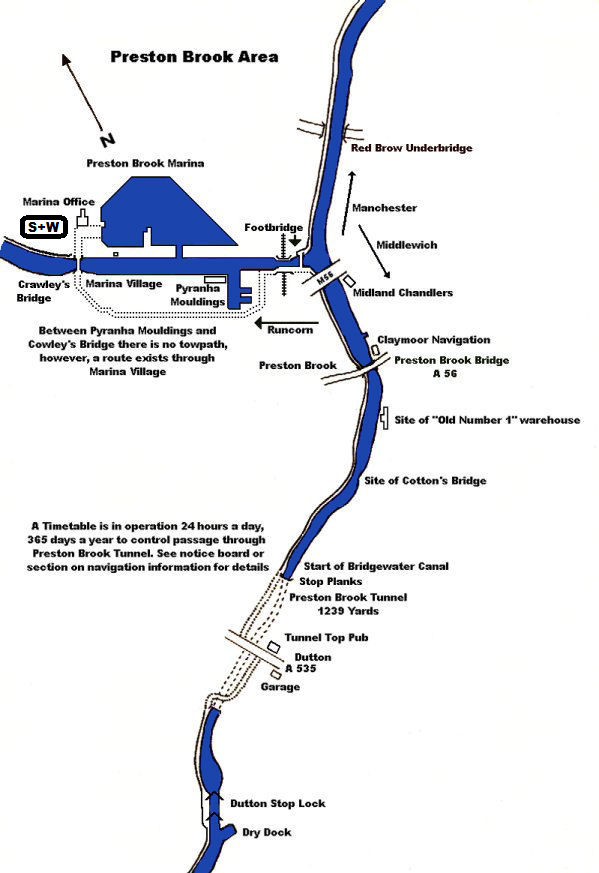
A little way along the horse path across the top of the
tunnel is a public house appropriately named the Tunnel Top (formally the
Stanley Arms) which cooks excellent meals in addition to selling alcohol. Across
the road from the pub can be seen the new ventilation and access shaft built
when the tunnel collapsed in 1981. Soon after emerging from the tunnel, adjacent
to the site of the demolished Cotton’s Bridge was Preston Brook Station
although, today, there are no remains of it left. The Old Number One was one of
the few remaining warehouses at Preston Brook. In it’s post-warehouse roll it
has been a nightclub and a restaurant but is now rebuilt as a prestige housing
project. It lapsed into it’s previous condition after being gutted by fire. It
has also featured prominently in an episode of Granada Television’s series
“Travelling Man” which was almost exclusively shot on the Bridgewater
Canal.
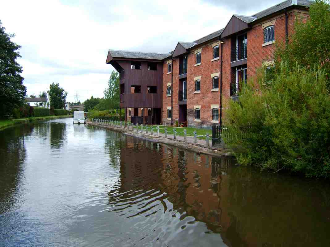
The "Old Number One" is now converted into luxury apartments
Claymoore Navigation, adjacent to the
A56 road bridge, offers boat hire and the usual boatyard facilities.
Between
the A56 road bridge and the M56 viaduct are more reminders of Preston Brook’s
importance as a canal port in years gone by. The most prominent reminder is the
row of canal cottages used by the people who worked in the numerous warehouses that lined the canal.
Overnight mooring is not recommended here due to the close proximity to the
railway hidden in a cutting to the left and the M56 motorway above. Nestling in
the shadow of the M56 viaduct is situated Midland Chandlers whose showroom is a
veritable “Canal Supermarket” for those interested in apparel for canal boats.
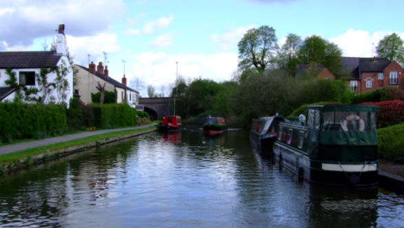
Looking towards Preston Brook A56 Road Bridge from The Old Number One...
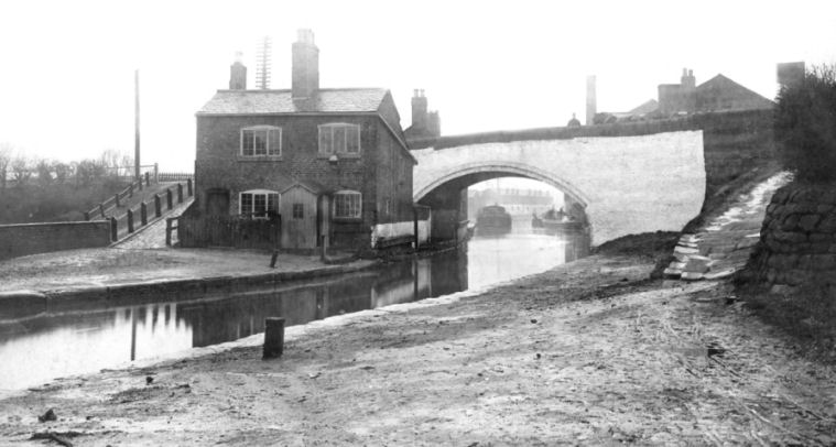
... and from a similar viewpoint around the 1920s
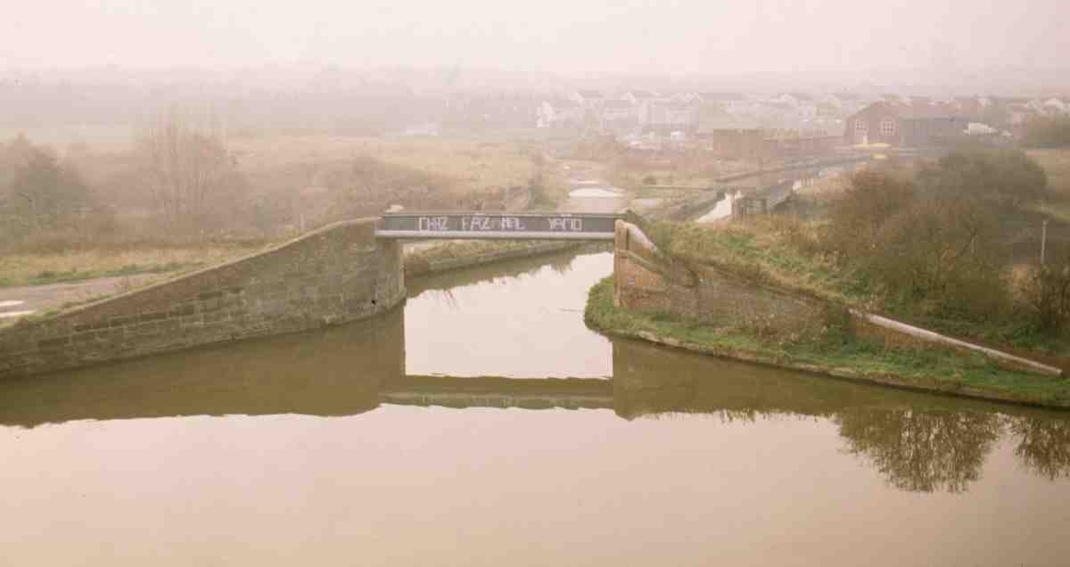
Waters Meeting at Preston Brook on a misty Autumn morning in 1986
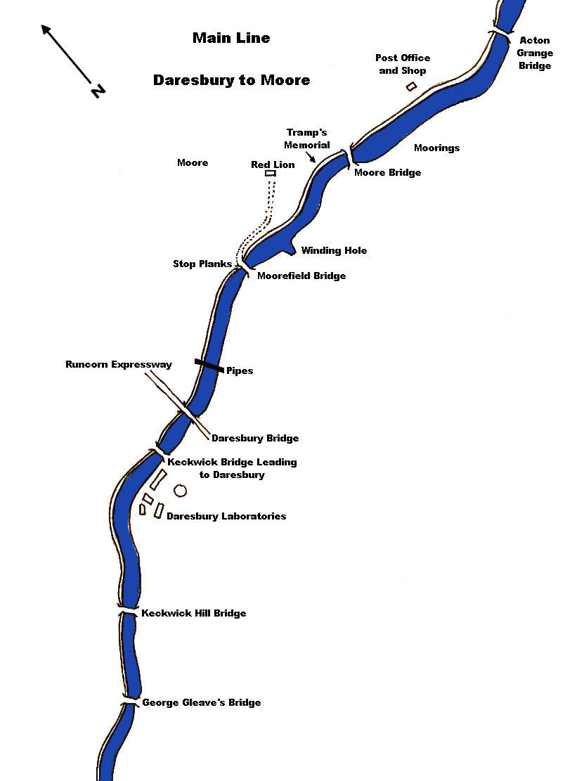
Immediately after the motorway viaduct is a junction… left
for Runcorn and straight on for Manchester.
Preston Brook’s 300 berth marina can be seen on the opposite side of the valley.
Also on the opposite side of the valley where the Runcorn Arm runs parallel to
the main line of the canal for a mile or so before turning towards Runcorn where it
is lined with new housing developments. Looking straight ahead, the white
concrete tower
of C.C.L.R.C.’s
(Council for Central Laboratories Research Councils) Daresbury Laboratories can
be seen poking up through the trees. The tower is a well known landmark in this
area and, no matter how inviting the canal banks adjacent to the laboratories
look, there is no mooring allowed.
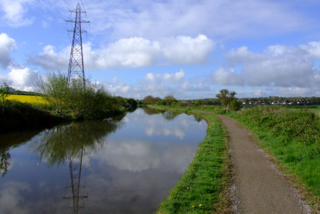
Looking towards Preston Brook from Daresbury
Past the laboratories, under Moorefield
Bridge,
are moorings convenient for visiting the nearby
village of
Daresbury.
The walk up the hill to the village allows a closer look at the tower mentioned
earlier. It was originally part of a “Van der Graph Machine” or, to be more
exact, a Vertical Particle Accelerator. This particular project has come to a
close and other departments within the laboratories now use the tower. Beneath
the ground, in front of the tower is buried a “Synchrotron”. This is a large
unit used for the research of particle physics and is one of the largest of it’s
type in the country.
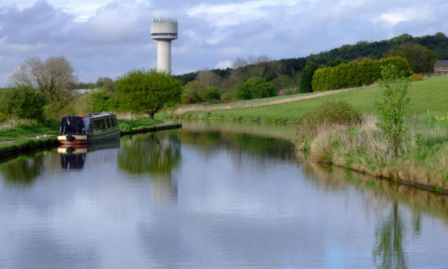
The tower at Daresbury Laboratories looks out over the Bridgewater Canal
and the rolling Cheshire countryside
The name “Daresbury” is derived from an ancient word meaning
“oak” and there is certainly an abundance of oak trees in the area. Within the
village is a beautiful stone church...
All Saints Church, one of the vicars of which was the Reverend
Charles W. Dodgson. The Reverend Dodgson took a particular interest in the well
being of the bargemen who crewed the boats that operated on the canal. He was
also a friend of Lord Francis Egerton. One day, when they were both out walking, the Reverend
Dodgson expressed a wish to provide the bargemen with some sort of religious
privileges. “If only I had £100”, he said… “I would turn one of those barges
into a floating chapel”. He went on to describe to Lord Egerton how he would
have the boat fitted out and how he would cruise along the canal giving
religious instruction and holding services. A few weeks later, he received a
letter from Lord Egerton, informing him that his floating chapel was ready and
waiting for the Reverend to collect it from Worsley. This floating chapel is
believed to be the first of it’s kind and was used regularly by people who
worked along the canal.
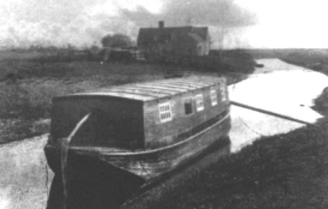
A
floating chapel similar to that of the Reverend Charles W. Dodgson's
The floating chapel wasn’t the Reverend Dodgson’s only
claim to fame. He was father to the renowned Victorian author and photographer
Charles Ludwidge Dodgson, better known by his pseudonym of Lewis Carroll, famous
for writing the Alice in Wonderland and Alice through the Looking Glass books.
If the church in Daresbury is visited, the stained glass windows are of interest
as they depict characters from the “Alice”
books. There is also an appreciation centre in the village, conveniently placed
next to the Ring-o-Bells public house where thirsts can be quenched and stomachs
filled before the return walk back to the canal.
The Lewis Carroll commemorative window in
All Saints Church, Daresbury
After the two Daresbury bridges, just before the next bridge...
Moore Field Bridge,
hidden in the trees lining the towpath is the remains of an Anderson Air Raid
Shelter. During the Second World War there was a lengthsman that kept an eye on
the canal and in the event of an air raid he would seek safety in the Anderson
Shelter.
If the canal was hit by a German bomb he would emerge from the shelter and lower
the stop planks into the grooves adjacent to the bridge so preventing the canal
from being drained and protecting the village of Moore from flooding. The
shelter is also featured in a website dedicated to
Anderson Shelters which can be found at
https://www.andersonshelters.org.uk/bridgewater_canal.html.
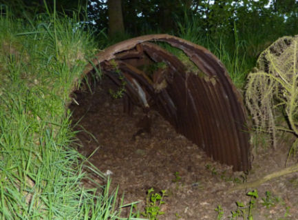
Remains of the Anderson Air Raid Shelter between
Daresbury and Moore...
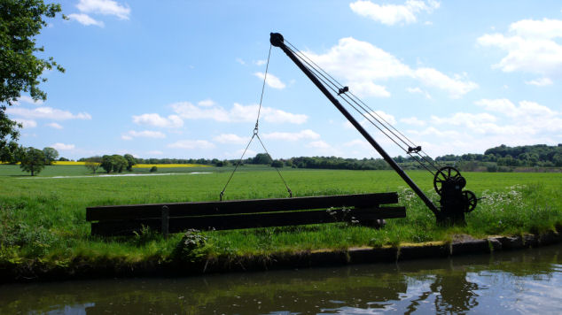
...and the nearby stop planks and crane
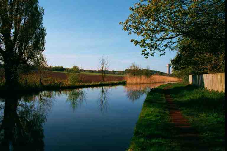
The Bridgewater Canal at Moore
Just after
Moore
Bridge,
is a track that leads to the
village of
Moore.
There is a general store and
The Red Lion at Moore
public house, the illuminated sign from which can be seen from the canal,
beckoning the thirsty. They also serve meals of a high standard.
to On the wall of the pub as well as some
rather good, old monochrome photographs of the Bridgewater and Manchester Ship
Canals was a commemoration to Ken Thomas the Tramp aka The Old Man of Moore.
Ken was a friendly, intelligent man who dropped out of society of his own
will. He sometimes slept in the Anderson air raid shelter mentioned previously,
but could usually be seen huddled beneath his umbrella,
and was always willing to catch the ropes
when we were mooring close by. We always offered him a cup of tea in return
and have a chat until he died of pneumonia in March 1984. .
He is remembered and missed by
the more experienced,
older boaters on the Bridgewater Canal . I was given permission to reproduce the painting of
Ken below and also the poem entitled "The Old Man of Moore" that was written
about him by Mrs Marjory Pike; also of Moore.
Around
the corner, just before Moore
Bridge,
was a memorial erected by the locals to the memory of “Ken the Tramp”. More
details of Ken's life can be found at...
https://www.facebook.com/stuart.allen.3538/posts/494818160903512.
A painting depicting Ken the Tramp at Moore
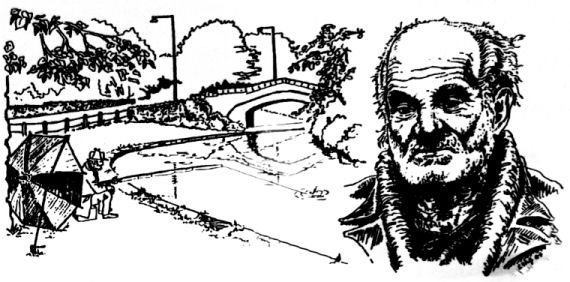
A sketch entitled "The Old Man of Moore"
The Old Man of Moore
Some things leave impressions in our
minds for all of time,
On recalling they're so vivid like the
pungency of wine,
Through the years I will remember the
first time I ever saw,
The canal and boatman and the Old Man
of Moore.
There he'd laze away the hours man and
nature so at one,
Not for him the homely comforts,
spurned they were, that life was done.
Large umbrella now his shelter, crooked
arm his head to rest!
But to him he's found his haven like
the bird high in its nest.
Children came each day to see him and
the boatmen knew him well
As he fished beside the water, oh what
stories he could tell!
Starry nights and frosty mornings, wind
and rain and summer gone!
He would while away the hours lost in
thought till day is done,
But I'm sure in times afar off telling
tales of days of yore
I'll remember my encounter with that
nice old man of Moore.
The location of Ken's Memorial and a close-up of the memorial itself
The “Red Lion” can also be reached from Moore
Bridge.
There are craft moored just after Moore
Bridge
on private moorings. This stretch is also a handy mooring for the convenience
store and Post Office, one hundred and fifty metres along the road.
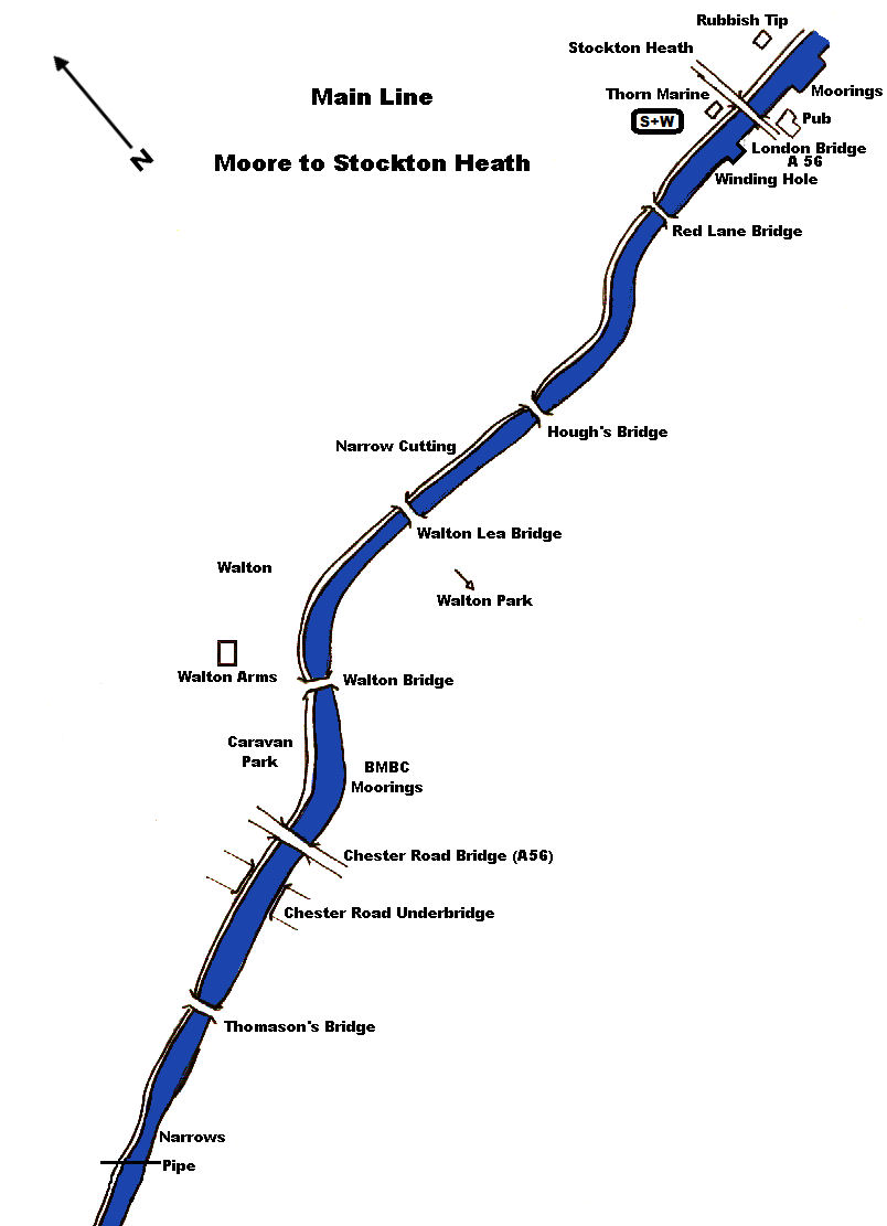
Between Moore and Walton, after Acton Grange Bridge, the canal winds through delightful
countryside punctuated by a wooded cutting. Here there is a good sheltered
mooring, perfect for barbeques. The location is usually known as "Spike
Bridge" due to the pipes and protective spikes that span the canal at this
point.
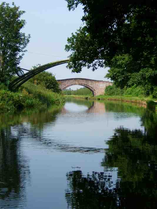
Spike Bridge between Moore and Walton
Before long, Walton’s A56 Chester Road Bridge can be seen.
This bridge is the last surviving concrete “Toast Rack” bridge on the
Bridgewater
Canal.
Just before and after the bridge are moorings of the Bridgewater Motor Boat
Club, based at Runcorn, opposite which, are excellent overnight moorings. At the
next bridge, the Walton Arms can be reached by going down the road on the
towpath side. The Walton Arms serves high quality meals as well as alcohol. From
the A56, near the Crematorium entrance, can be seen one of the two remaining
transporter bridges in the country. This example is scheduled as a Listed
Structure and spans the old
Mersey and Irwell Navigation, adjacent
to the Crossfields Chemical Complex (the original Lever Brothers factory) in
Warrington. Today, it is
owned by Warrington Town Council.
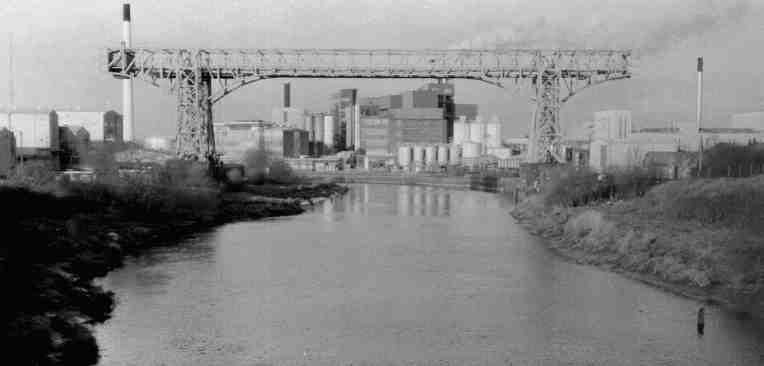
Crossfields Transporter Bridge across the River Mersey
At the next bridge,
Walton
Lea Bridge,
care must be exercised when passing other craft due to the jagged rocks jutting
out from the canal banks. Once at the bridge, steps give access to
Walton
Park.
The park is well worth a visit and possesses children’s swings, a children's’
zoo, beautiful gardens and crazy golf. The house itself is a function and
conference centre in addition to an appreciation centre, café and sweet shop.
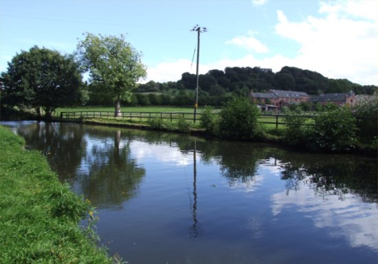
Heading towards Stockton Heath from Walton
After the cool darkness of the cutting, the canal winds
it’s way to Stockton Heath, with the trim back gardens and tidy houses on one
side of the canal overlooking the rolling Cheshire
countryside on the other. Stockton Heath was once the site of Stockton Quay, a
busy trans-shipment point in the canal’s heyday. The old quay contained many
warehouses in addition to Cash’s Boatyard, the basin for which can still be seen
in the shape of a square winding hole. The yard and warehouses were demolished
in the mid 1980’s to make way for the “Old Quay” housing development.
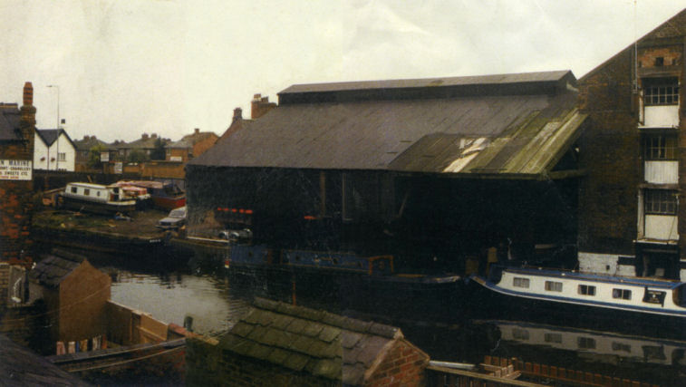
Cash's Boatyard in the early 1980's before demolition
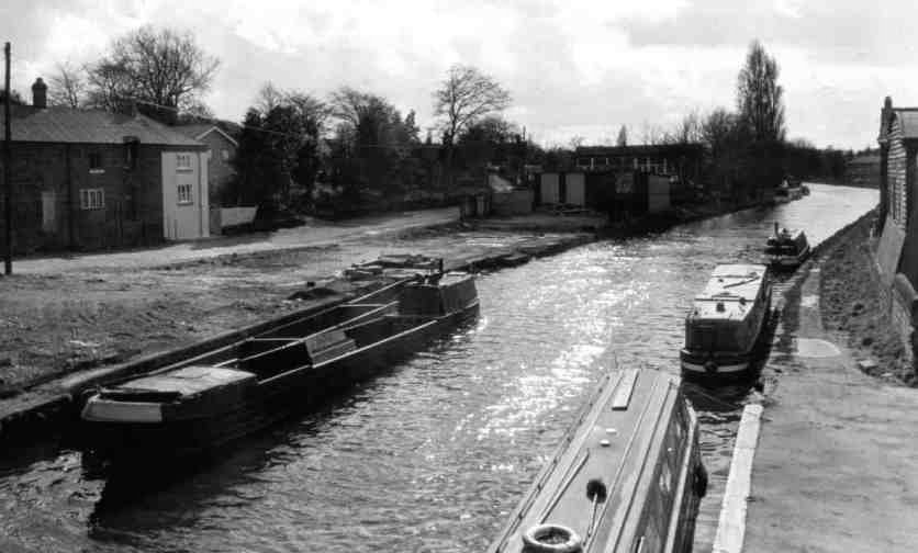
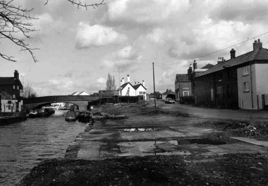
Two photographs taken in 1986 of Stockton Heath after Cash's Boatyard was
demolished
The
London
Bridge
public house was also one of the points along the canal where the passenger “Fly
Boats” such as the previously mentioned “Duchess Countess” would stop for a
change of horses and also to allow passengers to embark and disembark. The
actual point where the boats stopped was at the steps next to the bridge,
adjacent to the public house. The
London
Bridge
is a favourite with canal boaters offering meals as well as drinks. Boats can
moor next to the old fly-boat steps whilst visiting the pub.
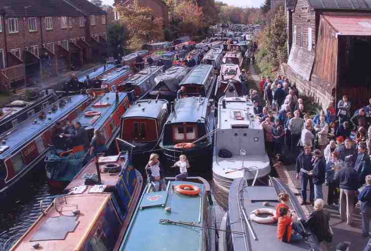
A blockade of boats protesting at the proposed development of the Bank
Rider's Cottage now Thorn Marine
Opposite the Old Quay development is Thorn Marine. They
offer all the usual boat shop facilities such as water and sanitary disposal and
is a veritable “Aladdin’s Cave” for chandlery, boat parts and canalalia. The
left hand side of Thorn Marine’s shop used to be the Lancashire Constabulary
(and the canal’s before it) mortuary, in use up to 1951, the tiles of which can
still be seen to this day. Rubbish disposal is at a recycling centre, access to
which can be gained via a gate one hundred metres along the towpath from Thorn
Marine (opposite the small marina moorings). As well as a garage and shopping
centre there is an off license, which is reached down the road at the side of
Thorn Marine. A little further on down the side road, on the main A56 road,
there is a convenience store that is open “eight till late” and an excellent
Chinese take-away. Across the
Manchester
Ship Canal
swing bridge is a large “Morrison’s” supermarket.
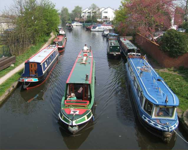
Stockton Heath with the London Bridge public house on the
right
Most of the original canal buildings have disappeared
although some still remain like the Bank Rider’s House (Thorn Marine), the
Smithy and Stables (behind the London Bridge public house) and a couple of
warehouses (behind the new housing development). Another reminder of the canal’s
past is remembered on a plaque at the top of the Fly Boat steps adjacent to the
pub. Around the back of Thorn Marine, a mural has been painted on a galvanised
steel fence, which adds a bit of colour to the area. Next to the pub is a small marina that only offers
moorings to residents of the adjacent buildings. After passing the backs of more
houses, the canal strides across a small valley on an embankment adjacent to
another new housing development. A side road passes beneath the canal on a small
aqueduct or “Underbridge” as they are called on the
Bridgewater.
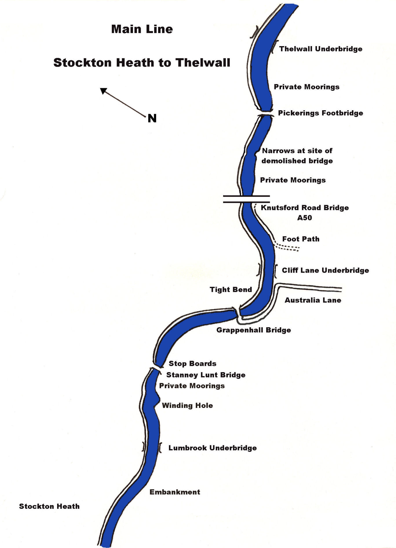
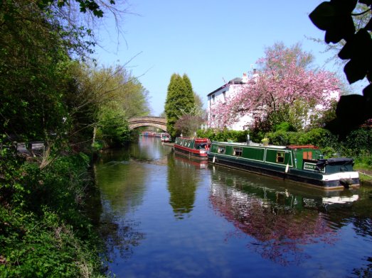
Grappenhall Turn
The next
port of call is Grappenhall where the A56 runs alongside the canal for quite
some distance. There are private moorings at
Stanney Lunt
Bridge and, through gaps
in the towpath hedge are bus stops on the A56 that offer a regular bus service
to
Warrington.
Nearby are shops and a Post Office that can be reached from
Cliff Lane
Bridge. Care must be exercised at the
bend just after Grappenhall
Bridge. It is an acute,
blind bend and Sod’s Law dictates that another craft will be met on this bend.
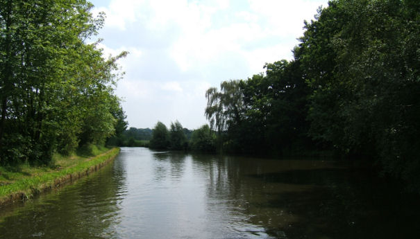
Thelwall Cutting
The canal leaves civilisation behind for a while until
Thelwall is reached. There are many boats moored on two private linear moorings
just past Knutsford Road Bridge (A50) and also past
Pickering’s
Bridge. Just before
Thelwall
Underbridge
is reached, logs for the solid fuel stove can sometimes be purchased from the
shed on the off-side of the canal. A short way along the canal, there are good
moorings in the shelter of trees, ideal for a barbeque or children to explore.
After the canal emerges from the wooded cutting, Thelwall Viaduct lifts the M6
Motorway high above the Bridgewater
Canal,
the Manchester
Ship Canal,
the old Mersey
and Irwell Navigation, a railway and a road on lofty concrete pillars. It would
be interesting to know what James Brindley’s thoughts on this particular piece
of civil engineering would be had he been able to see it. There is a garage that
sells milk, bread, etc. at
Ditchfield
Bridge
before which are more moored craft on private linear moorings.
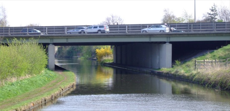
The approach to Thelwall Viaduct carries the M6 over the canal
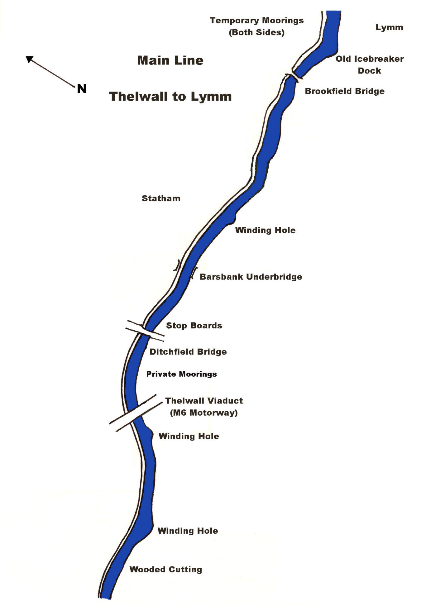
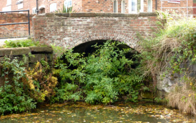
The old Ice Breaker Dock at Lymm
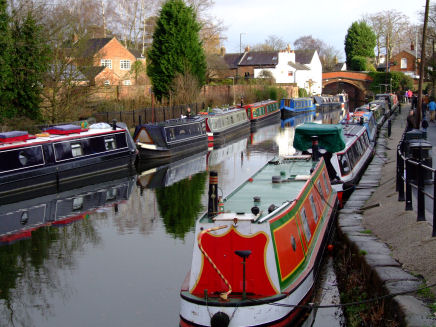
Busy moorings in Lymm Village
A new, tastefully designed housing development heralds the
approach to Lymm. The town of Lymm
itself is soon reached after negotiating a small rock cutting. This is a
beautiful town, full of character. As well as many public houses and shops,
there are medieval stocks and a cross from the same era worthy of inspection
plus an unusual linear park. The park is set in a gorge that runs right through
the town centre. The stream that runs through the gorge emanates from a large
lake known as Lymm Dam that is popular with anglers, walkers and picnickers. The
stream and the adjacent road pass beneath the canal adjacent to
Lymm
Green
Bridge.
There are temporary moorings on both sides of the canal and on the off-side of
the canal is a car park that accommodates a market every Thursday. There is an
excellent fish and chip shop and a good Chinese take-away opposite the Post
Office in the side road on the off-side of the canal as well as many pubs that
offer food in addition to the more usual beverages.
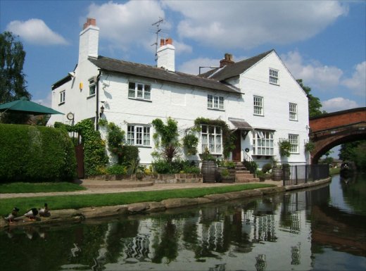
The old canal cottages adjacent to Lymm Bridge
Just before the car park is the entrance to a small, disused tunnel that once
housed the icebreakers used to keep the canal open for traffic during the
winter. These craft had a rounded bilge and were specially sheathed in iron to
prevent the ice cutting into the timber of the hulls over a prolonged period of
time. They were pulled by a team of horses whilst the crew members hung onto a
central bar and rocked the boat from side to side. As the boat progressed along
the canal, it opened up a channel, allowing other craft to travel along a
previously ice-bound waterway. One humorous tale is of an ice breaker that rose
onto the ice. It was pulled at a great speed, skidding along the ice, by the
horses for quite a distance before they could be brought under control and the
business of icebreaking resumed.
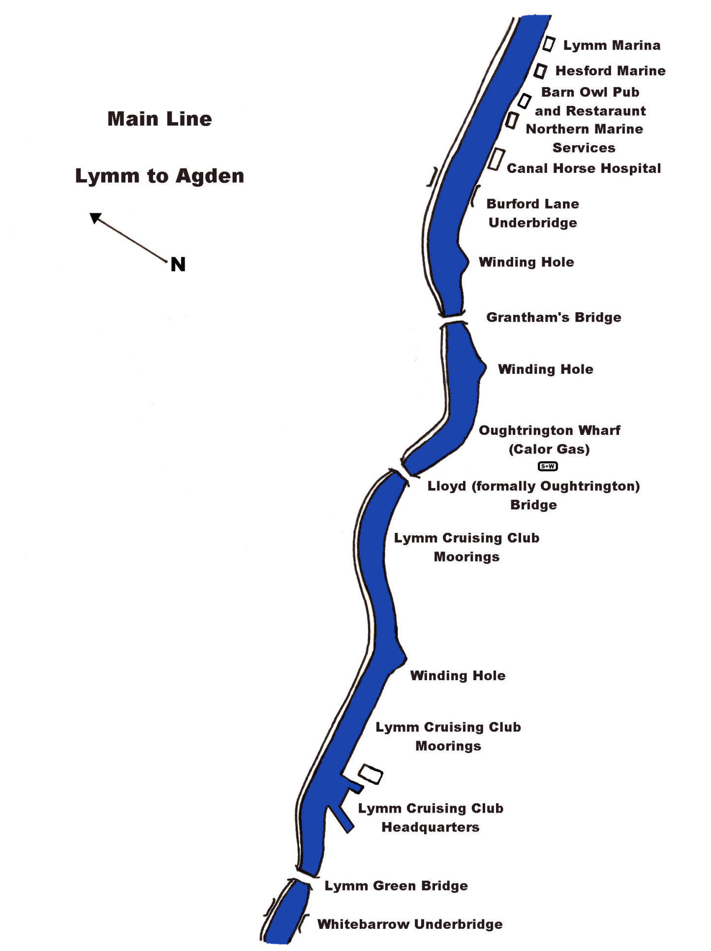
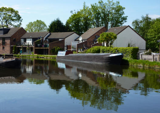
Lymm
Immediately after Lymm Green Bridge there used to be a fine
example of a typical Bridgewater Canal warehouse that featured the original
lifting equipment used for hoisting goods in and out of the boats.
Unfortunately, the warehouse has now been demolished and a new housing
development now occupies the site. Just around the corner is the headquarters of
Lymm Cruising Club and the first of their extensive moorings. Adjacent to their
slipway, there is a small arm that used to lead to the coal yard's unloading tunnel now
euphemistically called “Lymm Tunnel”. Where Lymm Cruising Club has its jetty
moorings there was once another arm off the canal that lead to Lymm Gasworks.
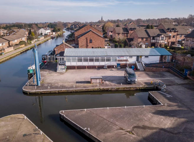
An aerial photograph of Lymm Cruising Club's Clubhouse, Arm and Slipway
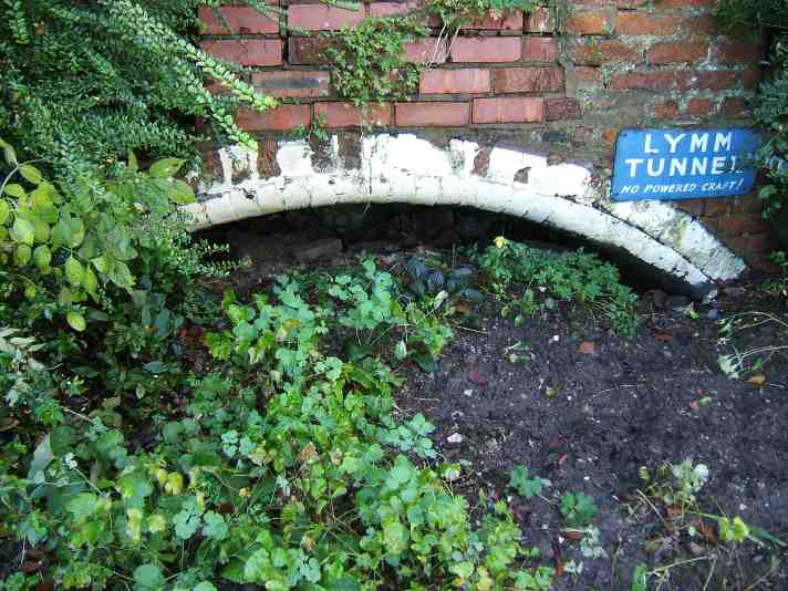
Lymm Tunnel which lead to the coal yard
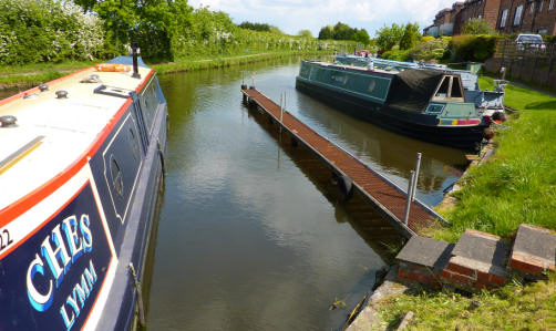
Location of the Gas Works Arm in Lymm
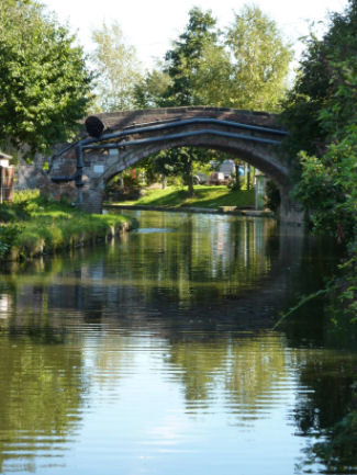
Approaching Lloyd Bridge
formally Oughtrington Bridge
As the canal leaves Lymm behind can be seen excellent
views of the rolling
Cheshire
countryside. More boat moorings from Lymm Cruising Club are seen around the bend
from the Lymm straight at Oughtrington. The bridge used to be known as Oughtrington
Bridge
but has been renamed Lloyd
Bridge
after a family that served the
Bridgewater
Canal
for many generations. Immediately after the bridge, at
Oughtrington
Wharf,
Calor Gas can be obtained. There is also a sanitary station here as
well but no water tank fill-up tap.
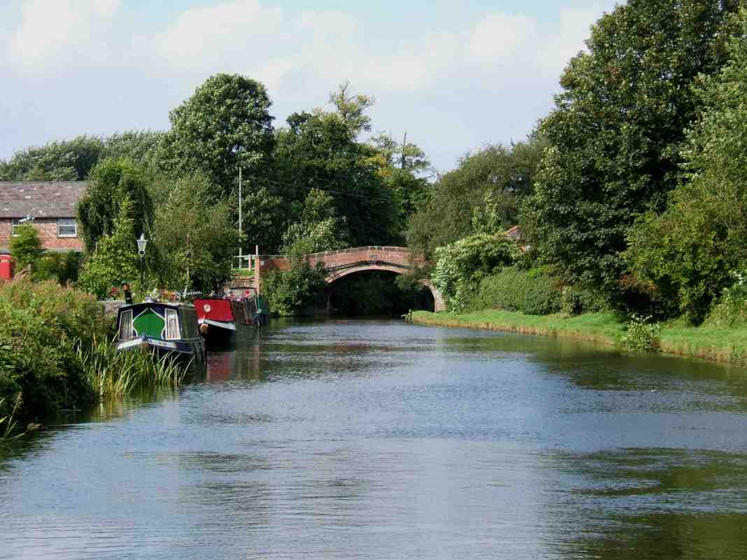
Oughtrington Wharf and Lloyd Bridge from the other direction
The canal now winds into the Agden area. Here, there is
another excellent example of an underbridge. Immediately after Agden
Underbridge
is a warehouse that was once used as a hospital for canal horses part of which
has been tastefully converted into a private house. The original winch and
entrance for the horses can be seen on the canal side of the building. This
building is at the beginning of a long straight stretch of canal on which is
situated three boatyards next to each other. Northern Marine Services is first,
next to which is the Barn Owl pub and restaurant. This is followed by Hesford Marine and
Lymm Marina (formally Ladyline). The two latter boatyards have excellent
chandleries and every service that may be required ranging from Calor Gas,
pump-outs, diesel fuel, moorings, boat sales and repairs whereas Northern Marine
Services are boat builders only.
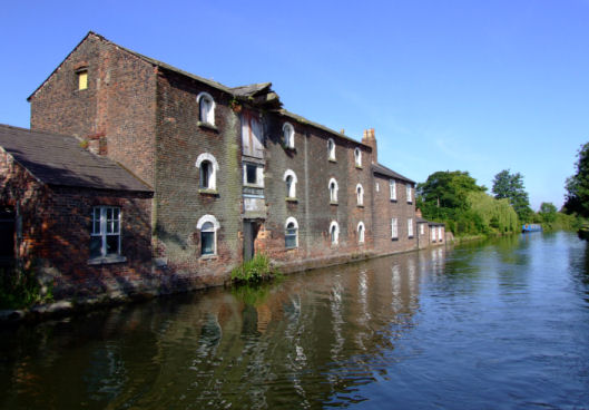
The old Canal Horse Hospital near Agden
More linear moorings for Lymm Cruising Club are passed and
soon the Old Number Three public house is reached. There is a water tap and
temporary moorings adjacent to the footpath that leads to the pub. This is a
good point to link-up with visitors coming by car as the A56 runs at the front
of the pub where there is a convenient lay-by as well as the temporary moorings
there are also permanent moorings.
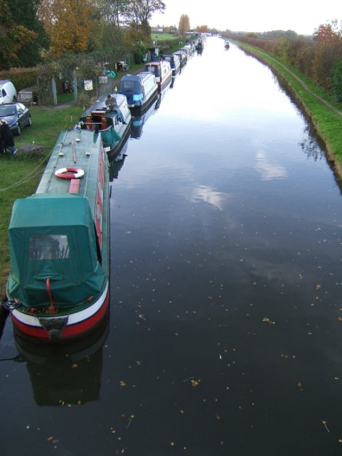
Lymm Cruising Club's Agden Moorings
Around the bend from the Old Number Three, the canal is built
on an embankment before it crosses the River Bollin on an aqueduct. This was the
site of a major breach in 1971 that closed the canal to through traffic for two
years whilst the aqueduct and adjacent embankment was rebuilt. On the offside of
the canal can be seen a mill that harnessed the River Bollin to drive a large
water wheel which, in turn, drove the mill machinery. The water wheel has gone
but the head and tailraces are still in existence and are well worth a visit.
Just after the embankment are more temporary moorings.
A panoramic photograph showing the banks of a disused meander in the River
Mersey
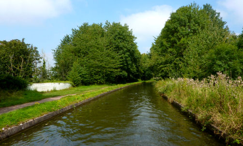
The aqueduct and narrows at the site of the 1971 Bollington Breach
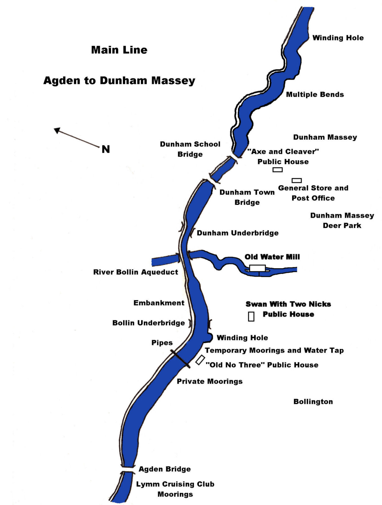
Dunham Massey is soon reached with it’s old school,
Deer Park,
Stately Home and Gardens. It is well worth mooring to spend an afternoon at the
grand house and
deer park.
The Axe and Cleaver public house is a favourite with boaters. Close to the Axe and Cleaver is a Post Office and
general store.
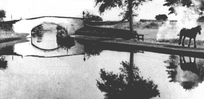
A horse drawn narrowboat at Dunham Massey in the 1930's...
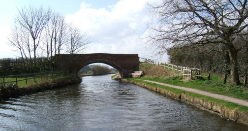
... and the same location today
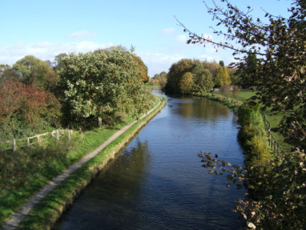
The rural setting of Dunham Village
The canal now starts to change it’s character. It leaves
behind the rural atmosphere and becomes increasingly industrial as factories
line the canal. A new marina development and the old “Linotype” works heralds
the approach to Altrincham. The old “Linotype” works was a user of
Bridgewater
Canal
for both receiving raw materials and distributing finished products. This is
confirmed by the extensive wharfing facilities that were once situated here. As
well as “Linotype”, there was a major coal yard belonging to Bridgewater Estates
where the new office block now stands. Altrincham is a busy town centre and
offers all the amenities and shops that one would expect.
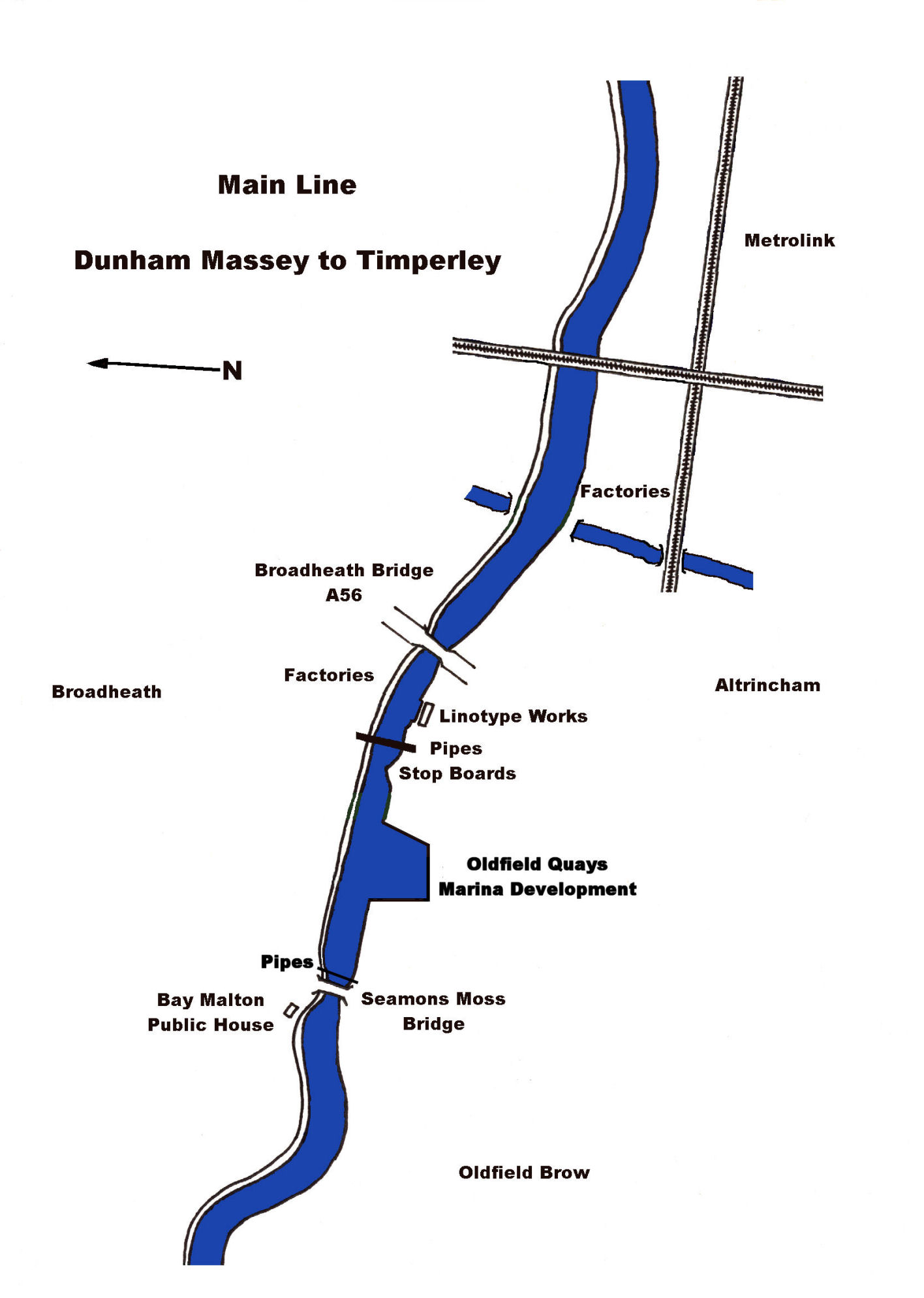
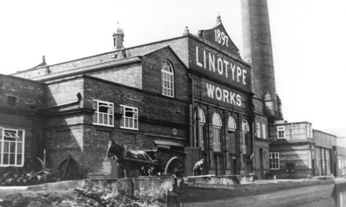
The Linotype Works at Altrincham around the early 1900's
Before long, the railway joins the canal and is to be it’s
constant companion until
Stretford. Even though originally a
railway line,
Manchester’s
Metrolink trams run along the line and offers a regular service straight to the
heart of
Manchester and the
surrounding area from the stations situated at regular intervals along the
canal. A seemingly unending straight stretch with similarly unending linear boat
moorings belonging to members of Sale Cruising Club on the offside of the canal
signals the approach of
Sale.
Sale town centre is reached through a hole in the wall just after Sale
Bridge.
The town centre offers a large precinct with every conceivable shop plus a
couple of garages for petrol, oil, etc.
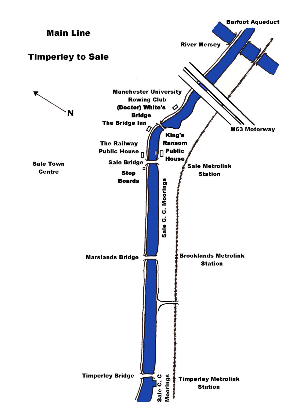
Right at the end of the straight stretch is a pub that
caters for boaters called, ironically, the Railway and is adjacent to
Dane Road
Bridge.
The canal leaves
Sale
behind and winds around for a bit before passing the boathouse of Manchester
University Rowing Club. Soon after this, the infant River Mersey is crossed on
the Barfoot Aqueduct. The M60 motorway also crosses the canal here and marks the
beginning of another straight stretch lined with craft, this time belonging to
members of the Watch House Cruising Club. The headquarters for this society is a
very distinctive piece of canal architecture. As the name of the club implies,
it was a watch or look-out post. In the days of passenger transport on the
canal, when a fly-boat was spotted in the distance, a fresh set of horses was
made ready so as to delay the boat as little as possible when it stopped to
change horse teams. Cutting through the side road from the Watch House gives
access to the Stretford Arndale Centre. Here there are many shops that will meet
the needs of even the most dedicated shopper.
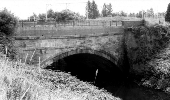
Barfoot Aqueduct carries the Bridgewater Canal across the infant River
Mersey
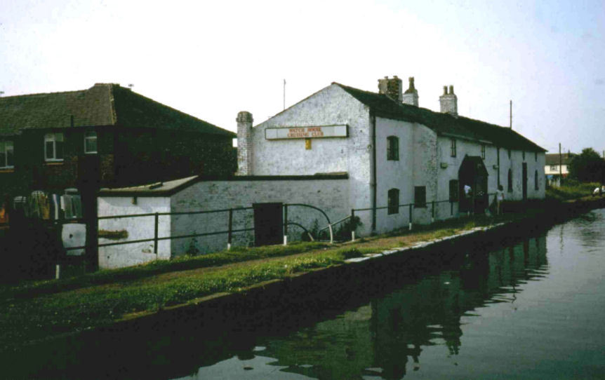
The headquarters of Watch House Cruising Club in Stretford
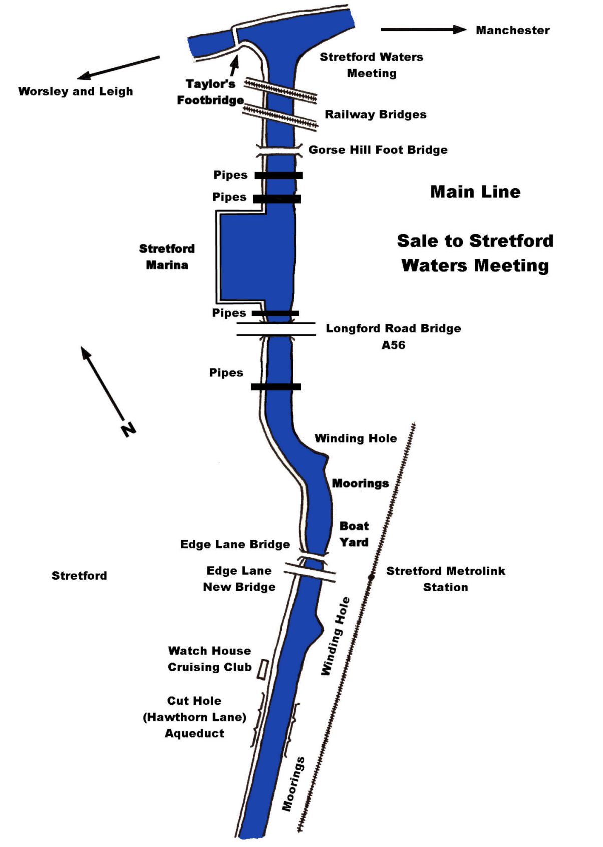
The Watch House signals the end of Sale Moor and the start
of Urmston on the outskirts of Manchester.
Urmston has a shopping centre reached from Edge Hill Bridge. The canal is now
very industrial and care must be taken to avoid tyres, plastic sheeting,
mattresses and other waterborne debris.
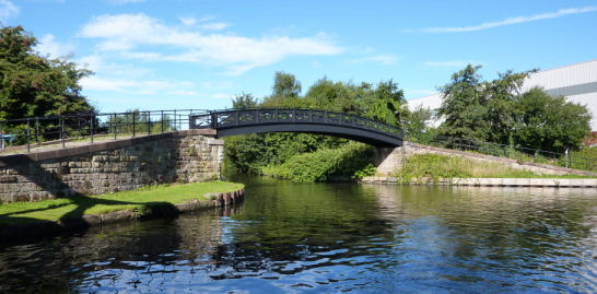
Waters Meeting at Stretford
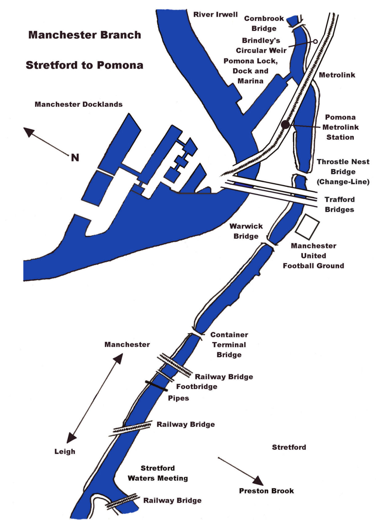
After winding through Urmston, the canal reaches a “T”
junction called “Waters Meeting”. To the left is the Leigh Branch, which was the
original part of the Bridgewater
Canal
leading to Barton Aqueduct, Worsley and the end-on junction with the Leeds
and
Liverpool
Canal
at Leigh. This branch is described later on but for now we will turn right and
head into Manchester
and the junction with the
Rochdale
Canal
at Castlefield, the canal’s terminus. This stretch is also part of Brindley’s
original canal and, originally, passed through a canyon lined with factories and
warehouses.
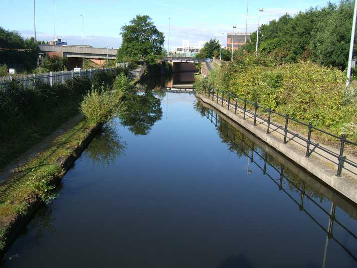
The canal at Throstle Nest
Originally one of the busiest ports in the country, the
docks are now mainly used for leisure although the occasional Mersey Ferry and
coastal traffic can be seen in the complex. Manchester United’s Football Ground
has dominated the skyline for the last mile or so and the canal runs next to the
rear of the ground. Soon after this, the canal’s towpath changes sides at
Throstle
Nest
Bridge
immediately before a re-profiled stretch of canal is reached. Pomona Station is
right on the canal banks and would be a suitable place to moor the boat and
catch the Metrolink into
Manchester
if the remainder of the canal is not to be navigated.
The River Irwell can be glimpsed through the Metrolink
viaduct supports. Access to the River Irwell and Manchester Docks is achieved by
the new Pomona Lock constructed to replace to original Hulme Locks, the site of
which can be seen a little further on past Woden Street Footbridge where the
River Medlock joins the River Irwell. If access to the docks, River Irwell and
Manchester
Ship Canal
is required, please refer to the section dealing with navigational information.
Close to the Pomona Lock, the canal is criss-crossed by railway and the
Metrolink. A little further on from Pomona Lock, on the towpath side of the
canal, can be seen an early example of a circular Brindley overflow weir. This
example may have been a prototype for the type seen on the Staffordshire and
Worcestershire Canal.
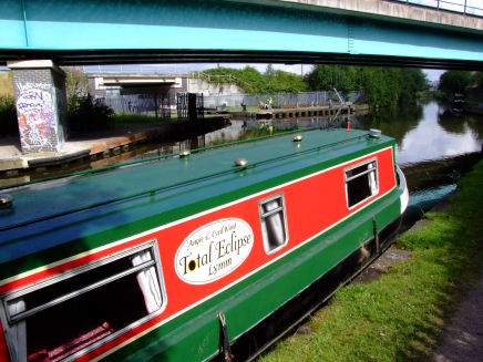
Waiting for Pomona Lock
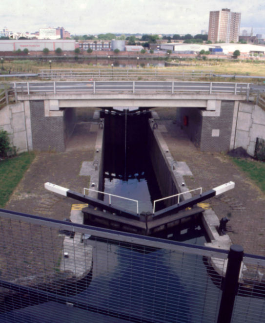
Pomona Lock as seen from the Metrolink
The River Irwell is fairly wide at this point and,
originally, boats could only navigate downstream as far as Woden Street
Footbridge, where the Irwell flowed into Manchester Docks. Boats can now
navigate through the docks to the start of the
Manchester
Ship Canal,
which is marked by Lowry Footbridge, but stringent preparations must be made
prior to navigation. Passage along the Ship Canal is controlled due to
commercial sea-going vessels using the lower reaches of the canal. Upstream, the
river passes through the centre of
Manchester
to the head of navigation at Hunt’s Bank.
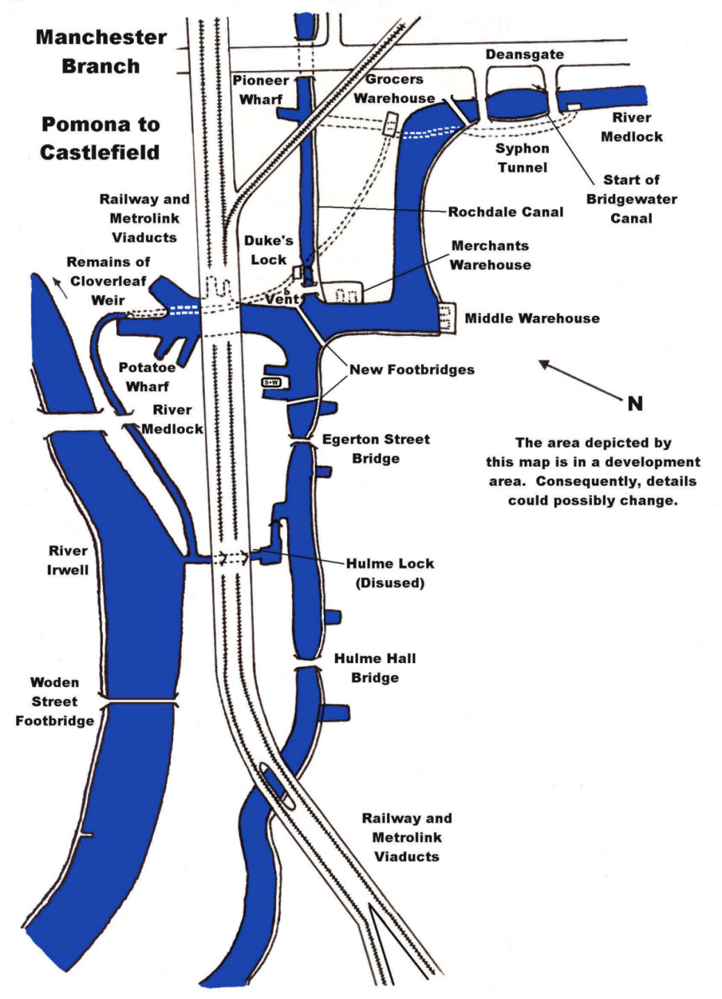
Besides the Bridgewater
and Manchester
Ship Canals,
there were two other canals that joined the River Irwell. They were the
Manchester,
Bolton
and
Bury
Canal,
the lower parts of which are filled-in but traceable (just), and the
Manchester
and Salford
Junction
Canal.
The latter was basically a tunnel connecting the
Rochdale
Canal
to the River Irwell in an attempt to prevent the
Bridgewater
Canal’s
monopoly on passage to the River Irwell via Hulme Lock. Only isolated glimpses
of this canal can now be seen although the remains of a lock chamber are still
present beneath the Granada Television Studios, as are some of the lengths of
tunnel, which were once used as air raid shelters during the Second World War.
For further information about this canal go to the section of this website that
deals with the Manchester and Salford Junction Canal.
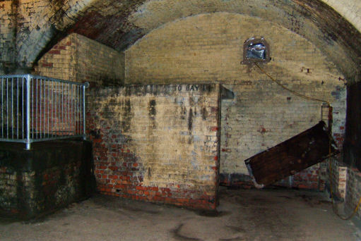
Remains of the Manchester and Salford Junction Canal beneath
the old Granada TV Studios
Returning to the
Bridgewater
Canal,
soon after passing beneath
Egerton
Street
Bridge,
the cast iron railway viaducts that surround Castlefield Junction can be seen.
To the left is
Potato
Wharf
where the remains of Brindley’s original cloverleaf overflow weir can still be
seen. Straight on is the junction with the
Rochdale
Canal,
which can be reached via Duke’s Lock. To the right are the extensive wharves and
the branch that leads up to the River Medlock and the canal’s terminus.
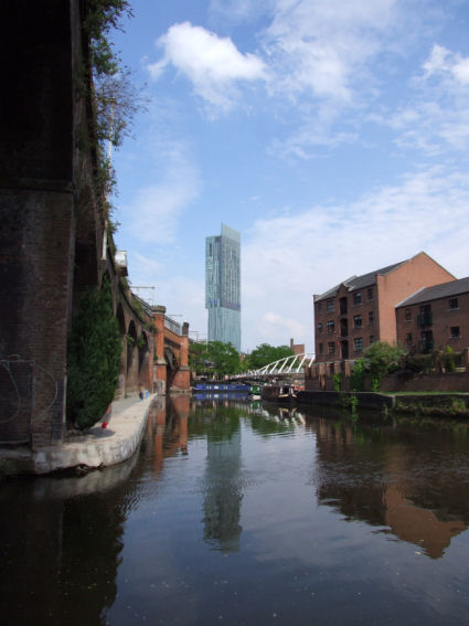
Approaching Castlefield Junction
The
Castlefield area was tidied up and dredged prior to the 1988 Inland Waterways
National Rally of Boats. Since then, the new Merchant’s footbridge from the
beginning of the Rochdale
Canal, which spans the entrance to the
Castlefield
Basin, has been constructed. There was
also considerable development of the site in recognition of it’s industrial
heritage. This development included the construction of additional bridges,
converting warehouses into residential apartment buildings, theme pubs, and even
a radio station. The buildings not renovated have been demolished to make way
for developments more in keeping with the canal’s new image.
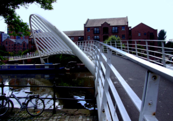
The futuristic Merchant's Footbridge spans the entrance to Castlefield
Basin
The
Rochdale
Canal
was previously owned by the Rochdale Canal Company but now comes under the
jurisdiction of the Canal and River Trust (C & R T). A special licence was required to cruise the
Rochdale
Canal,
but since coming under the umbrella of C & R T, their
licence is required.
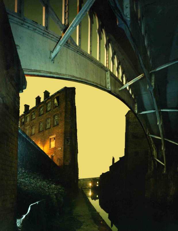
Looking down the Rochdale Canal towards Castlefield Junction at dusk
Manchester City Centre is reached by going across the new
footbridge and around the wharf to Deansgate where the shops and major
attractions are a fifteen-minute walk to the left. A little way along the road
is the entrance to The Manchester Museum of
Science and
Technology. For a small entrance fee can be seen displays ranging from steam
engines, aircraft and road transport in addition to modern technology exhibits.
Also worth a visit are the remains of the Roman Fort that gave Castlefield it’s
name. There was also a Roman “Fosse” which was an early form of navigable cut
that connected the rivers Irk and Irwell. Unfortunately, nothing remains of this
early navigation. Over the River Irwell from the Granada TV Studios is the Mark
Addy public house. The pub is named after a man who, as a seven year old boy,
was instrumental in the rescuing of an oarsman on the river close to Albert
Bridge.
In later life, Mark Addy saved more than fifty people from drowning.
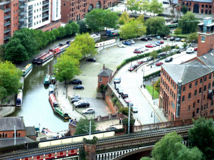
Castlefield as seen from Beetham Tower
In addition to the obvious attractions mentioned earlier,
there are many interesting canal features in the area. At the end of the arm
adjacent to Deansgate is the River Medlock. It plunges into a “syphon” or tunnel
and runs beneath the length of the arm to emerge behind Potato
Wharf
and Brindley’s cloverleaf weir. At the other side of the bridge, at the end of
the arm can be seen the rebuilt entrance to the unloading tunnel. A chamber
beneath the canal contained a waterwheel turned by the Medlock, which was the
motive power for the winch that raised the coal and other cargoes in containers
from the canal boats up to street level. The remains of the other end of the
tunnel can be seen at
Pioneer
Wharf,
adjacent to Deansgate, on the
Rochdale
Canal.
When this canal was built it cut across the line of the tunnel, which
effectively shortened it. Further details go to the section of this website that
describes a walk around the
Canal Heritage Features of Castlefield. The latest attractions and a road map
can be obtained from the Heritage centre adjacent to Deansgate.
Return to Contents
The River Irwell and Salford Quays
The River Irwell at Pomona Dock
After descending Pomona Lock Pomona
Dock is entered. This dock gives access to the Upper Reaches of the Manchester
Ship Canal (MSC) and the River Irwell. At Salford Quays the MSC reaches its ultimate destination of
Manchester Docks. The once busy
docks have now been redeveloped into business and housing complexes.
The first dock is now called the North Bay (previously Number Nine Dock)
and its banks are dominated by the Lowry
Art
Gallery, Lowry Shopping
Centre and Salford Quays. Opposite
is Trafford
Wharf, the location of the Imperial
War Museum
– North. The Millennium Lifting
Footbridge spans the canal connecting
Trafford Wharf
to the Lowry Centre for pedestrians and marks the boundary separating the MSC
from Manchester Docks. The
bridge is a vertical lift bridge of similar design to the
Centenary Bridge
a little way downstream although, with commercial traffic no longer using this
stretch of the canal it is rarely lifted.
Pleasure craft are not permitted to navigate below Lowry Footbridge
without prior arrangements being made with the MSC Company and craft are allowed
to moor at various locations above Lowry Footbridge.
Manchester
Docks as
Originally Constructed
Salford
Quays - Present Day
(Manchester Docks After Regeneration)
The Lowry Footbridge - the lower limit of navigation
Illuminated at Night
North Bay continues on to Huron and Erie
Basins, the two basins being divided by the relocated
Trafford Railway
Swing Bridge
relocated from further upstream and converted into a fixed footbridge.
A new canal, the Mariners’ Canal, connects to
Ontario
Basin, a continuation of Central
Bay, the next bay along.
Central
Bay is connected to Ontario
Basin by the newly constructed Welland
Canal and Lock.
Adjacent to the lock are moorings conveniently located for visiting the
Lowry Centre and Imperial War
Museum - North.
Welland Lock connects to St Louis and St Peter Basins, access to which
is currently strictly controlled, although it is planned to allow pleasure craft
access through Welland Lock on the first weekend of the month during the summer
period. Located in the base of
Welland Lock’s control tower is a sanitary station, water point and rubbish
disposal, access to which is by the conventional BW key.
Huron Basin
Detroit Footbridge... previously Trafford Railway Swing
Bridge before relocation
Development in
Erie Basin... once the location of Grain Elevator Number
Two at the end of Number Nine Dock
Welland Lock gives access to Mariner's Canal
Mariner’s Canal connects Ontario
Basin to Erie Basin
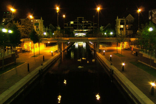
A nocturnal photograph of Mariner’s Canal
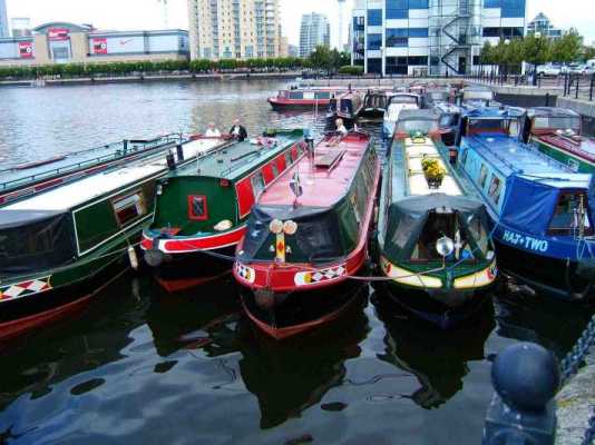
Narrowboats moored at Salford Quays
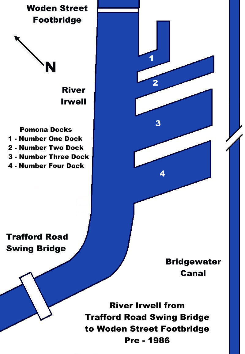
The Upper Reaches or River Irwell pre-1986
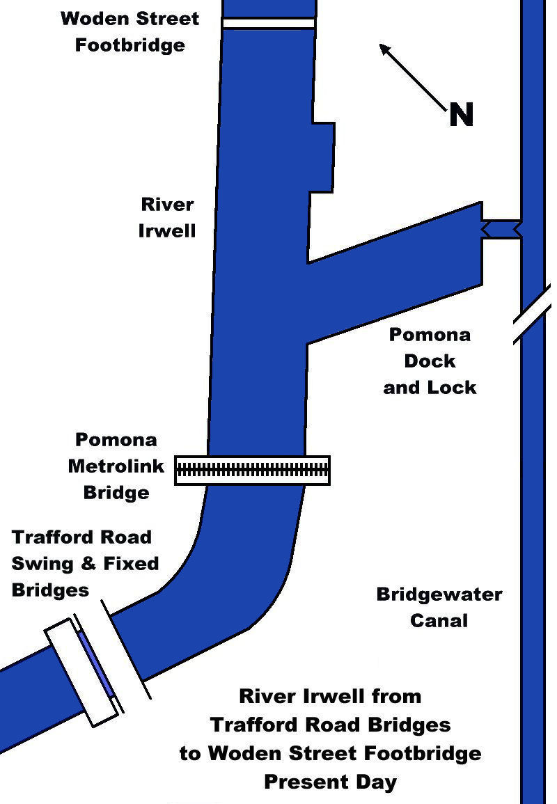
The Upper Reaches or River Irwell -
Trafford Road
Bridges to
Woden Street
Footbridge - Present Day
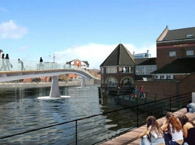
An
artist's impression of the proposed Clipper Quay Footbridge near Trafford Wharf
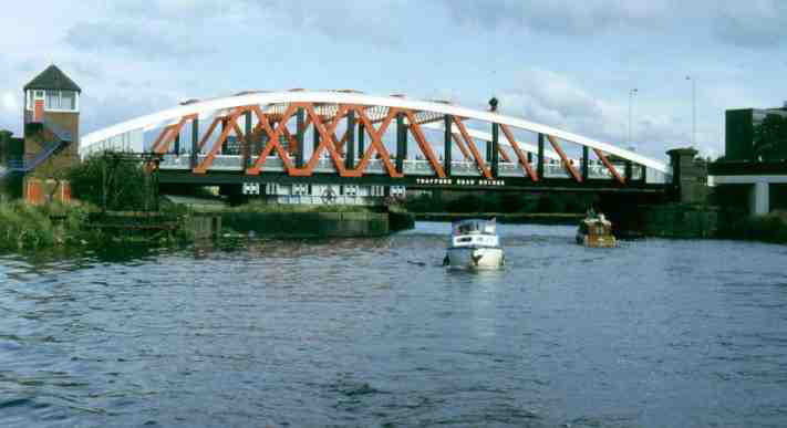
Two pleasure craft passing Trafford
Road Swing
Bridge in 1988 prior to the construction
of the fixed bridge alongside the swing bridge
The
description of the route of this section commences from Lowry Footbridge. After
Central Bay are the Eastern Wharf North and South and South Bay. Immediately
after South Bay is the original location of the Trafford Railway Bridge that is
now located in North Bay. The unusually shaped basin on the left is where the
bridge swung away from the bank of the canal and some of the supports can still
be seen as can the pivot island on the right which is now built upon and is part
of the Wharfside Promenade. The two Trafford Bridges follow. The original swing
bridge was once the largest swing bridge of this type in England but is is now a
fixed Bridge. The next crossing... just around the bend carries Manchester's
Metrolink tramway across the waterway into the heart of Salford Quays and Media
City.
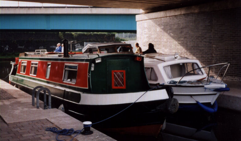
The author’s narrowboat “Total Eclipse” in Pomona
Lock, May 2003
On the
right is Pomona Dock originally Pomona Number Three Dock and is the proposed
location of a marina complex offering residential and permanent moorings once
the area is redeveloped. At the far end of the dock is Pomona Lock which
connects with the Bridgewater Canal. This lock was built in 1995 to replace the
old Hulme Lock about a mile upstream. The locations of Pomona Number Two and One
Docks... now in-filled, can be seen on the left. A little further upstream is
Woden Street Footbridge. This footbridge marks the boundary between Manchester
Docks and the River Irwell. Before the docks were de-commercialised it was also
the lower limit of navigation for pleasure craft. Today it is more generally
referred to as the River Irwell or the "Upper Reaches". Beyond this point care
must be exercised if there has been a prolonged period of rainfall as the water
level can rise quite dramatically. As the Irwell is narrow further upstream the
current of water can be hazardous to navigation. In this situation it is
advisable to make for Pomona Lock and the safety of the Bridgewater Canal.
Nestling beneath the railway viaduct arches is the disused Hulme Lock, once the
connection between the Bridgewater Canal and the River Irwell.
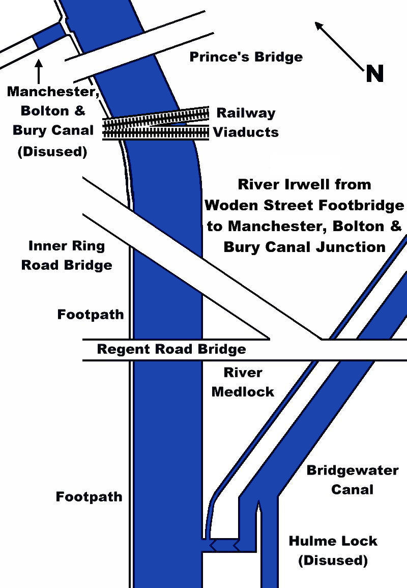
Hulme Lock to the
Manchester, Bolton
and Bury Canal Junction
Hidden
away to the left of the lock entrance the diminutive River Medlock flows into
the River Irwell after its subterranean journey beneath Castlefield Basins and
Potato Wharf. James Brindley constructed a syphon to convey the Medlock from
Deansgate, beneath the basins and wharfs that he had built, to emerge a few
hundred metres from the junction with the Irwell. Along the way, a subterranean
chamber housed a water wheel which powered winches to lift cargo from the canal
level up to Deansgate. An overflow weir was also constructed at Potato Wharf in
the shape of a giant cloverleaf to help regulate the water level in the canal.
Over the years, successive developments have eaten away at the weir and only a
small portion of it remains today.
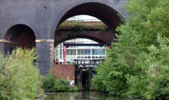
The entrance to the River Irwell from the disused
Hulme Lock. The River Medlock also joins the river to the left of the lock
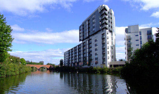
Housing development above Hulme Lock looking towards Regent Road
Bridge
A twin arched road bridge... Regent Road
Bridge carries Regent Road across the river. This is followed by the new
Manchester Inner City Ring Road Bridge. Shortly after the next two bridges,
which both carry railway lines (one of
which is the original line of the Liverpool to Manchester Railway) and
Prince's Bridge, on the left hand bank can be seen the entrance lock to the
Manchester Bolton and Bury Canal. When excavations for the new Inner City Ring
Road were taking place work was held up whilst industrial archaeologists
inspected the site. The Ring Road is carried across the canal on bridges
allowing full navigational height and width due to the proposed restoration of
the canal of which the first few hundred metres have already been completed in
the shape of the Middlewood Locks and Basin development. The canal has many
interesting features including the Prestolees Aqueduct across the River Irwell
and the Wet Earth Colliery where James Brindley constructed drainage soughs for
the mines and carried them beneath the Irwell in a siphon similar to the one
used a Castlefield for the Medlock and later used extensively on the MSC.
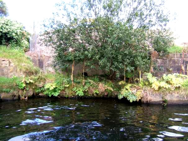
The entrance to the
Manchester, Bolton
and Bury
Canal
prior to restoration...
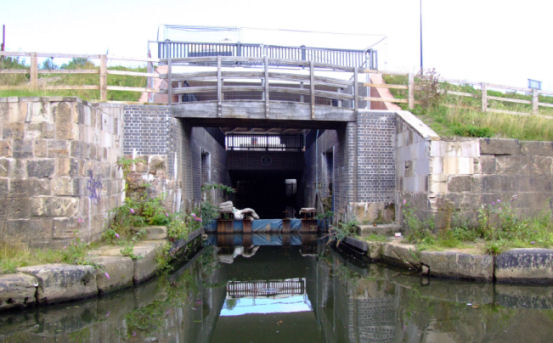
... and the same location after restoration leading to...
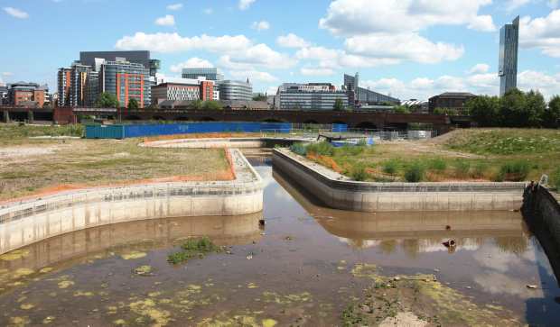
... Middlewood Locks and basin complex prior to redevelopment
Returning to the River Irwell, a short distance upstream and on the right hand
bank is another canal junction. This is the Manchester and Salford Junction
Canal that was constructed to break the Bridgewater Canal Company's monopoly on
boat movements and exorbitant tolls for entering the Bridgewater Canal from the
Rochdale Canal as well as for using Hulme Lock. Little of the canal can be seen
as it ran mostly in tunnels beneath what was to become the Granada TV Studios
and the original set for Coronation Street before it was moved to opposite Media
City a couple of kilometres downstream. During the Second World War part of the
canal was drained and used as air raid shelters. To learn more about this canal
go to the
Manchester and Salford Junction Canal section of this website.
Manchester
and Salford Junction
Canal to the Lowry Hotel
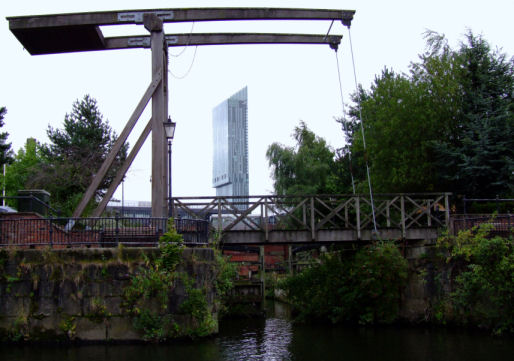
A short distance upstream is the entrance to the Manchester and Salford Junction
Canal
After Irwell Street Bridge the left hand bank
of the river makes a convenient place for moorings. There is access to the city
centre via the new Irwell Footbridge adjacent to the Mark Addy pub. This pub is
names after a man who, as a seven year old, saved an oarsman from drowning in
the river close to Albert Bridge. In later life Mark Addy went on to save fifty
people from the river. It is ironical that at this time the Irwell was renowned
for being severely polluted with sewage and chemicals and Mark Addy died of
poisoning after rescuing his fiftieth person. The pub that bears Mark Addy's
name has convenient moorings next to it, serves excellent food and beers as well
as making a convenient place from which to explore the city. A new footbridge
connects the promenades on both sides of the river just below the Mark Addy. It
also gives access to the Spinningfields development that combines business
accommodation with apartments that overlook the river. Albert Bridge is followed
by the Calatrava or Trinity Footbridge whose revolutionary design connects the
Lowry Hotel with the opposite bank. The river now enters a brick and concrete
canyon punctuated by the occasional bridge and disused landing stages... a
throwback to when passenger boats left from the city centre. Large office blocks
loom over the river as Blackfriars and Victoria Bridges are passed beneath.
After Victoria Bridge the river is close to Manchester Cathedral and only a few
hundred metres of navigable river are left before the limit of navigation is
reached at Hunt's Bank.
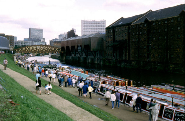
Narrowboats moored on the River Irwell during the 1988 IWA National Rally
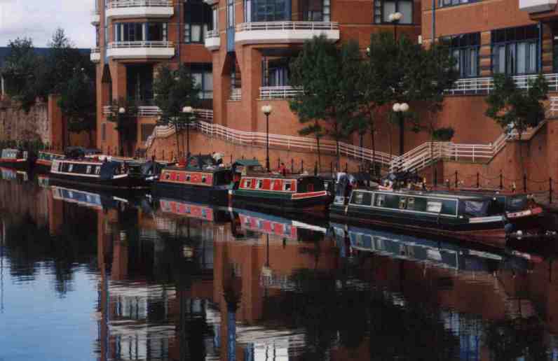
Narrowboats moored
outside the Mark Addy public house
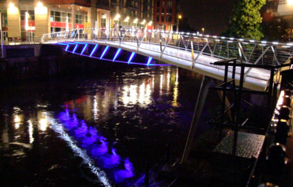
Irwell Footbridge adjacent to the
Mark Addy Public House
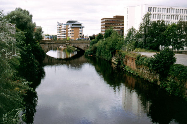
Looking downstream towards Albert
Bridge
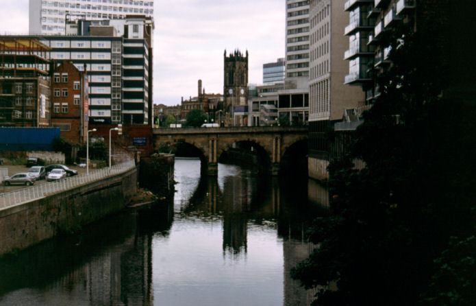
Blackfriars Bridge with the Cathedral in the
background
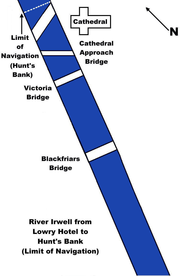
Lowry Hotel to Hunt’s Bank
(Limit of Navigation)
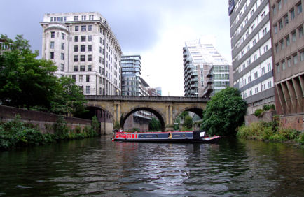
A narrowboat winding above Blackfriars Bridge
The disused landing stage
adjacent to the Cathedral once gave access to the now sealed tunnels that run
through the buried remains of “Old Manchester” and lead to the Cathedral’s
vaults. Beneath
Salford Bridge
is Hunts Bank the head of navigation and the point at which it is time to turn
around. Shallow-drafted craft can,
in theory, navigate further upstream as far as the weir at Shooter’s Bank but
this is not recommended due to the unpredictable nature of the river and the
presence of submerged obstacles.
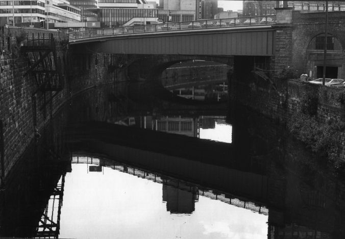
Looking downstream at Hunt’s
Bank… the limit of navigation, adjacent to the cathedral. Note the disused
stairs to a long gone landing stage on the left.
The nearest bridge is
Cathedral Approach
Bridge after which is Victoria
Bridge
Return to Contents
The Leigh Branch
From
Stretford "Waters Meeting" the canal winds
around factories that from Trafford Park Industrial Estate.
Soon, a long straight stretch is reached.
The water along this stretch is unbelievably clear. The plastic bags and other
submarine obstacles can be easily spotted and avoided. The fish dart about, some
of them very big, lurking beneath the weeds. No
wonder this stretch is so popular with fishermen.
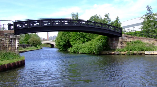
Waters Meeting at Stretford looking towards Trafford Park
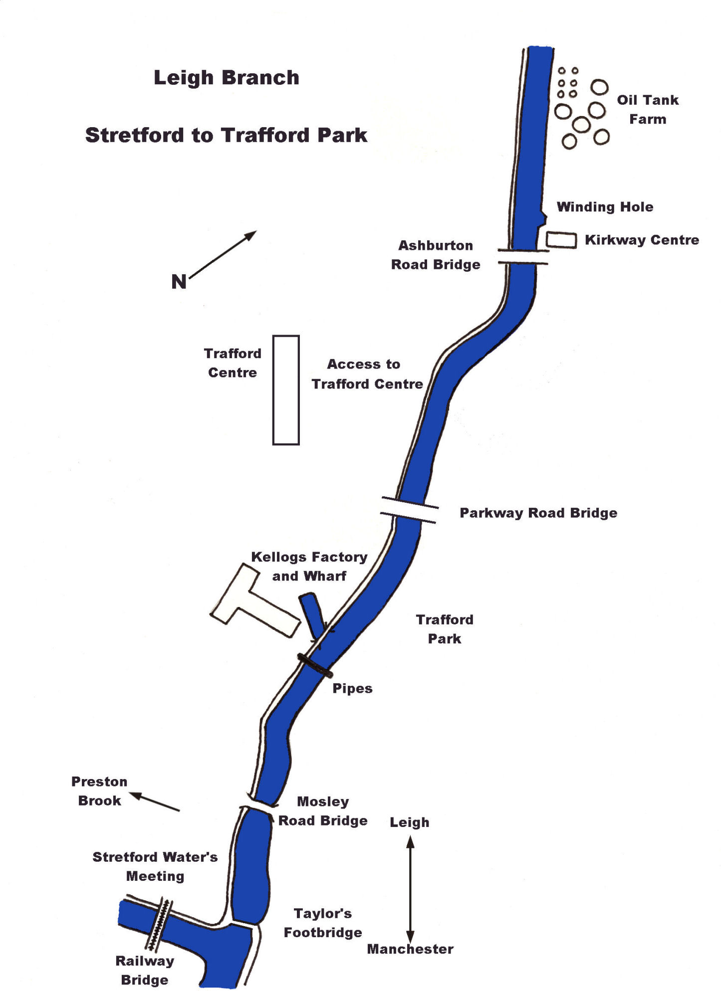
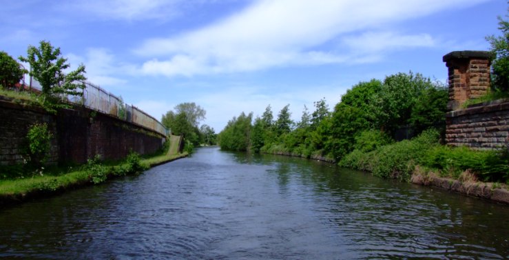
The site of Barton Power Station in Trafford Park
At the end of
the straight is Barton Swing aqueduct. Not very long ago, the ship canal,
spanned by the aqueduct, was busier than the
Bridgewater Canal.
Now, the tables are turned, and the
Bridgewater is busier than
the ship canal. To the left can be seen
the original line of the canal before Brindley's Aqueduct was demolished. If the
aqueduct is open to the Bridgewater
canal, cruise straight over, but care must be exercised if it is windy. During
the winter months, the aqueduct is periodically closed for maintenance. The
Manchester Ship Canal Company should be consulted for confirmation of the
closure dates.
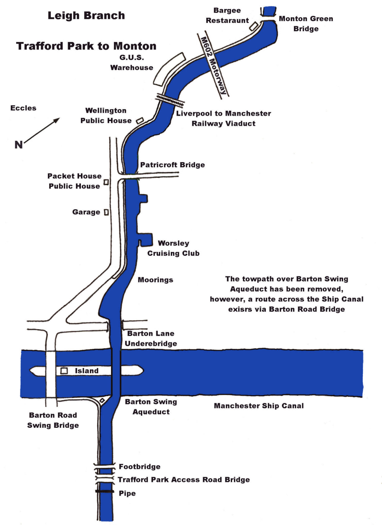
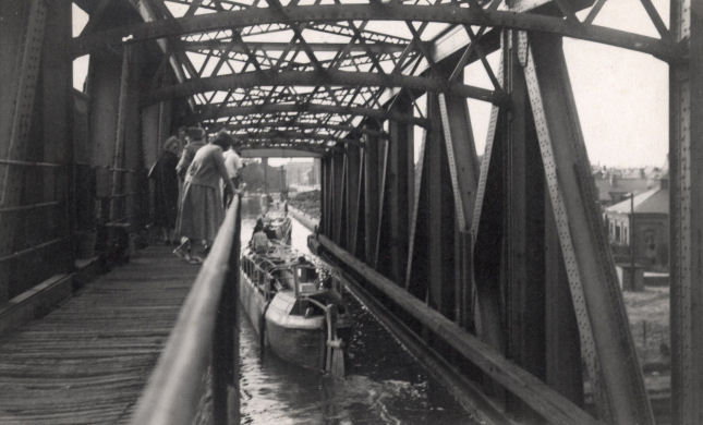
An undated photograph of Barton Swing Aqueduct before the towpath was removed
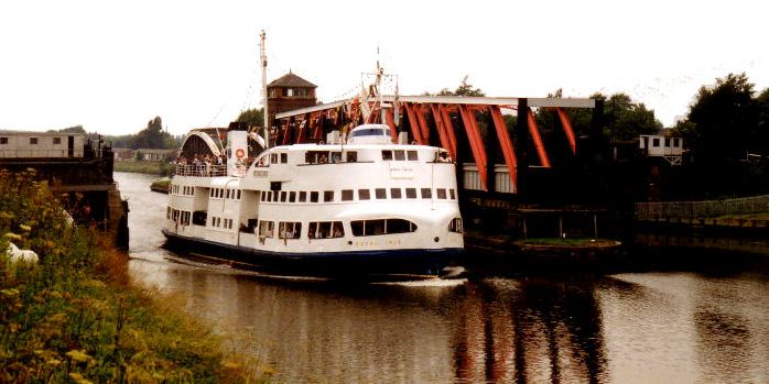
One icon passes another... the Mersey Ferry "Royal Iris" passing Barton Swing
Aqueduct
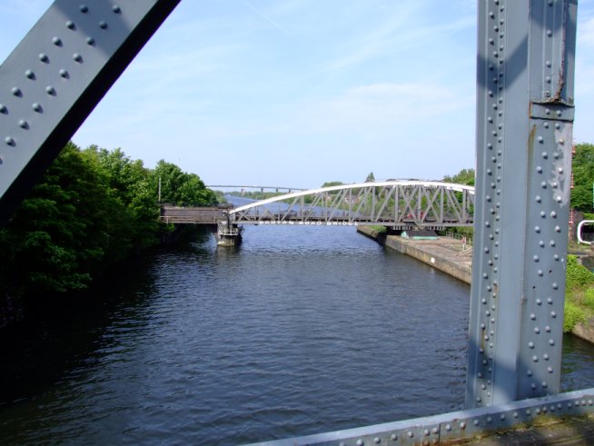
The Manchester Ship Canal viewed from Barton Swing Aqueduct
Once over the aqueduct, the canal passes through
Patricroft where there are shops and a garage. The moored boats belong to
members of
Worsley Cruising Club whose clubhouse is adjacent to an old loading
wharf. The canal soon swings beneath the
Liverpool to
Manchester Railway, which
crosses the canal on a bridge reminiscent of the original Barton aqueduct in
design. From Barton the canal can be shallow and quite weedy.
When
cruising this stretch of the canal, it is advisable to have a towel ready to dry
your hands just in case de-weeding is necessary.
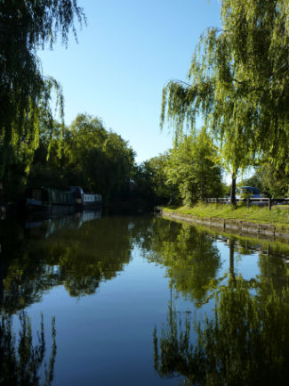
Worsley Cruising Club's Patricroft Moorings
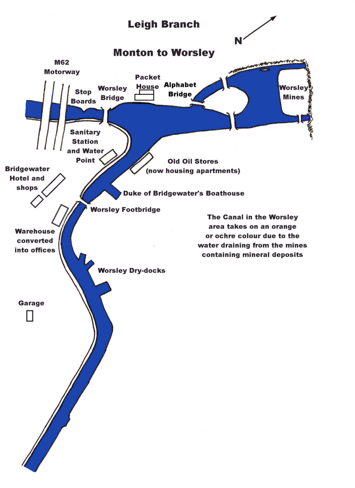
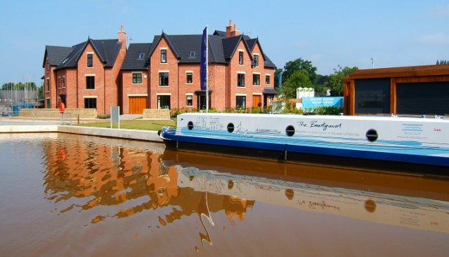
The Boatyard development at Worsley
The water now starts to have an orange tint to it, which
grows stronger as Worsley is approached. Worsley has much to offer.
There
are shops, a pub, sanitary station, water point, dry docks, hire boats and the
mines. Opposite
the sanitary station is the Duke’s Boathouse that once sheltered his “V.I.P.
Barge”. Adjacent to the moorings is a sanitary station and water point. A walk
across the road will be rewarded by the opportunity to have a drink in the
Bridgewater Hotel public house.
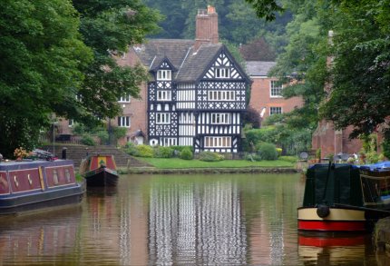
The much photographed Packet House at Worsley
Adjacent to the
Old Boat House, the Old Oil Stores have been tastefully transformed into private
apartments. There are other places of interest such as the Duke of Bridgewater’s
original mine entrances. The short branch to the mines is no longer navigable
and starts at the Alphabet
Bridge adjacent to the
Packet House steps. This bridge is so called due to the walkway having twenty
six planks along it’s span. Children used to sing as they practiced their
alphabet when crossing it. To reach the mine entrances, walk down a path at the
side of the Casserole Restaurant, signposted the "Delph". The "Delph"
is a large basin with two arms leading to the mine
entrances. There is also a sunken "Starvationer”, the first known type of
container boat, kept in the basin. Other examples of this type of boat and the
associated containers can be seen at the
Ellesmere Port Boat
Museum.
For more information about the cradle of the canal
revolution go to the
section of the Canalscape website that describes a walk
around the
Canal Heritage Features of Worsley.
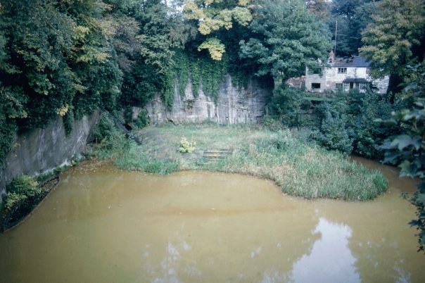
Worsley Delph with the sunken "Starvationer" on the left
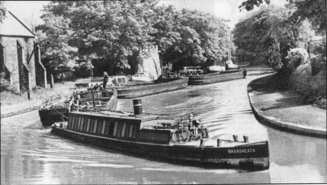
The Bridgewater tug "Broadheath" rounding Worsley Turn with a train of
barges in tow
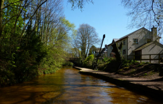
Leaving Worsley
Leaving Worsley
beneath Worsley
Bridge, the canal is
crossed by the M62 and the M60 Manchester Outer Ring Motorway, after which,
Worsley Old Hall, the Duke of Bridgewater’s residence can be seen through the
trees. The Hall is now used as a Conference Centre. The orange colour of the
canal, caused by the drainage from the mines, soon starts to fade.
It is always possible to tell when a boat
has visited Worsley by the orange stain left by the water, but it washes off
easily. On
the left, at
the end of the straight stretch, can be seen the remains of the old Hollins
Ferry Branch, now filled-in and last used as a dredgings dump.
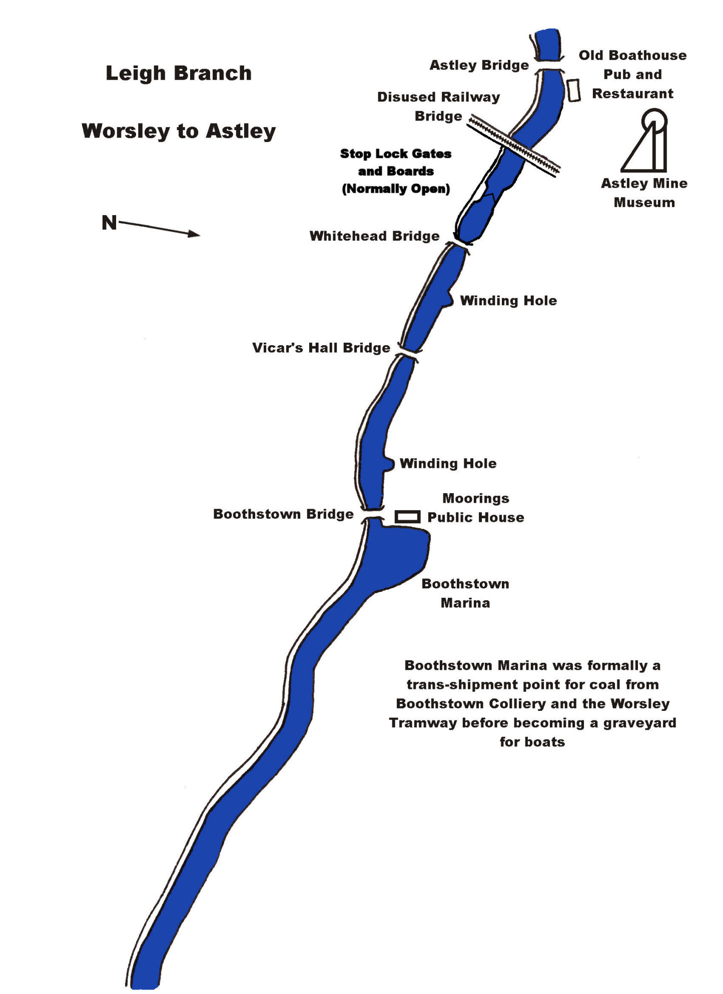
.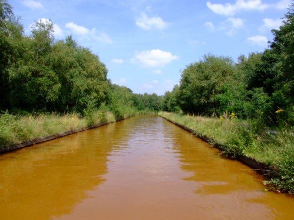
The straight after Worsley with the location of the Hollins Ferry Branch at
the bend
The next point
of interest is the Boothstown Pen. Here, there were more underground canals, but
only one and a half miles compared to Worsley's forty six. It was also the
terminus of the Bridgewater Tramway, which transported coal from outlying mines
to the canal. The basin was once surrounded by warehouses, now demolished, and
was quite a busy area in it’s heyday. In later years, after the mines had been
closed, the basin became a boats’ graveyard where fishermen tried to lure fish
from their hiding places between the sunken narrowboats, Leeds and Liverpool
short boats and Bridgewater barges. The entrance from the canal was filled in to
prevent boats being damaged on the many sunken craft. In 1989, the basin was
emptied, the old boats removed and the basin converted to off-line marina
moorings complete with a small canal shop, an up-market housing development
built, the surrounding area landscaped and a new pub… The Moorings, added. Quite
a contrast from how it was in the not too distant past. Whilst looking at this
area, it is surprising just how clear the water is in direct contrast to a short
distance away at Worsley.
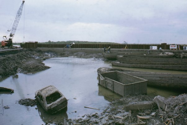
Boothstown Pen being drained prior to converting it into a marina
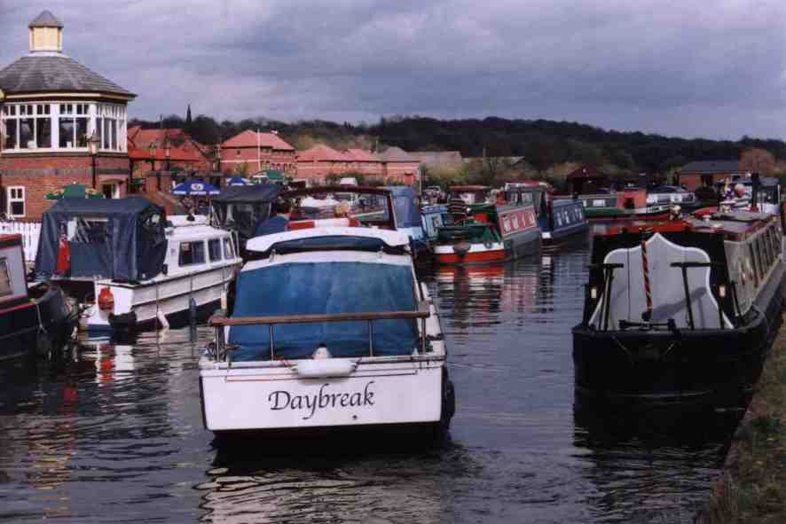
The Moorings at Boothstown are popular with boaters
The canal
threads its way through the strange landscape filled with coal tips until
Astley is reached. Here there is a
Mining Museum
and public house, access to which is gained via
Astley Bridge.
A little further on, the Boat House pub and restaurant is reached. There is
also another pub along the road, some
shops and a Post Office.
Due to the continuing threat from
subsidence two new stop gates have been installed to minimize the risk of
leakage from the canal.
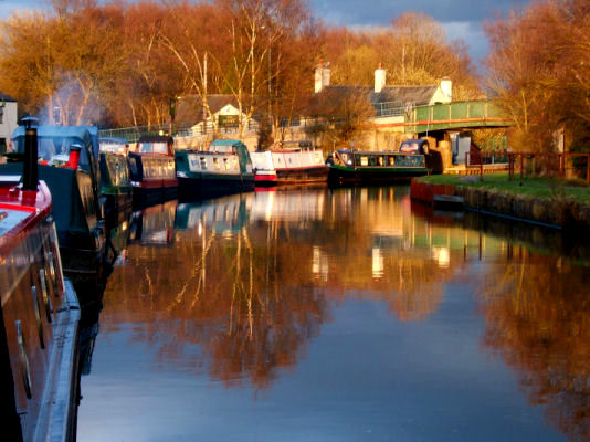
Narrowboats moored at Astley
The chimneys
and hills of Leigh slowly grow closer. After passing a large school the canal
enters a factory-lined canyon. A little further on is located Butt's Basin
where there are boats moored
here from
Worsley Cruising Club.
A little further on at
Butt's Bridge is a sanitary station.
Shortly after Mather bridge
is Bedford Basin basin is also home to “Water Womble”, an
ex-Leeds and Liverpool short boat that travels along the canal acting as a
waterborne road sweeper. Butts Bridge,
Mather and Leigh bridges give access to Leigh town centre with all the usual
amenities.
The best
moorings are through the stop boards that mark the end of the Bridgewater
Canal and on the
Wigan
side of Leigh
Bridge, in the basin opposite the old Leeds and Liverpool
canal warehouses now tastefully renovated. If traveling on towards Wigan, at Plank Lane Lift Bridge, a British Waterways
Board Officer records boat details and checks boat licenses.
Return to Contents
The
Runcorn Arm
Immediately
after turning onto the Runcorn Arm from the main line, the canal crosses a
railway on a modern concrete aqueduct. Just past the aqueduct are the old
trans-shipment wharves (which are now private moorings) and
Pyranha
Mouldings Ltd who occupy
the "Black Shed" warehouse that has been tastefully extended. Pyranha
produce fibreglass
kayaks and canoes renowned the World over.
Opposite the
Marine Village
housing development is the entrance to
Preston Brook Marina. The
Marina offers secure
moorings for over three hundred boats as well as brokerage, slipways, Calor gas,
boat and engineer repairs in addition to winter storage. The
Marina is owned by the
Bridgewater Canal
Canal Company. One hundred metres past the marina entrance is a
water tap, toilet and sanitary station.
An aerial view of Preston Brook Marina - note the Main Line of the canal to Manchester
on the top
right
At Borrow’s
Bridge, there is Runcorn East Station, shops, a pub and a fish and chip shop a
short walk up the hill. Along this
stretch of canal, there are excellent views across the valley towards Daresbury.
Norton Bridge is a rare commodity on the Bridgewater canal, for it’s a change-over
bridge where the towpath changes sides. The
canal now enters a very pleasant wooded cutting as Norton Priory is reached. The
Priory is well worth a visit and features beautiful gardens and restored
buildings. Access is gained via Green’s Bridge and following the path over the
bridge, also at Norton are swimming baths, squash and tennis courts in addition
to running tracks. Immediately after Green’s Bridge, the canal negotiates an “S”
bend as it skirts a large natural lake. Just before
Astmoor
Spine Road
Bridge, The Barge public
house and restaurant is situated.
The towpath
reverts to it’s usual side at Old
Astmoor
Bridge, which is followed
by a wide stretch of canal that was once lined with warehouses. Today, the only
give-away to their past existence is the odd stump from a loading crane
and the mooring rings. The next stretch is very exposed giving a good view of
Fiddler’s Ferry power station. This stretch is renowned for the winds coming in
off the River Mersey.
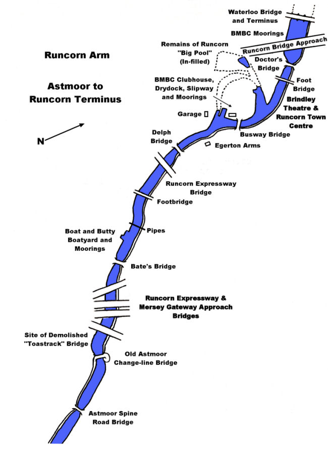
Soon, boats
moored at the “Boat and Butty Company” are passed. The
Jubilee
Runcorn-Widnes
Suspension Bridge
can be
seen on the horizon before warehouses enclose the canal. The Grapes Hotel is
adjacent to the footbridge with the Egerton Arms just around the corner. A little further on are
the headquarters of the Bridgewater Motor Boat Club, the oldest boat club on the
canal, founded in 1952. At one time, the area was Sprinch’s Boat Yard, but now
B.M.B.C. members operate the slipway and dry dock built on one of the old arms
that used to lead to the “Big Pool”. The clubhouse has a bar and the atmosphere
is cordial. Boaters are invited to call for a chat and enjoy their hospitality. The Arm just past the Club House used for
members’ moorings once lead to the “Big Pool” before building of the Runcorn
Expressway necessitated it’s in-filling.
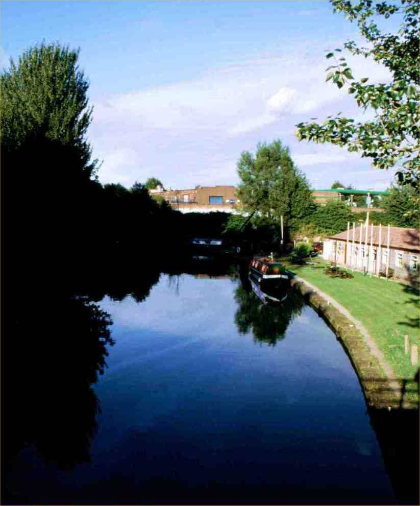
A surprisingly rural corner of Runcorn
The end of the
canal is now in sight. At Waterloo
Bridge there are more
moorings belonging to B.M.B.C. members and easy access to the town centre, which is a short
distance away. The three arches of
Waterloo
Bridge
once
spanned a canal dual carriageway with a dry-dock in the centre, but were removed
to make way for
the Jubilee Bridge link road bridge. If
time allows, a walk down the old line of the canal is a must. The two lines of
locks are still traceable down to Bridgewater House, where the canal once
connected to the
Manchester Ship Canal
as well as giving access to the Runcorn and Weston
Canal, which connected with the River Weaver
Navigation via Runcorn Docks.
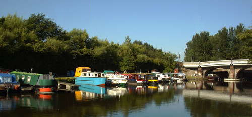
BMBC moorings at Waterloo Bridge
A contemporary photograph of Bridgewater House in Runcorn... now a college
campus
What a
pity the canal had to be vandalised by town planners. When walking around here
one thinks how easy it would have been to re-open. Access to the Runcorn and Weston
Canal
would give a second route into the Weaver and create a small circular cruising
route in the shape of the “Runcorn Ring” consisting of the Runcorn and Weston
Canal
leading to the River Weaver,
up the Anderton Boat Lift and onto the Trent and Mersey Canal before returning
to the Bridgewater Canal.
With the
current upsurge in recognising the potential of our canals in urban development
schemes and the re-opening of many disused canals, there is the possibility that the mistakes of the past will be rectified in Runcorn.
With the opening of the Mersey Gateway Bridge, the old Jubilee Bridge link road
bridge behind Waterloo Bridge has now been demolished leaving the way forward
for the reinstatement of the canal leading down to the Manchester Ship Canal.
The Unlock Runcorn scheme has the backing of Halton Borough Council and plans
have been made for the reinstatement of the canal using the Old Line of locks.
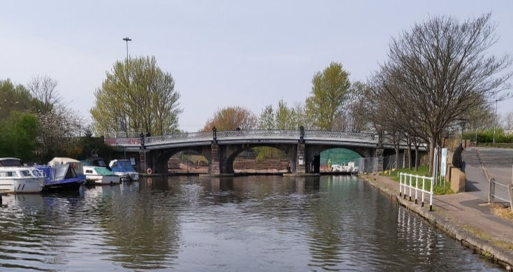
Waterloo Bridge with the concrete bridge behind it
demolished
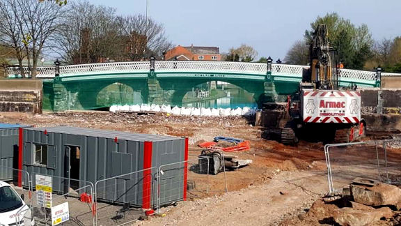
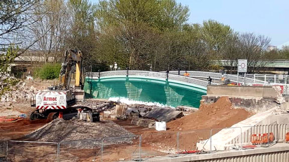
Two photographs of Waterloo Bridge from the opposite
direction
After Waterloo Bridge it is proposed to build a vertical boat lift to lower the
new canal to allow it to pass beneath the railway viaduct. After the boat lift
the canal makes a right turn, beneath Percival Lane Bridge and enters a holding
basin for the two-step staircase locks and the entrance to Runcorn Marina. After
the staircase locks, there is another waiting basin. This one is for the
inclined plane which lowers craft down to the level of the Manchester Ship Canal
adjacent to Bridgewater House.
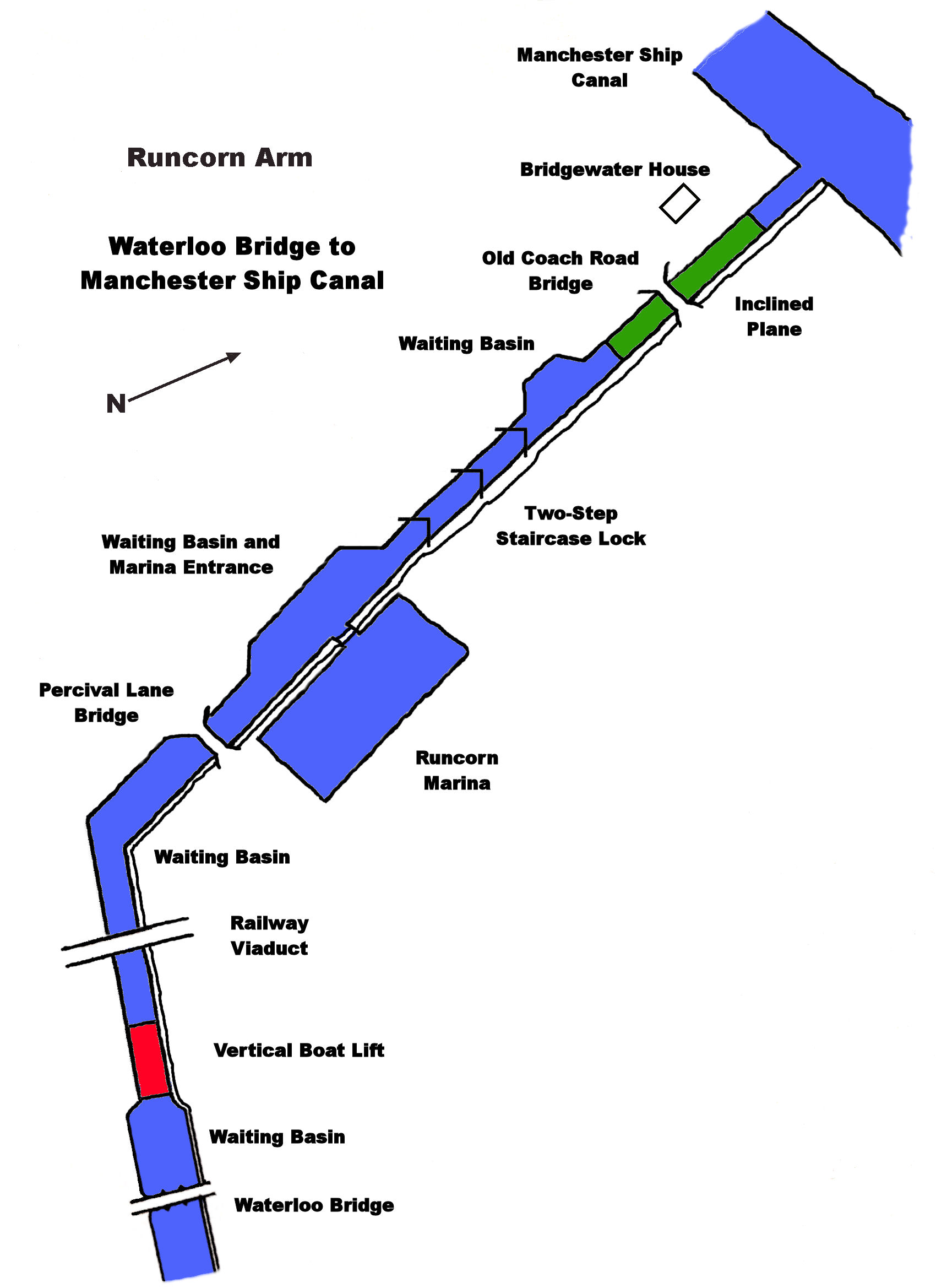 -
-
The proposed route from Waterloo Bridge to the
Manchester Ship Canal Connection
The link is, at present, only a proposal and the end result may be quite
different to the one planned. The development of the canal in this area would
provide a renewed focus to Runcorn Old Town, provide new marina moorings, bring
in canal tourists to view the boat lift and inclined plane in the same way that
the Falkirk Wheel and Anderton Boat Lift do for their respective areas. It ,
jobs and prosperity would also
open up the isolated northern end of the Runcorn Arm and create a new cruising
ring via the Manchester Ship Canal, Runcorn and Weston Canal, Weaver Navigation,
River Weaver, Anderton Boat Lift and the Trent and Mersey Canal. This tourism
would also generate
employment which would, in turn, bring
added
prosperity to the area.
Return to Contents
Preston Brook Tunnel
Preston Brook Tunnel is 1133 metres (1239 yards) in length
and is not straight. It is just possible toe see from one end to the other. It
is not possible to pass through the whole length of the tunnel. As a result of
this, a timetable is in operation for craft movement at all times. In an
emergency, craft may just pass in the wide part of the Cathedral.
Craft Entry Southbound - Entry is only between twenty and thirty minutes
past the hour.
Craft Entry Northbound -
Entry is only between ten minutes to the hour and on
the hour.
About two thirds of the way through the tunnel can be seen the new sections (affectionately
referred to as the "Cathedral") constructed when the tunnel collapsed in 1982. A
quick look upwards when passing the
ventilation duct (drips allowing) will give some idea of how far beneath the
ground the tunnel is. Unpowered craft are not allowed passage through the
tunnel.
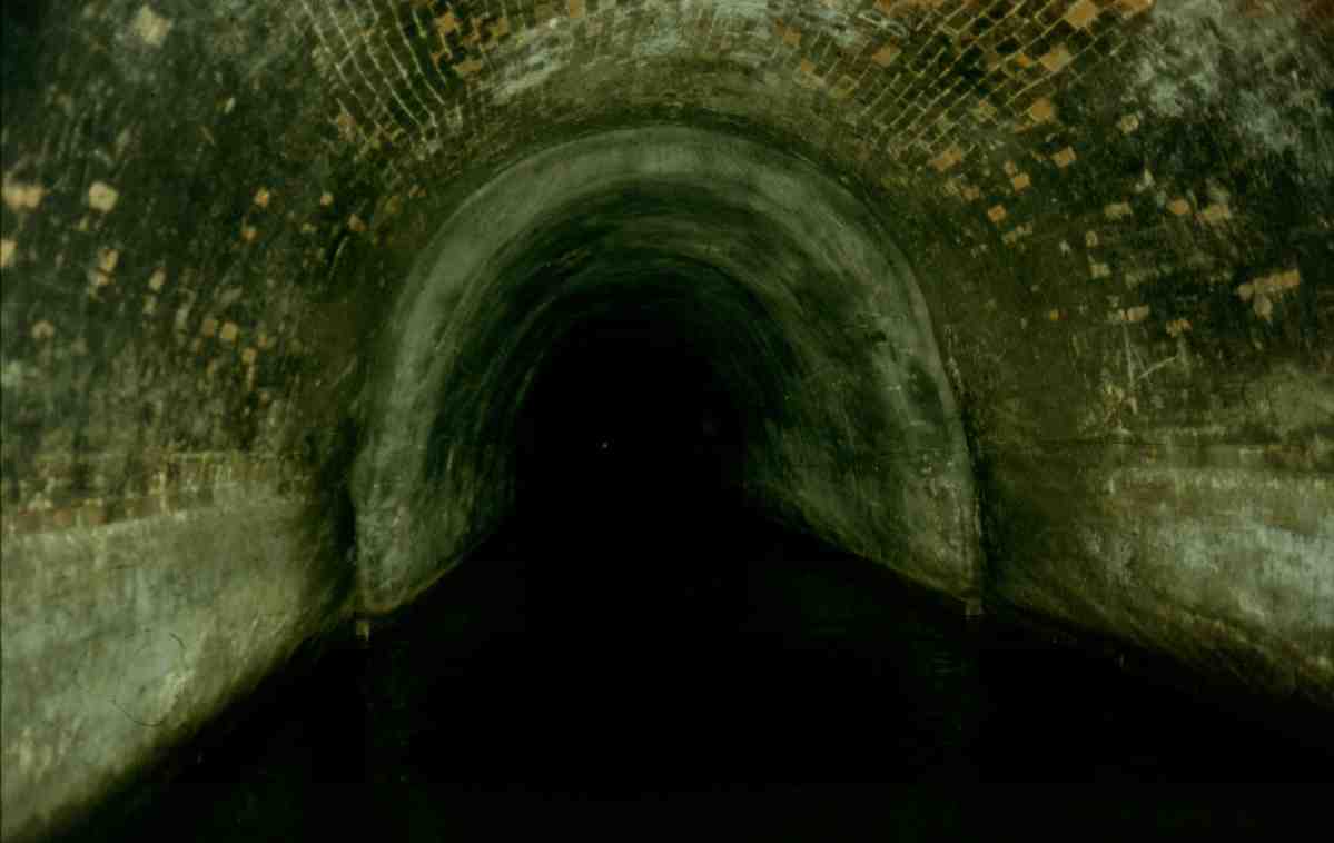
Inside Preston Brook Tunnel
The "Cathedral" in Preston Brook Tunnel
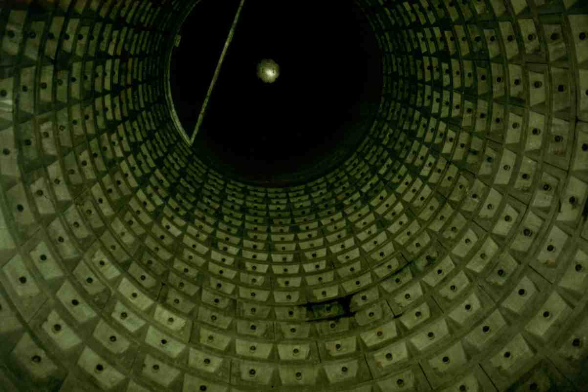
Looking up the ventilation shaft in the "Cathedral"
Branch Distances
|
Preston Brook to
Runcorn
Waterloo
Bridge
-
|
8 km (5 miles) |
|
Preston Brook to Preston Brook Tunnel - |
1.2 km (0.75 miles) |
|
Preston Brook to
Stretford -
|
33 km (20.5 miles) |
|
Stretford
to Leigh -
|
17.3 km (10.75 miles) |
|
Stretford
to Castlefield -
|
4.4 km (2.75 miles) |
|
Woden St.
footbridge to Hunt’s Bank (River Irwell) - |
3.6 km (2.25 miles) |
Mileage Chart
| Main
Line - |
|
|
Preston
Brook Waters’ Meeting -
|
0 km (0 miles) |
|
Red
Brow
Underbridge
- |
1.6 km (1 mile) |
|
Keckwick
Bridge
- |
3.2 km (2 miles) |
|
Moore Bridge - |
4.8 km (3 miles) |
|
Walton
Bridge
- |
6.4 km (4 miles) |
|
London
Bridge
- |
8 km (5 miles) |
|
Lumbrook
Underbridge
- |
9.6 km (6 miles) |
|
Stanney Lunt Bridge - |
11.2 km (7 miles) |
|
Pickering’s Bridge - |
12.9 km (8 miles) |
|
Thelwall Viaduct - |
14.5 km (9 miles) |
|
Barsbank
Bridge
- |
1.6 km (10 miles) |
|
Oughtrington Bridge - |
17.7 km (11 miles) |
|
Agden Bridge - |
19.3 km (12 miles) |
|
Bollin Aqueduct - |
20.9 km (13 miles) |
|
Seamon’s Moss Bridge - |
22.5 km (14 miles) |
|
Broadheath Bridge - |
24.1 km (15 miles) |
|
Timperley
Bridge
-
|
25.7 km (16 miles) |
|
Marsland
Road
Bridge
- |
27.3 km (17 miles) |
|
Doctor White’s Bridge - |
28.9 km (18 miles) |
|
The Old Watch House - |
30.5 km (19 miles) |
|
Longford
Road
Bridge
- |
32.1 km (20 miles) |
|
Stretford Waters’ Meeting - |
33 km (20.5 miles) |
| Leigh Branch - |
|
Stretford Waters’ Meeting -
|
0 km (0 miles) |
|
Parkway Road Bridge |
1.6 km (1 mile) |
|
Barton Aqueduct - |
3.2 km (2 miles) |
|
Patricroft Railway Bridge - |
4.8 km (3 miles) |
|
Worsley - |
6.4 km (4 miles) |
|
Keeper’s Turn - |
8 km (5 miles) |
|
Boothstown Pen - |
9.7 km (6 miles) |
|
Vicar’s Hall Bridge - |
11.2 km (7 miles) |
|
Morley’s Bridge - |
12.9 km (8 miles) |
|
Marsland
Green
Bridge
- |
14.5 km (9 miles) |
|
Butt’s Basin - |
16 km (10 miles) |
|
Leigh Stopboards - |
17.2 km (10.75 miles) |
| |
|
| Manchester Branch - |
|
Stretford Waters’ Meeting - |
0 km (0 miles) |
|
Pomona Lock -
|
1.0 km (0.6 mile) |
|
Hulme Lock - |
3.2 km (2 miles) |
|
Castlefield Junction - |
4.4 km (2.75 miles) |
Return to Contents
Navigational
Information
The
Bridgewater Canal is owned, operated and administered by the Bridgewater Canal
Company Limited, Peel Dome, The Trafford Centre, Manchester, M17 8PL, telephone
number - 0161 629 8266, fax number - 0161 629 8334. There is also an emergency
out of hours telephone number which is - 0151 327 2212. This number is Port
Security at Eastham Locks.
| Maximum Craft Dimensions
|
| Beam |
4,2 mtrs (14 ft) |
|
Length
|
21.3 mtrs (70 ft) |
| Draught |
0.6 mtrs (2 ft) (deeper craft by arrangement) |
| Air Draught (Headroom) |
2.5 mtrs (8ft 6ins) |
Licensing
All
craft, including dinghies, canoes and tenders must display a current Bridgewater
Canal Licence or British Waterways Licence. If possible, the licence should be
displayed at the front of the craft, facing forwards, on the port (left) side of
the cabin or in the windscreen. Craft licensed by British Waterways may cruise
on the Bridgewater
Canal for a period not
exceeding seven days. Any period longer than this will require a Bridgewater
Canal licence which can be obtained on
application for periods of time less than the standard twelve-month licence.
Private license holders are not permitted to trade, hire or to carry fare-paying
passengers.
Under a reciprocal arrangement with British Waterways,
Bridgewater Canal licence holders may cruise on the following stretches of
waterway for a period not exceeding fourteen days, free of charge -
Leeds and Liverpool Canal
Leigh to Burscough and from Leigh to the bottom of
Blackburn Locks although until 2013 the arrangement
includes
passage to Liverpool
Trent and Mersey
Canal
Preston
Brook Tunnel to Harecastle Tunnel
Shropshire
Union
Canal
Middlewich
to Barbridge Junction
River Weaver
Between Hunts Lock and Saltersford Lock with the
usual charges payable for use of the Anderton Lift
The
Bridgewater
Canal licence also covers the Upper
Reaches of the Manchester
Ship Canal from Lowry
Footbridge to Hunt’s Bank on the River Irwell (the head of navigation) subject
to additional conditions available on request from the Bridgewater Canal Company
Limited. All craft must be insured for Third Party Risks and Salvage Costs and
have a current Boat Safety Certificate covering current boat construction and
use regulations. Craft can only be permanently moored on the canal at approved
sites or marinas.
Speed Limit
·
The maximum
speed limit on the canal is 6.5 kph (4 mph).
·
If excessive
wash is produced, then craft must slow down until an acceptable wash is present.
·
Slow down when
passing moored craft, when approaching a bridge, junction, fishermen, small
un-powered craft or other navigational hazards.
Every vessel should, at all
times, proceed at a safe speed so that the steerer can take proper and effective
action to avoid collision and be stopped within a distance appropriate to the
prevailing circumstances and conditions.
Mooring
Do not moor…
-
On a bend
-
Within 23 metres (25 yards) of a bridge
-
On an
Aqueduct
-
Try to avoid mooring within 9 metres (10 yards) of an angler
-
0n the offside of the canal whilst in transit except on
an
approved 24hr mooring
-
At a water
point/sanitary station except when using the facility
-
Opposite a
Winding Hole (used by boats to turn around)
-
Where there is an official Company mooring prohibition
notice
When Mooring…
-
Tie up bow and stern (front and back)
-
Use mooring
rings or bollards if available
-
Beware of possible erosions, which may be hidden by grass
-
Beware
of possible services laid within the towpath. Look for markers
indicating possible dangers e.g. electricity cables, gas, water,
etc
-
Ropes must not cross the towpath as this creates a
hazard for
Pedestrians
-
Mooring
adjacent to the towpath is for 24 hours only whilst in transit
-
Make sure
that the mooring pins are marked with something light or bright
to indicate to other towpath users a potential hazard, eg -
upturned plastic bottle, a white cloth or plastic bag attached to the top of
the pin.
-
Mooring
stakes must be driven into the towpath with care to avoid damaging the canal
sidewall
-
In some places,
electricity cables are buried beneath the towpath. These locations are
signposted and should be avoided for obvious reasons
-
The towpath is a Public
Right of Way, so mooring ropes must not be placed across it so as to prevent
pedestrians tripping over the ropes
-
It is forbidden to moor
within 21.5 mtrs (70 ft) of bridges, aqueducts, locks, other obstructions or
engineering and maintenance works
Navigation
Every vessel
shall…
·
At all times,
maintain a proper look-out by sight and bearing.
·
Where possible,
keep to the centre of the canal.
·
Overtake other
boats on the port side (left) at normal speed. The boat being overtaken has
right of way.
·
Make sure your
way is clear before commencing your maneuver. An overtaking maneuver must not be
made where your visibility is restricted i.e. on a bend or approaching a bridge
or where your wash will disturb anglers or moored craft.
·
When being
overtaken, slow down, travel at a speed sufficient to maintain steerage.
·
Where possible,
move over to starboard (right).
·
Try to avoid
turning or maneuvering in the vicinity of any anglers.
·
When
approaching narrow bridges, give way to the nearer craft. It has right of way.
If you are unsure, give way.
·
Give way to
towing craft. A towing craft has right of way.
·
All craft shall
keep well clear of any dredging or working craft and obey any hazard or speed
notices. Working and other wide craft need more room to maneuver.
·
Give an audible
notice of approach when necessary. A craft shall give adequate warning by
sounding a horn or other suitable device.
·
Be aware of
unpowered craft. Slow down when approaching as many un-powered craft are crewed
by small children.
·
Give due
consideration at all times to other users of the canal’s facilities and the
canal’s neighbors.
·
Navigation at
night is not recommended. Every vessel, when under way between Sunset and
Sunrise or in conditions
of restricted visibility shall, as a minimum carry a suitable white light
visible fore and aft. A navigation light is not a tunnel light. Craft equipped
with side navigation lights eg - red port (left), green starboard (right) and
white masthead (centre), shall also exhibit them.
·
The total
number of persons carried on board the pleasure craft must not exceed the
craft's designed carrying capacity. To maintain stability and headroom under
bridges whilst underway, crew and passengers must not occupy the roof area of
the craft.
Health and Safety
In the event that a member
of the crew falls overboard, put engine immediately into neutral. Throw out a
line or lifebelt to the person in the water. When safe to do so, advance the
boat slowly towards the bank to effect a rescue or move the craft near to the
person in the water where he or she can be pulled back on board. Remember that
the person in the water may be at greatest risk from the propeller. Never put
the engine in gear to turn the propeller until it is safe to do so.
Water Borne Diseases
Certain water
borne diseases associated with vermin may be present in canal water. Users of
the canal and adjacent land should pay due respect to cleanliness, particularly
where open wounds, e.g. cuts, abrasions, etc., are involved and should always
wash their hands before eating. Anyone accidentally falling into the canal
should seek medical attention as soon as possible as a precautionary measure.
Children and Pets
·
Children and
pets should be under supervision at all times.
·
Arms and legs
in particular should be kept clear of potential crush hazards, e.g. - canal
banks, bridges and other craft.
·
Children and
all non-swimmers should wear lifejackets at all times.
·
Obey any signs
ordering dogs to be kept on a lead.
·
Abide by any emergency
measures controlling animals that are in force.
Swimming
To swim or wade
in canals is dangerous and is not permitted. Swimming may result in death.
The Dangers Are
-
-
Poor water
quality.
-
Depth of water
-
Coldness
of water
-
Underwater
obstructions
-
Presence
of silt and mud
-
Swimmers
may become entangled in rubbish or weed
-
Swimmers
may be hit by a passing boat
-
To swim in
the Bridgewater Canal is an offence under the Bridgewater Canal Bye Laws
1961
-
The Water
depth is up to 2 metres. Children should be supervised at all times
·
Ice
Never walk on the canal (or
any other deep water for that matter) when covered with ice. The thickness of
the ice cannot be measured and is unpredictable. When cruising in icy
conditions be aware that ice will damage craft with GRP and wooden hulls.
Steel hulled craft will have the paint removed at waterline level.
Pollution and Waste Disposal
-
Sewage,
oil or oil derivatives, toilet waste or any other pollutants must not be
discharged into the canal at any time
-
Always
take your rubbish home or dispose of it into skips and bins provided by the
Company
-
-
In the event of a pollution incident please contact the Company or
Environmental Agency (0800 807 060) at the earliest opportunity, giving full
details of the incident
Dog Fouling
The fouling of
the towpath by dogs is not permitted.
Dog owners are
asked to show consideration for other users of the towpath by cleaning up after
their pet.
General Information
Angling
·
A current Angling License
for the stretch of canal being fished must be obtained.
·
Exercise due
consideration at all times for other users of the canal, it’s facilities and the
canal’s neighbours. The towpath, in many places is a public right of way.
Take care that your fishing equipment is
not blocking the towpath.
·
·
Before setting
up to fish always check for power
lines and never fish within 30 metres (100
feet) of them.
·
Look out for pedestrians and
others when casting or drawing back.
·
Do not leave
your rod or pole across the towpath when not in use. In the interests of safety, anglers are advised not to
raise the pole or rod
over a passing
boat. It is much better to either pull back or place it parallel to the canal
wall.
·
Do not fish within 9 metres
(30 feet) of a bridge.
·
·
Take your
litter and unused bait home. Discarding bait or food will spoil other peoples
fishing and may attract vermin.
·
To avoid
disturbance by boats turning, do not fish in winding holes (wide areas of water
used by boats to turn around).
·
Anglers should
not shout instructions to passing craft. Craft will normally keep to the centre
of the canal.
·
Do not fish
within 5 metres (16 feet) of a moored boat. When fishing
opposite a moored boat, take care not to allow ground bait etc. to come into
contact with the boat.
·
The fishing
rights on the Bridgewater Canal
are leased to a number of different Fishing Clubs, information on which is
available from the Manchester Ship Canal Company.
Use of Towpaths
|
● |
The following
points are to be observed at all times when using the towpaths - |
|
● |
Motorcycling on the towpaths is not permitted |
|
● |
Cycling on the towpaths is not permitted |
|
● |
Horse riding on the towpaths is not permitted |
|
● |
Due
consideration is to be given at all times to other users of the facilities
and the canal’s neighbours |
|
● |
Footwear should
be worn to suit the towpath and weather conditions |
|
● |
In certain areas the towpath may not be suitable for prams or wheelchair
use |
|
● |
The towing path is unlit and due to the close proximity of deep water care
must be taken in poor light conditions |
|
● |
Bank erosion is caused by water action washing against the walls of the
canal. Sometimes, holes can appear at the back of the coping stones and
these holes may be hidden by grass |
|
● |
Care must be taken when alighting from boats and when using the towpath |
|
● |
Historic features such as mooring rings, posts, etc. may obstruct the
towpath |
|
● |
Mooring ropes and fishing tackle may also present a hazard for pedestrians |
|
● |
Barriers have been erected across the towpath at various locations to
prevent access by motorcycles |
|
● |
Please take
your uneaten food and litter home to dispose of it properly.
Carelessly discarding food may attract vermin |
|
● |
If an angler is baiting his line, the pole or rod may be across the
towpath. Please wait a moment or two for the pole or rod to be removed |
| |
|
Footnote
Acknowledgements
I would
like to thank my wife, Angie, for putting up with me whilst working on yet
another project and for her painstaking help with the proof-reading,
Mike Webb
in the Bridgewater Department of Peel Holdings for his invaluable assistance
and for allowing access to the Bridgewater Canal Photographic Archives,
Graham Bridge - Runcorn
Locks Preservation Society for providing old photographs,
Margaret, Brian and Nigel Hamilton of Thorn Marine, Stockton Heath for
lending photographs for scanning and the many friends and fellow canal
cruisers too numerous to mention who have also loaned their valuable
photographs for scanning, provided additional details and information. All
contemporary photographs were taken by myself unless otherwise accredited.
Return to Top
Click
here for the latest entries or select another book below...
Website
|
 |
|
 |
|
"Canalscape" and "Diarama" names and
logo are copyright |
Updated
08/07/2020