|
A supplement to the |
|
eBook and website by Cyril J Wood |
Canals and Inland Navigations throughout the World
|
A supplement to the |
|
eBook and website by Cyril J Wood |
![]()
![]()
In Preparation
| Contents |
| Introduction |
| French Connection - The Canal du Midi |
| Canadian Wanderings - The Rideau Canal |
| Teutonic Travels - The River Rhine |
| Isthmus Investigation - The Panama Canal |
Every so often a colleague or friend will travel to foreign parts on holiday and when they see what appears to be a canal they take photographs of it for me. With this happening with increasing frequency I decided to dedicate part of the website to foreign waterways. I have also included our trip along the River Rhine which is also documented in Canalscape Book 4 - New Horizons. As more photographs are taken and reports made, different waterways will be added. With the locations being so distant I have to rely on additional photographs sourced from the Internet. Where possible, the website they come from is credited.
|
The Canal du Midi |
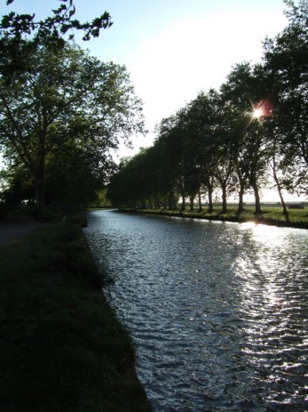
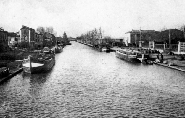
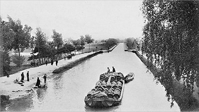
The Canal du Midi as we have come to expect it... complete with avenues of trees lining the banks
(Photograph - Gary Sculthorpe)
I have made no secret of my predilection for the European waterways and the Canal du Midi in particular. Imagine my envy when a work colleague announced that she and her husband were spending a week in Carcassonne in the South of France! When she returned to work after the holiday the inevitable photographs were shown and made me even more determined to visit the Canal du Midi and this ancient walled town basking in the southern French sunshine (even in April when, back home, we were still experiencing hail).
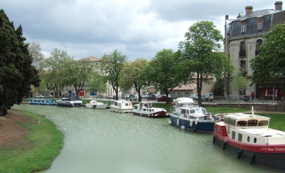
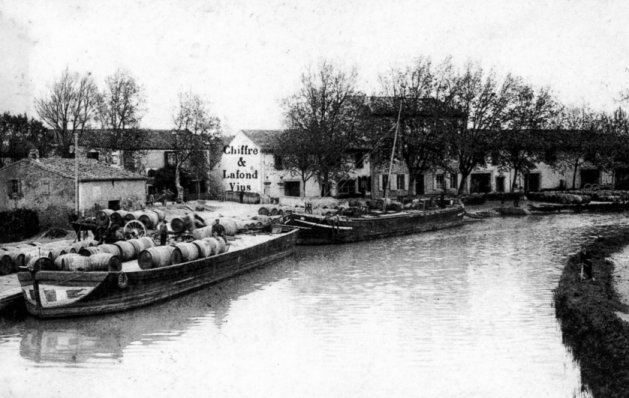
Boats including a narrowboat on the far left (two-tone blue), moored on the Canal du Midi at Carcassonne
(Photograph - Barbara and Gary Sculthorpe)
When my colleague was relating their experiences in Carcassonne she told me that they saw a narrowboat moored in the town which they photographed to show me. Closer inspection of the photograph revealed that the narrowboat in question was called "Amethyst", came from Appley Bridge near Wigan and had D.V.C.C. (Douglas Valley Cruising Club) painted on the cabin side. We most probably passed the boat at it's home moorings last summer when cruising to and from the Coal and Cotton Boat Rally held in Liverpool.
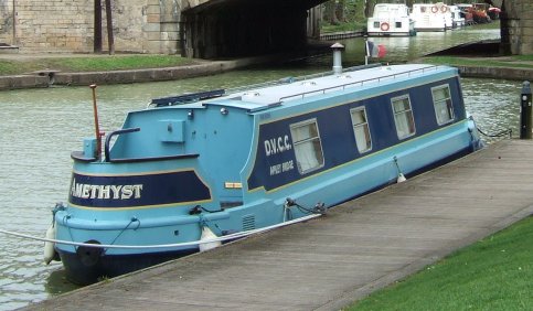
NB "Amethyst" with D.V.C.C. (Douglas Valley Cruising Club) and Appley Bridge painted on the cabin side
(Photograph - Barbara and Gary Sculthorpe)
I recently discovered a link between the North West of England and the Canal du Midi (the Canal du Lateral actually). At Broughton near Chester is the Airbus factory that builds the wings for the enormous Airbus A380. The massive completed wings are loaded onto a barge and transported down the River Dee and transhipped onto a cargo ship that takes them down the coast, across the English Channel and down the French coast to the Bay of Biscay. At Bordeaux the wings are transhipped onto another barge for carriage up the River Garonne to the Airbus Assembly Complex at Toulouse. The Canal du Midi was the subject of such works as Terry Darlington's best selling book... "Narrow Dog to Carcassonne" and the location for the popular culinary BBC TV series... "Rick Stein's French Odyssey" where the renowned chef cruised along the Canal du Midi on a barge, sampling local cuisine on the way. But two hundred and fifty years earlier it was partly the inspiration behind the construction of England's Bridgewater Canal. Besides this, the Canal du Midi has much more in common with the Bridgewater Canal than one might think... they are both the first canals independent of a watercourse to be built in their respective countries, they were both the brainchild of local entrepreneurs and they both featured pioneering civil engineering works of the time such as aqueducts and tunnels.
A Brief History of the Canal du Midi
A connection across France between the Atlantic and Mediterranean Oceans had been dreamt about since Roman times. A waterway between these two seas would have serious commercial benefits in removing the need for a trip around Gibraltar for coastal traffic transporting goods and produce from one side of France to the other. It would also have political and military significance in the transportation of materials for military purposes as well. Unfortunately the civil and hydraulic engineering expertise and technology to construct an artificial waterway such as this was not in available until the 17th century. The project that was to eventually become the Royal Canal de Languedoc (the canal's original name) was was the brainchild of Pierre-Paul Riquet, born in Béziers (1604 - 1680), who was a wealthy farmer and tax collector in the area of Languedoc. The canal's original name of the Canal Royal de Languedoc or the Canal des Deux Mers (Canal of Two Seas as it connects the Atlantic and Mediterranean Oceans) was changed in 1789 when it was renamed the Canal du Midi... the name by which it has been known as ever since. Along with many of his predecessors, Riquet identified the need for a reliable and cheap means of transporting grapes, fuel, locally grown farmers' produce as well as general goods and foodstuffs to either the west (Atlantic) coast of France to the southern (Mediterranean) coast. In Riquet's vision, the logical means of doing so was by an artificial waterway linking the two oceans. The main barrier that hindered the implementation of previous schemes to construct a waterway was the crossing of Seuil de Naurouze... the summit level of the proposed route. As well as the physical problems that would be encountered in this area was the problem of water supply. How would sufficient water be obtained to fill the canal and provide water for lockage? Riquet undertook a hydrographical study of the area and came to the conclusion that if water from streams and small rivers in the Montagne Noire area was channelled into an artificial lake or reservoir it could provide the water supply for the canal's summit level. Once his study was complete he personally surveyed the remainder of the route and sought permission from King Louis the Fourteenth to construct the canal. Once permission was given in the French equivalent of an Act of Parliament, construction commenced in 1667.
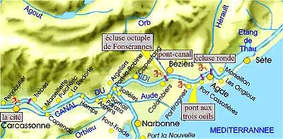
The canal was to run 240 kms from Toulouse in the north to Sète in the south. At Toulouse the canal connected to the River Garonne which runs into the Atlantic Ocean at Bordeaux. At Sète the canal connects to the Mediterranean Ocean via the Etang de Thau... a large tidal basin separated from the Mediterranean by a narrow isthmus or strip of land with an opening to allow shipping to reach to the port constructed on the Island of Sète within the basin.
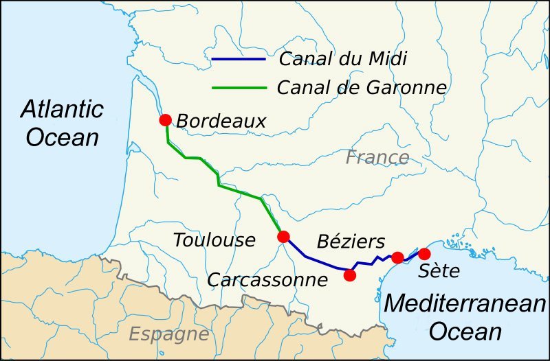
The route of the Canal du Midi from the Atlantic to the Mediterranean Oceans
Twelve thousand men were employed in the construction of the canal and during the next thirteen years Riquet sunk all of his personal fortune into it's construction. During the construction of the canal there were many engineering problems to be overcome such as the previously mentioned problem of water supply and crossing a watershed. The many streams and rivers in the Montagne Noire area were diverted along many kilometres of artificial water channels (which also had to be constructed) into a man-made lake. This lake known as Saint Ferréol Lake was (and still is) the primary water supply for the canal's summit level. It was created by the construction of a dam along a narrow part of the valley which was to contain the lake. The watershed was pierced by the construction of the Malpas Tunnel which was hewn out of solid rock. Many aqueducts were constructed to carry the canal over some quite large rivers. Unfortunately, Riquet did not see his grand scheme completed. He died in 1680 and French military engineer Sebastien Le Prestre, Seigneur de Vauban completed the work. It was opened on 15th May 1681, six months after the death of Riquet. The canal also contains many engineering masterpieces designed by François Andreossy who assisted Riquet as the canal's engineer.
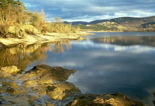
Saint Ferréol Lake - the Canal du Midi's main water supply reservoir
(Photograph - www.canal-du-midi.org)
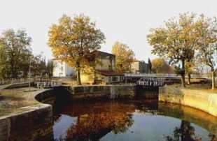
Modifications were made to the canal over the years. They include an alternative route to the Mediterranean at Port la Robine. Here there is a canal junction with the original line of the canal leading to Sète and the newer branch leading via Narbonne to Port la Nouvelle on the Mediterranean coast. At the other end of the canal, there were problems navigating the tidal Garonne River. The obvious solution was to extend the canal to run alongside the river with the entrance locks well downstream where the effects of the tide were less of a problem to navigation. This canal was known as the Garonne Canal or the Canal du Lateral.
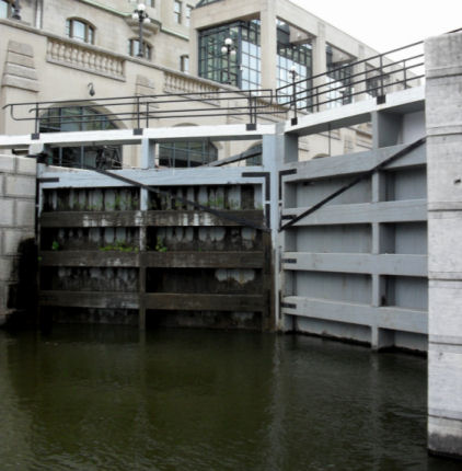
One feature that the Bridgewater Canal differs from the Canal du Midi is locks. Whereas there are no locks on the main line of the Bridgewater the du Midi possesses sixty three conventional locks, most of which possess unusual elliptical chambers measuring 30.5 mtrs long, a chamber width of 11 mtrs at the widest point and a gate width of 6 mtrs.
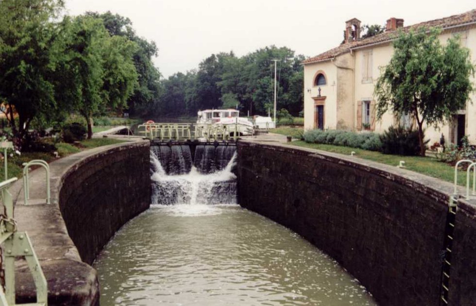
A typical elliptical lock on the Canal du Midi
(Photograph - www.canal-du-midi.org)
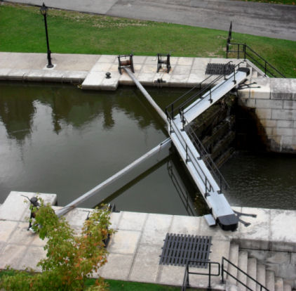
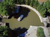
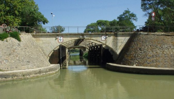
The Round Lock at Agde is unique inasmuch as not only is it circular but it incorporates a junction with the Canal du Garonne. It has three sets of gates locks with multiple exits at different levels... one for the main line of the Canal du Midi to Sète, one for the Canal du Midi leading to the Garonne River and the other for the Canal du Garonne (Canal du Lateral) leading to Béziers and eventually Toulouse. Subsequently, it must be one of the most unusual canal junctions in the world. In the 1970's it was modified to accommodate craft of the Freycinet (large French barge) gauge (38.5 mtrs by 5.05 mtrs) and, as can be seen in the left hand photograph below, is no longer completely circular although the extended side wall of the lock does remain semi-circular.
 |
 |
The unique Round Lock at Agde which features three exits at differing levels
(Photographs - www.canal-du-midi.org)
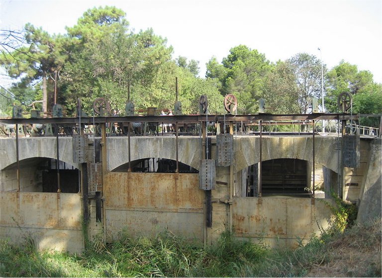
We cannot match the European's when it comes to the scale of their waterways and the complexity and lateral (as well as vertical) thinking used in some of their features. For instance... whilst we only have two operational boat lifts at present in the UK, in Europe there are many. The largest number of chambers in a British staircase lock is normally five but "Neptune's Staircase" on the Caledonian Canal is exceptional in having eight. The French also have one that features eight chambers at Fonserannes (although the eighth chamber is now out of use) giving a rise of 21.44 mtrs and at the same location, as an alternative to the locks is an unusual inclined plane or "water slope" where the water complete with craft floating in it is pushed up a hill. The water is contained by a flexible seal around the movable "gate" at the bottom of the slope. The "water slope" was constructed in 1987 and is similar to one at Montech.
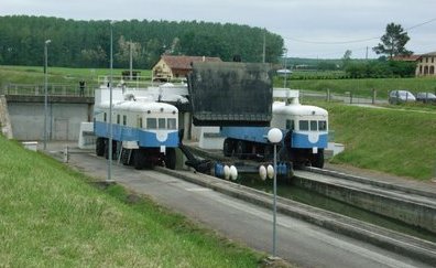
Two converted railway locomotives provide the motive power for the Montech Water Slope
(Photograph - www.canal-du-midi.org)
The two water slopes differ in one fundamental way... at the Montech slope the movable gate and seal is moved up the slope by a pair of modified railway locomotives running on road wheels and tyres. At Fonserannes the gate and seals are moved up the slope by an electrically powered gantry from which the gate mechanism is attached. The other staircase locks on the canal include ten two-step staircases, four three-step staircases and one four-step staircase.
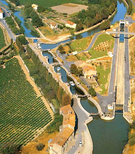
The eight-step staircase locks and Water Slope (right) at Fonserannes
(Photograph - www.canal-du-midi.org)

A closer view of the Water Slope at Fonserannes
(Photograph - www.canal-du-midi.org)
As can be seen, the parallels between the Canal du Midi and England's Bridgewater Canal are many. They were both constructed by men of great vision that sunk their personal fortunes into the respective projects who died before their respective projects were completed. They were both the first examples in their respective countries of a canal built independent of a watercourse and possessed aqueducts that were deemed revolutionary in conveying the canals across some quite sizeable rivers. Admittedly, the Canal du Midi was seen as transport more for agricultural materials whereas the Bridgewater was "a canal that had coal at it's heels" but they both expanded the economic wealth of the areas through which they flowed as well as promoting these areas.
Homps
(Photograph - www.canal-du-midi.org)
La Redorte
(Photograph - www.canal-du-midi.org)
L'Aude
(Photograph - www.canal-du-midi.org)
Narbonne
(Photograph - www.canal-du-midi.org)
Naurouze
(Photograph - www.canal-du-midi.org)
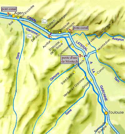
Maps and a Brief Description of the Route
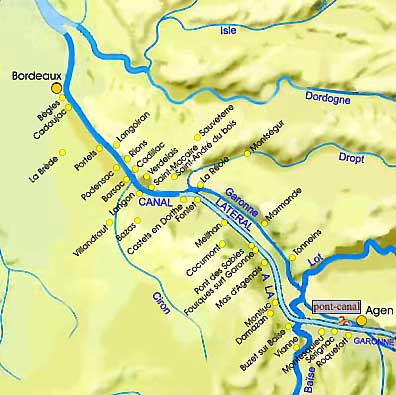
A map of the River Garonne from Bordeaux, Canal du Lateral and Canal du Midi to Agen
(Map - www.canal-du-midi.org)
This section deals with the description of the Canal du Midi's route and is accompanied by maps. The route will be described from west to east. The route starts at the Atlantic port of Bordeaux where the tidal River Garonne meets the ocean. The river was originally navigated as far as Toulouse but due to the unpredictable water levels in the river a "collateral" known as the Canal Lateral or Canal du Garonne was constructed in the 1800s alongside the river which removed the problems associated with river navigation. The entrance locks at Castets-en-Dorthe in Aquitaine are illustrated below.
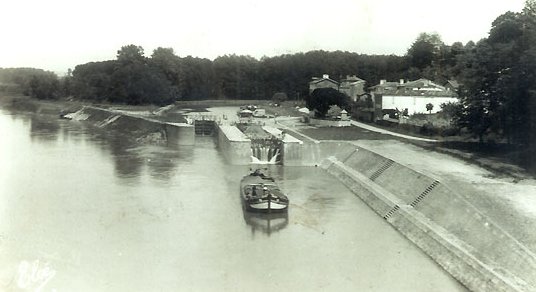
The junction between the Canal Lateral and the Garonne River at Castets-en-Dorthe in Aquitaine
Once Toulouse is reached the original section of the Canal du Midi is entered.
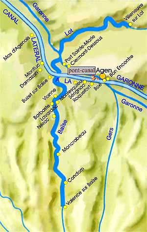
The Rivers Lot and Baise and the Canal du Lateral at Agen
(Map - www.canal-du-midi.org)
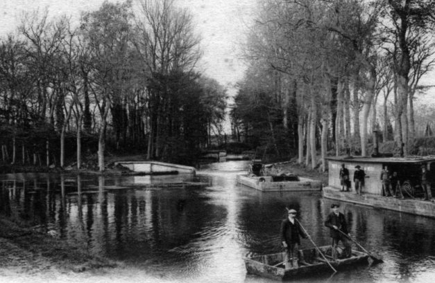
A heavily laden barge with the Agen Aqueduct in the background
(Map - www.canal-du-midi.org)
The Canal du Lateral from Agen to Toulouse
(Map - www.canal-du-midi.org)
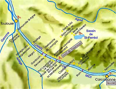
The Canal du Midi from Toulouse to Carcassonne
(Map - www.canal-du-midi.org)
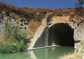
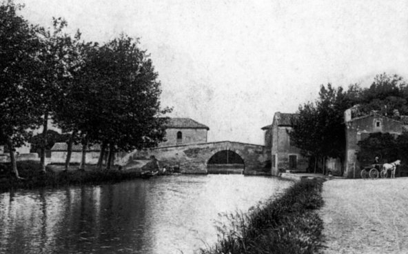
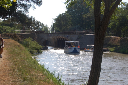
Malpas Tunnel... not far from Beziers
The Canal du Midi from Carcassonne to Narbonne and Sète
(Map - www.canal-du-midi.org)
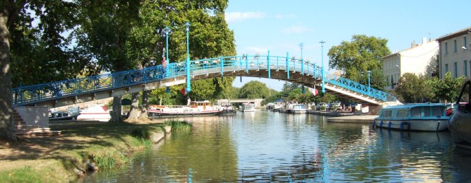
The futuristic footbridge in Homps
(Photograph - Barbara and Gary Sculthorpe)
The unique double aqueduct and overflow weir at Argent near to La Redorte
(Photograph - Barbara and Gary Sculthorpe)
Approaching the Libron Aqueduct... a unique solution for crossing the River Libron on the level
(Photograph - Barbara and Gary Sculthorpe)
Inside the aqueduct are water control sluices to redirect the River Libron in times of flood
(Photograph - Barbara and Gary Sculthorpe)
The River Libron side of the water control sluices
(Photograph - Barbara and Gary Sculthorpe)
This canal's natural beauty, it's unique engineering features and the location of the canal only add to my enthusiasm for visiting it. Much as I would like to cruise in the wake of Terry Darlington and his wife Monica not forgetting Jim the Whippet (now returned safely from cruising down the east coast of the USA in the NB "Phyllis May" - "Narrow Dog to Indian River"). Unfortunately, I do not think that we would be able to afford to take "Total Eclipse" over to the Continent, but hopefully we will be able to explore this fascinating and beautiful canal and it's connections in the not too distant future.
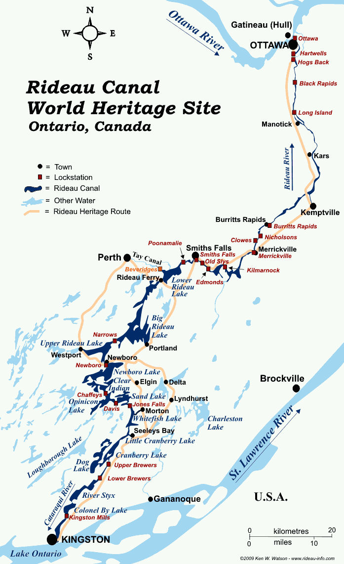
The Rideau Canal and Associated Waterways
Jenni Higgins... another of my colleagues at Wirral Met College recently returned from a trip to Canada. Whilst in Ottawa she came across the Rideau Canal and brought me back many photographs in addition to some explanatory leaflets about the canal. They aroused my curiosity and I immediately felt a project coming on!
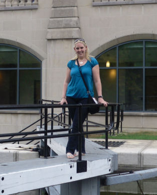
Jenni Higgins at the Rideau Staircase Locks, Ottawa
(Map - www.rideau-info.com)
This little known canal (outside Canada) runs from Kingston on Lake Ontario in the south connecting a series of river waterways starting with the Rideau River and lakes to Ottawa in the north where it runs into the Ottawa River down an eight-step staircase lock. The canal has a total length of 202 km (125 miles). Another river running not too far from the Rideau River is the Niagara River with the water from the famous falls adding to that in Lake Ontario. The Rideau Canal was constructed between 1826 and 1832 by the Royal Engineers supervised by Lieutenant-Colonel John By. Just like the much later Panama Canal many men died during construction due to Malaria.
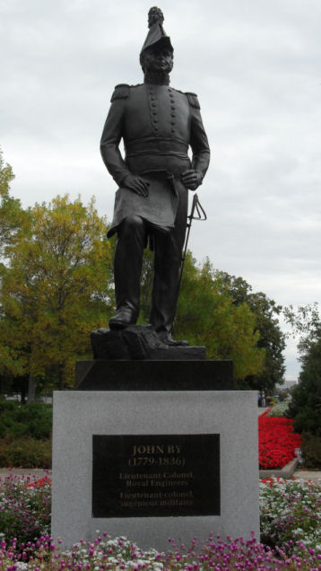
A statue commemorating Lieutenant-Colonel John By
(Photograph - Jenni Higgins)
I traced the course of the canal on Google Earth and was surprised at the size of some of the lakes that the canal route passes through. They are more like inland seas than lakes and make the "Wides" on the Trent and Mersey Canal seem like puddles in comparison. There are 45 locks on the main canal plus another two on the Tay Canal. They are arranged in 23 flights or "lockstations" (24 including Beveridges on the Tay Canal) as they are known in Canada. The canal has a minimum depth of 1.5 mtrs (5 ft) and a maximum depth on the lake sections of 100 mtrs (329 ft).
(Photograph - Jenni Higgins)
During the winter when the canal freezes it becomes the World's longest skating rink and hosts a winter festival every February known as "Winterlude". The Rideau Canal is a National Historic Site of Canada, a Canadian Heritage River and a UNESCO World Heritage Site, There is an excellent website dedicated to the canal at www.rideau-info.com but in the meantime here are a few of Jenni's photographs plus some from other sources as well.
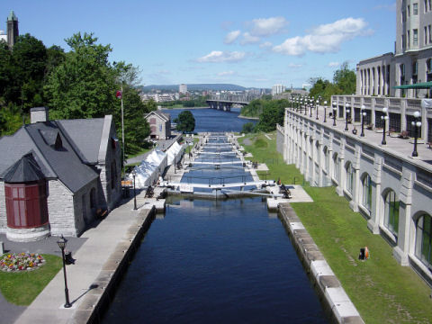
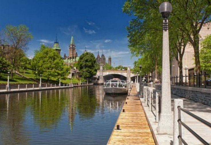
The wonderful iconic eight step staircase lock lowering the canal to the Ottawa River at Parliament Hill
(Photographs - Jenni Higgins)
|
|
|
The unusual lock furniture (left) and familiar-looking lock gates at the staircase locks
(Photographs - Jenni Higgins)
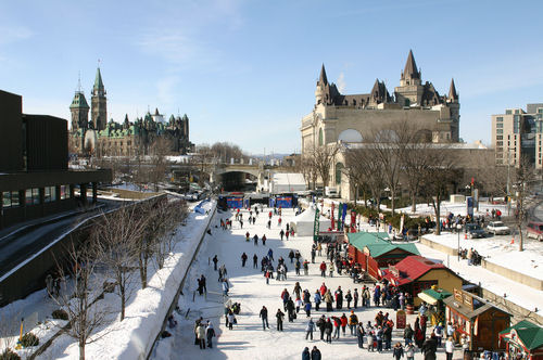
The Rideau Canal Ice Rink during the annual "Winterlude" festival in Ottawa...
(Photograph - www.planetware.com)
... and the same location looking towards Parliament Hill in warmer weather
(Photograph - www.123rf.com)
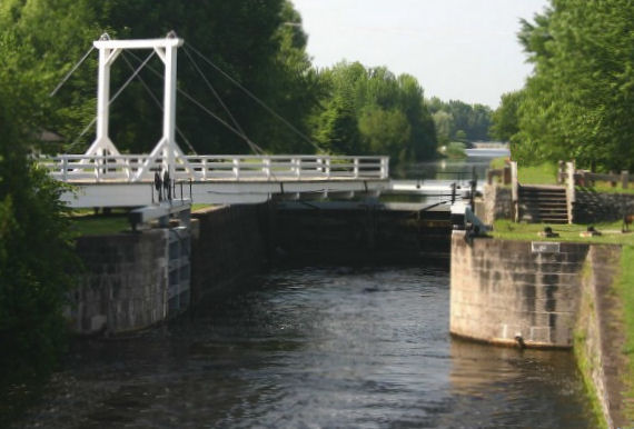
A typical Rideau Canal lock complete with swing bridge over the lock chamber
(Photograph - www.citizenship.org)
Many canals and waterways throughout the world built in the late 1700s to the mid 1800s were constructed to local barge dimensions of approximately 10 mtrs (33 feet) wide by 41 mtrs (134 feet) long. These dimensions conform to James Brindley's optimum length to width ratio of ten to one. Over the years, just like canals and waterways in other parts of the World, the size of craft wanting to use the waterways started to increase. An example of this that is closer to home is the Bridgewater Canal being superseded by the Mersey and Irwell Navigation which was in turn was expanded upon to become the Manchester Ship Canal. Similarly, the original 1832 Rideau Canal was superseded by the 1932 Welland Ship Canal and later the 1959 St. Lawrence Seaway. I was aware of the St Lawrence Seaway as I remember a television series in the mid-1960s entitled "Seaway" based around the waterway.
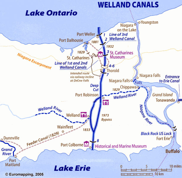
Welland Canal Map
(Map - www.skyscrapercity.com)
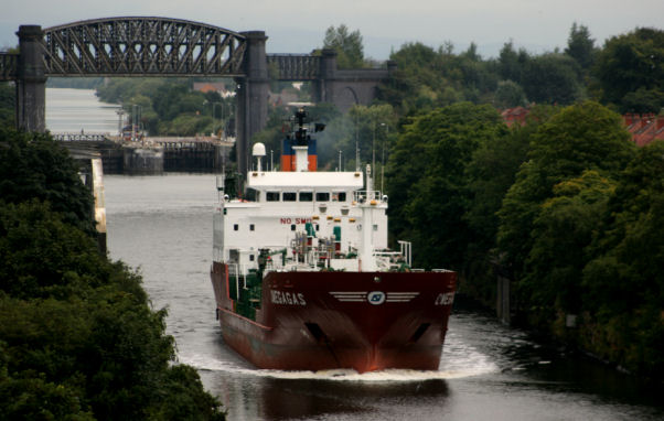
An example of a Welland Canal lock - note the vertical lift bridge in the background
(Photograph - Jenni Higgins)
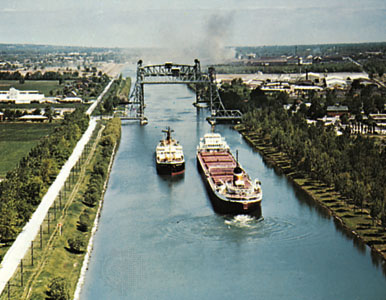
This photograph of the Welland Canal is reminiscent of the Manchester Ship Canal (see below)... except for the vertical lift bridge
(Photograph - www.ironmanfundraiser.blogspot.com)
The Manchester Ship Canal at Latchford
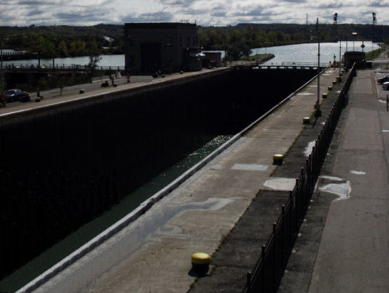
This photograph illustrates the size of the Welland Canal
(Photograph - Jenni Higgins)
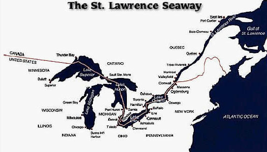
Map of the St. Lawrence Seaway
(Map - www.mybaycity.com)
Entrance to a canalised section of the St Lawrence Seaway in Montreal
(Photograph - www.wbez.org)
The River Rhine
In Preparation
The Panama Canal
There had been recognised the need for a connection between the Atlantic Ocean (Caribbean Sea) and the Pacific Ocean since the Middle Ages. In the late 1400's Christopher Columbus had searched in vain for a water route across the Panama Isthmus. In 1534 King Charles of Spain ordered a survey of the region with the hope of discovering a route. Emperor Napoleon III also toyed with the idea of constructing a route across the French owned land on the Panama Isthmus. All these endeavours were in vain and it was not until 1878 that the Columbian authorities gave permission for the French engineer Ferdinand de Lesseps who had built the Suez Canal to make a survey for a waterway to cross between the two oceans. For a variety of reasons (both technical, medical and political) de Lesseps did not complete the work and subsequently, an American civil engineer buy the name of John F Wallace made the survey. In July 1905, Wallace resigned and his place was taken by another American civil engineer... John Stevens. Stevens didn't last long and he too was replaced by Army Lieutenant George Washington Goethals who was appointed by President Roosevelt. Construction work commenced in 1908 and, despite major earthworks and civil engineering undertakings the canal was completed in 1914. In more recent years there has been a trend for ships to be constructed "Post Panamax". That is, too large to pass through the canal. Consequently, plans were drawn up to increase the size of the canal to accommodate these vessels and in September 2007 work to widen the canal commenced. This work is due to be completed by 2014... one hundred years after the canal was opened.
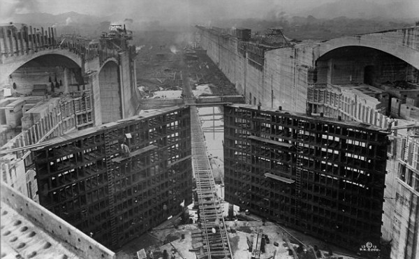
Construction of one of the locks on the Panama Canal in 1912
(Photograph - www.pancanal.com)
The route of the canal is shown in the map below and the photographs by Paul Savage illustrate various locations along it's route going from the Pacific Ocean to the Atlantic Ocean (Caribbean Sea). The location on the map of the photographs is indicated by a red number.
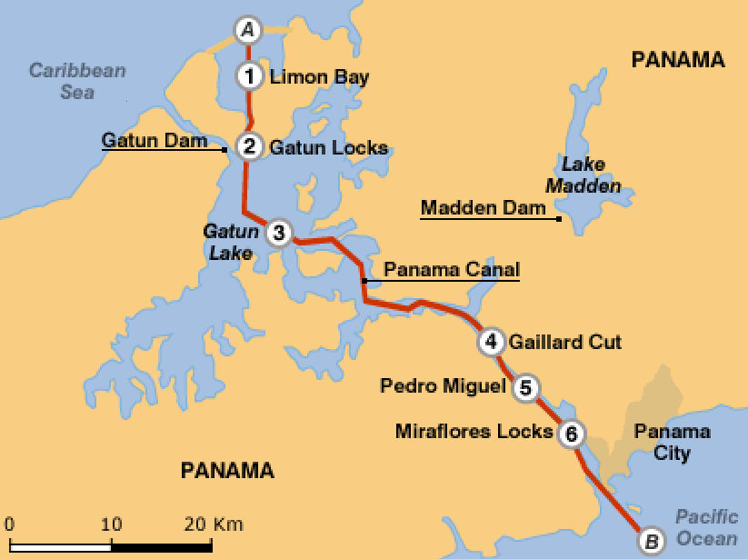
Map of the Panama Canal's route
(Map - bbc.co.uk)
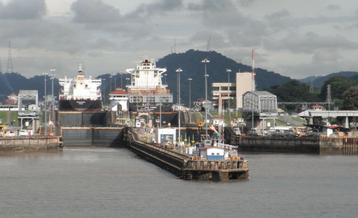
The entrance to Miraflores Locks (6) at the Pacific end of the canal
(Photograph - Paul Savage)
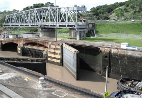
The swing bridge over Miraflores Locks is reminiscent of Barton Swing Aqueduct (6)
(Photograph - Paul Savage)
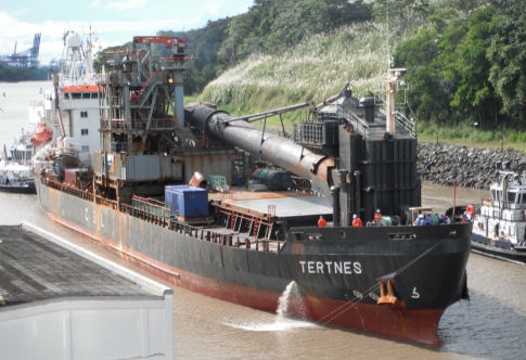
MV "Tertnes" (according to it's website... always ready to rock) is a flexible fall-pipe vessel used in the canal's expansion programme (6)
(Photograph - Paul Savage)
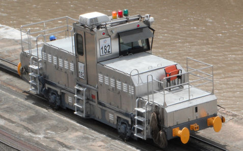
One of the locomotives (mules) used to guide vessels through the locks (6)
(Photograph - Paul Savage)
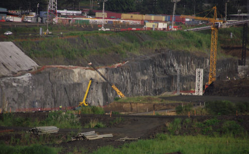
Construction of the new locks at Miraflores underway (6)
(Photograph - Paul Savage)
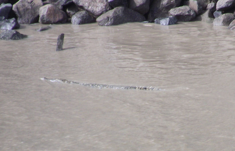
You won't see crocodiles swimming in the Bridgewater Canal (I hope!) (5)
(Photograph - Paul Savage)
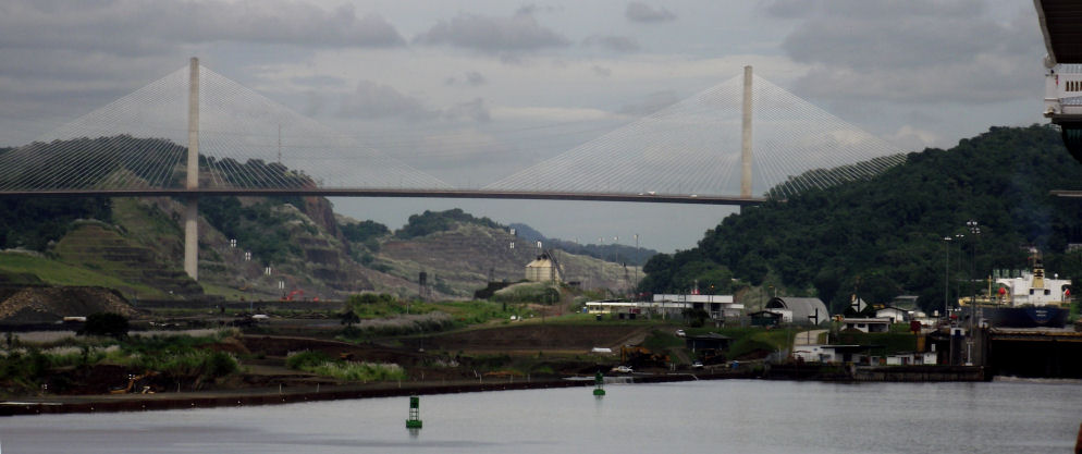
The Centenario Bridge as seen from below Pedro Miguel Locks (5)
(Photograph - Paul Savage)
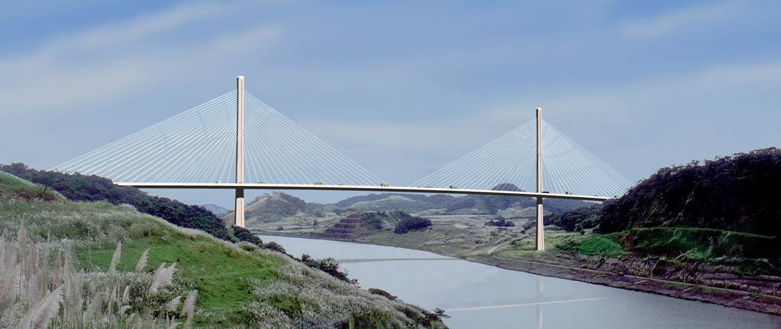
The Centenario Bridge just before the narrow and steep sided Gaillard (originally called Culebra) Cut (4)
(Photograph - www.loadtest.com)
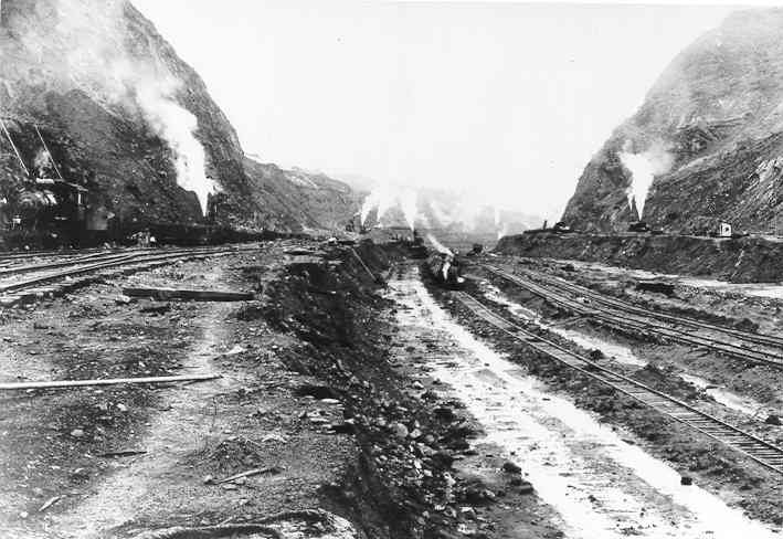
Gaillard Cut under construction in June 1911 (4)
(Photograph - www.pancanal.com)
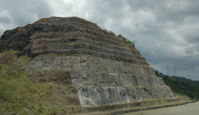
Gaillard Cut today (4)... the scale of earthmoving can be seen by comparing this with the 1911 photograph above
(Photograph - Paul Savage)
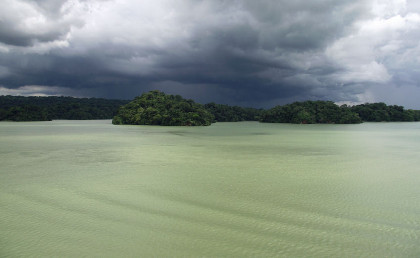
Storm clouds gathering over Gatun Lake (3)
(Photograph - Paul Savage)
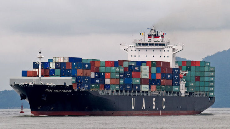
UASC Khor Kakken - a "Panamax" sized container ship passed on the Panama Canal (3)
(Photograph - www.pbase.com)
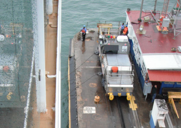
Steel hawsers being attached to a mule at Gatun Locks (2)
(Photograph - Paul Savage)
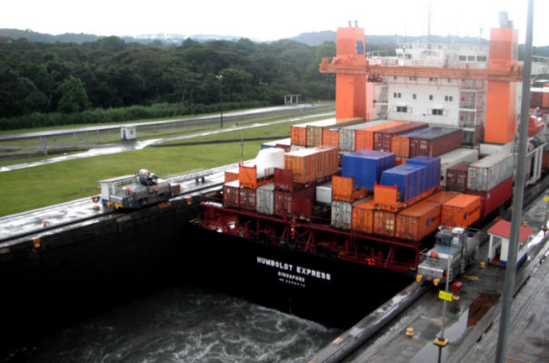
This photograph illustrates a Panamax vessel fitting snugly in Gatun Locks (2)
(Photograph - Paul Savage)
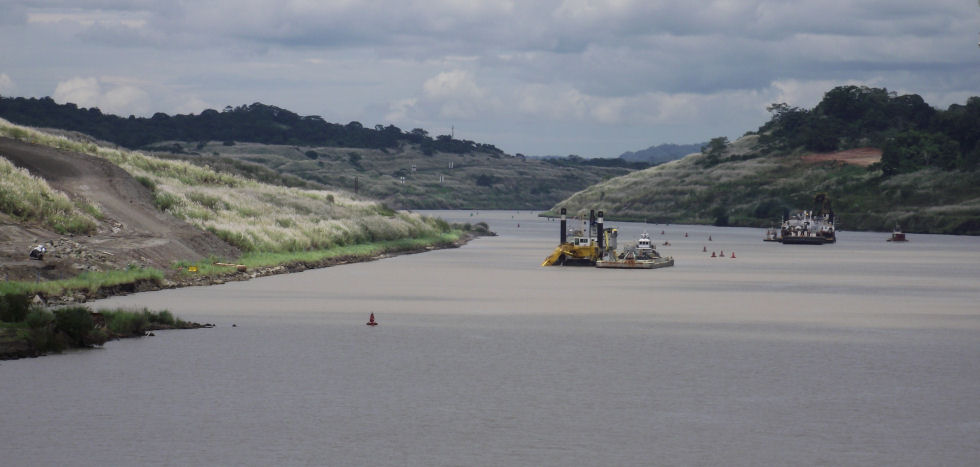
Like all canals the Panama Canal requires constant dredging (1)
(Photograph - Paul Savage)
I am grateful to fellow Lymm CC member Paul Savage for providing and allowing me to use the photographs that he took when cruising through the Panama Canal in 2011 (but not on nb "Adreva"!) and for suggesting that I wrote this section on what is an absolute monster of a waterway.
|
|
|
|
Updated 08-11-2011