|
A supplement to the |
|
eBook and website by Cyril J Wood |
A Walk Around the Canal Heritage Features of
Worsley...
The Birthplace of Britain's Canal System
|
A supplement to the |
|
eBook and website by Cyril J Wood |
|
|
|
|
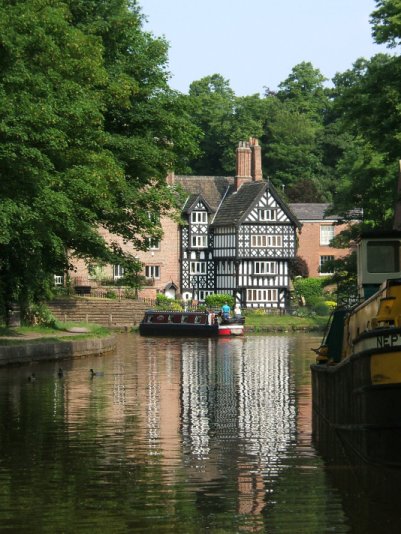
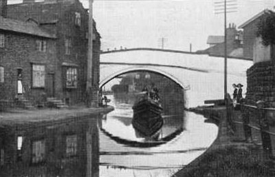
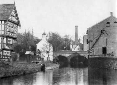
The Packet House and Worsley Turn
Worsley Canal Heritage Walk
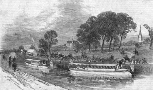
On Saturday the 27th June 2009 I gave a conducted walk around the canal heritage features of Worsley to members of Lymm CC to commemorate the two hundred and fiftieth anniversary of the successful passing of the Act of Parliament allowing the construction of the first part of the Bridgewater Canal from Worsley to Castlefield in Manchester.
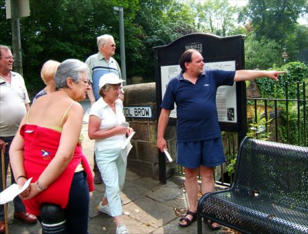
The Author and members of Lymm CC
The Post Office also (accidentally) commemorated this anniversary by issuing a stamp featuring James Brindley and his aqueduct over the River Irwell )now the Manchester Ship Canal) at Barton. Below is a résumé of the walk with descriptions and photographs of the various features covered by it.
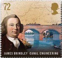
The commemorative postage stamp issued by the Post Office in 2009
The Dry
Docks
The first point of interest is the Worsley Dry Docks built in the 1760s. Most of the mine boats and some barges (“Dukers”) were built and repaired here. These dry docks are the oldest inland waterway dry docks in Britain and are Grade Two Listed Buildings.
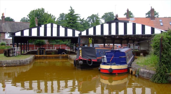
The Grade Two Listed Dry Docks
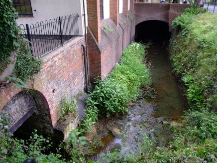
The Worsley Brook opposite the Dry Docks
Interestingly, when emptying, the water from the dry docks runs into the Worsley Brook. The first proposals (and Act of Parliament) for a waterway here by Scroop Egerton… the Canal Duke’s father, was in 1720 to construct navigable “soughs” (drainage channels) from the mines and make the Worsley Brook navigable from the “soughs” to the River Irwell for transporting the coal from the mines. This plan was never realised. Later Acts featured a canal totally independent of an existing watercourse making it the first true canal in Britain (the St Helens Canal shared the route of the Sankey Brook on which it relied upon for water supply).
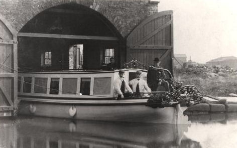
The Duke of Bridgewater's Boathouse
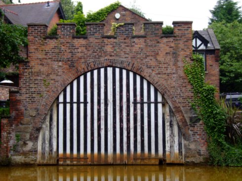
The distinctive doors to the Duke of Bridgewater's Boathouse
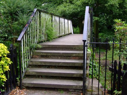
The building adjoining the canal with the vertical stripes on the doors is the Duke of Bridgewater’s Boathouse. This is where the Duke’s Inspection Barge was kept. The Barge once transported Royalty (including Queen Victoria) when visiting Worsley Old Hall and the canal. Since then the Duke's Barge is sometimes referred to as the "Royal Barge" The Boathouse and the nearby footbridge are Grade Two Listed Buildings.
The Old Oil Stores
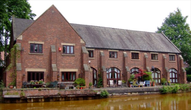
The Oil Stores and Duke's Wharf
The Old Oil Stores, as their name suggests are where oil and
other liquids were
stored before being loaded onto boats on the canal at the adjacent Duke’s
Wharf. The buildings are now residential dwellings and are Grade Two Listed
Buildings.
The
Packet House
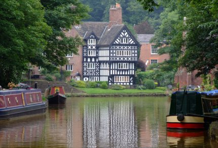
The Packet House as seen from the cast iron footbridge
This building, along with ”Top Locks” at Runcorn, “The Old Number One” at Preston Brook, The London Bridge Public House at Stockton Heath, The Old Number Three at Dunham Massey, The Watch House at Stretford and the terminus at Castlefield were all “stops” or way stations for a “Flyboat” service that carried passengers, perishable and urgent goods as well as cattle (rings were fitted inside the boat to secure cattle to) along the canal. The passengers boarded the boats via steps leading down to a boarding wharf. There are similar steps at The London Bridge Public House. The Packet House is a Grade Two Listed Building.
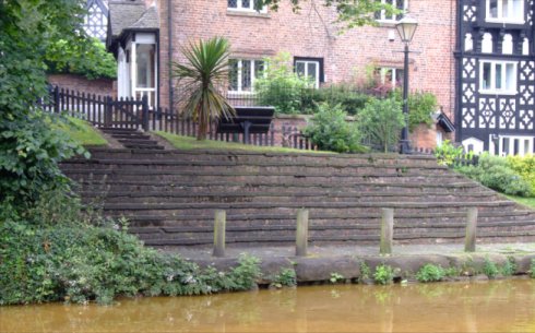
The steps and boarding wharf adjacent to the Packet House
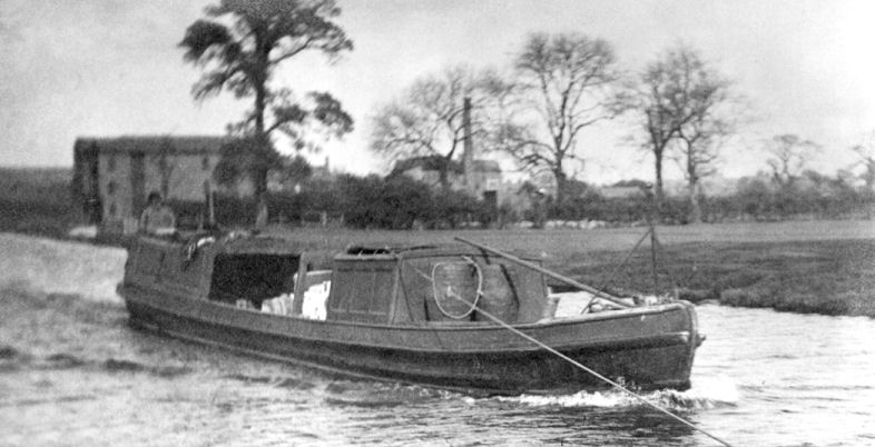
The "Duchess Countess" Flyboat on the Bridgewater Canal
The "Duchess Countess" at Lymm in 1927
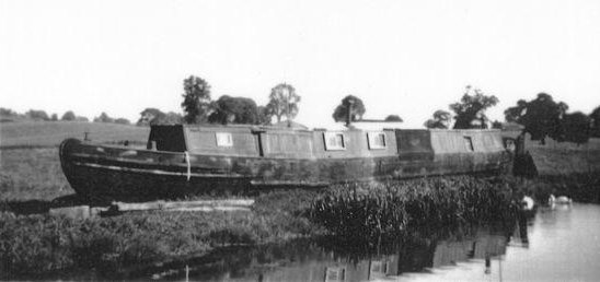
The "Duchess Countess" in 1958 at Welsh Frankton prior to being broken up
These specially built light weight boats were pulled by teams of horses that were regularly changed at the way stations that also possessed stables. The boats were given priority over other canal traffic and featured a knife on the bow to sever the tow lines of any boats getting in the way. The last remaining Bridgewater Flyboat was the "Duchess Countess". After retiring from service she was home to Mr Mackey who was a recluse a recluse before ending her days on the banks of the Llangollen Canal at Welsh Frankton as a hen house before being broken up in 1960. There is a restoration society dedicated to constructing a replica of this historic boat.
The
“Alphabet” Bridge
The Alphabet Bridge as seen from the canal with the Nail Maker's House in the background
The "Alphabet" footbridge spans one of the entrances to Worsley Delph is so called because it takes twenty six steps to cross from one side of the canal to the other. In years gone by children used to recite the alphabet whilst crossing it. The path leading from the Alphabet Bridge passes Worsley's oldest building... the Nail Makers House.
The
Duke’s Memorial
The memorial dedicated to Francis Egerton on The Green
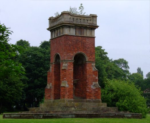
The Duke of Bridgewater’s Memorial is the only one dedicated to the Canal Duke. It was originally the chimney in the Duke’s Yard (possibly the blacksmith’s forge chimney) then an ornamental Victorian fountain before being adopted as a memorial. The Duke’s Yard once contained a clock that struck thirteen at one o’ clock so that workers would not be confused between one o’ clock and a quarter past one. This clock is now in Worsley Church… and still strikes thirteen at one o’ clock!
The chimney at it's original height can be seen in this old photograph directly above the bridge
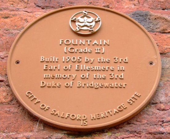
The commemoration plaque on the Duke's Memorial
The
Mine Entrances
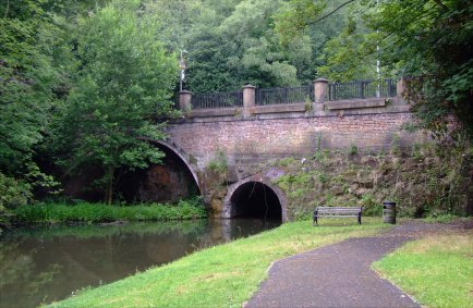
The single Mine Entrance in 1770
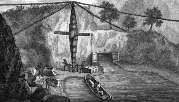
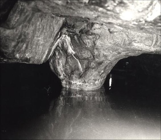
The reason that the Bridgewater Canal was built was to transport coal from the mine at Worsley to Castlefield in Manchester. Originally there was only one entrance but as the mine's output increased there was a need for a second allowing the original right hand entrance, and the later left hand one as an exit. Boats entered the mine and the forty six miles of navigable subterranean canals which included a lock and an inclined plane for the boats to reach differing levels within the mines. Coal was loaded into wooden boxes in the boats at or near to the coal face. The loaded boats would then navigate the subterranean canals before emerging through the right hand portal.
The junction of the two Mine Entrances known as "Waters Meeting"
The right hand mine entrance
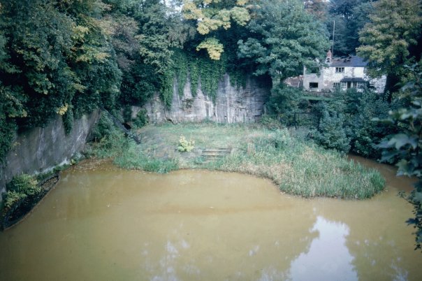
The Delph
and mine entrances
when
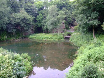
The Delph and Mine Entrances today... note the absence of orange water
When the boats, known as “Starvationers” due to their exposed ribs, reached their destination the boxes were lifted out by crane and emptied before being returned to the boat. This makes them the first container craft in England. A “Starvationer” is preserved in the weeds on the left hand side of the basin and there is a preserved example at the Museum of Inland Navigation at Ellesmere Port. The Mine Entrances are now Scheduled Monument.
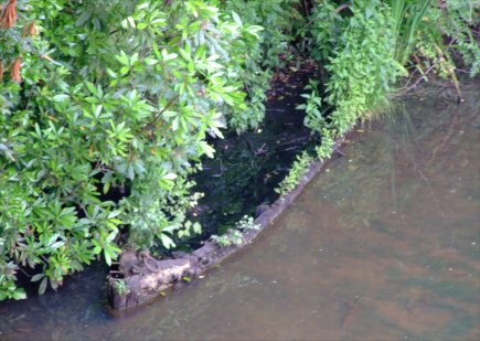
The sunken Starvationer hiding in the weeds
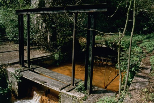
The water flowing out of the mines is stained ochre… an orange colour, by the iron ore deposits located within the mines. This water flows into the main line of the canal and Worsley has long been known for it's orange water. Due to environmental considerations a water treatment plant was constructed in 2004 to help reduce the amount of iron deposits in the water. The water from the mines is channelled into the treatment plant by pipeline and returned to the canal as clean water.
The
Other Mine Entrances
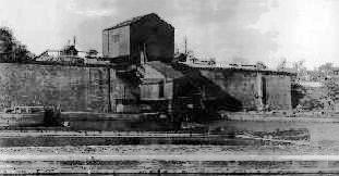
Boothstown Coal Chute
It is not generally known that there were other subterranean canals nearby at Boothstown (where the Bridgewater Marina is today). This subterranean canal, known as the “Chaddock Level” constructed in 1816 was not as extensive as those at Worsley but they were, non-the-less an important part of the Bridgewater mining empire.
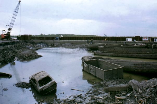
Boothstown Pen being emptied in preparation for redevelopment as a marina
In later years the coal was brought out of the mines by conventional mine “tubs” (small railway trucks) and a loading chute similar to that at Wigan pier was situated here. When the mine fell into disuse the large basin became a graveyard for narrowboats and barges and was only drained and emptied of rubbish in 1991. It has since been landscaped and converted into a marina and the location of the mine is now buried beneath a housing development.
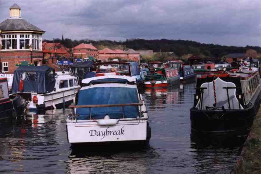
Today Boothstown Pen houses a marina and a public house (the Moorings).
A housing development is built on the site of the old mine.
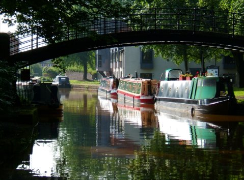
Narrowboats moored adjacent to the cast iron footbridge
or select another book below...
Updated 22-10-2011