![]()
![]()
Buried deep beneath the streets of Manchester is a hidden canal... the Manchester and Salford Junction Canal (referred to as the M & S J) which ran between the Rochdale Canal and the River Irwell. It was built to circumnavigate the original connection lock between the Mersey and Irwell Navigation and the Bridgewater Canal who charged an exorbitant toll for boats to pass through. This connection, known as the "Gut" was later superseded by Hulme Locks in 1838... a year before the M & S J was completed, and more recently Pomona Lock. Another reason to construct the canal was to remove some of the congestion from the streets of the City. When it was opened in 1839 the M & S J also offered a more direct route between the the Manchester Bolton and Bury Canal across the River Irwell (both canal entrances are virtually opposite each other) and the Rochdale Canal. Thus alleviating the need to go downstream to Hulme Locks before doubling back along the Bridgewater and Rochdale canals.
History and Geography of the Canal
The need for a direct link between the Rochdale Canal and the River Irwell had been identified as early as 1801 but nothing became of schemes to build a tunnel beneath the city streets to alleviate the afore mentioned congestion on the city's streets and the exorbitant tolls levied by the Bridgewater Canal Company. In response to this a canal was proposed to run from a short branch off the Rochdale Canal above Lock 89, through a complex of basins to a stop lock which isolated the waters of the Rochdale from that of the M & S J. The M & S J was an expensive canal to construct costing £57 per linear yard. The tunnel was illuminated by gas lamps every thirty yards and the gas supply for these lamps came from the company's own gasometer located at the western end of the canal by Grape Street.
The company built a reservoir and pumping station between Lower Moseley Street and Watson Street beneath what was to later become Manchester Central Station to ensure that there was sufficient water to allow the canal to operate. Immediately before Watson Street a set of twinned double staircase locks lowered boats into the main length of the canal below where the Great Northern Railway Warehouse was later located. Two arms of the canal were used as transhipment basins where cargo was raised and lowered between the two means of transport. The main tunnel ran for approximately five hundred metres before emerging into daylight adjacent to the Victoria and Albert Warehouses. Here was located the Brunswick Basin used for transhipment. After the basin a final lock lowered craft into the River Irwell virtually opposite the entrance to the Manchester, Bolton and Bury Canal. It was not a great commercial success and additional funds were generated in 1840 by the passing of a second Act of Parliament to raise £25000. In the end the canal was purchased by the Bridgewater Canal Company in 1845.
Over subsequent years the canal was gradually closed in stages. The first part of the canal to be closed was in 1875 which was the section between the junction with the Rochdale Canal and Watson Street. This was in-filled and became the location of Manchester Central Station built in 1880. There were hoists located here to tranship cargo to and from the canal and railway. Traffic eventually ceased in 1922 and the canal closed in 1936. The tunnel gained a new lease of life during the Second World War when it was drained and blast walls were constructed across the width of the tunnel to facilitate its use as an air raid shelter. Other additions included installation of chemical toilets, a filtered ventilation system and electric lighting.
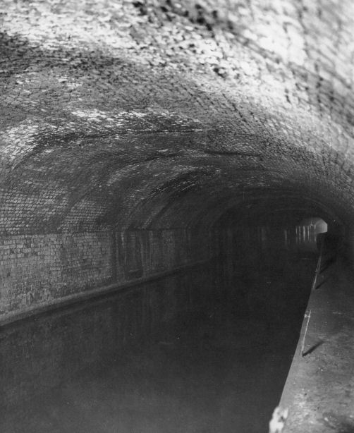
The canal in water looking towards the Victoria and Albert Warehouse entrance in 1938
(Photograph - "Underground Manchester" - Willow Publishing )
After the war in 1948 the tunnels were once again closed. At the River Irwell end of the canal the lock into the river was re-instated during the 1980's and a bascule bridge built across the lock entrance replaced the original brick built hump-backed bridge as well as landscaping the area adjacent Victoria and Albert Hotel. A pump was installed to bring water from the river into the basin to maintain the water level in the basin. In recent years the condition of the lock and basin have been allowed to degenerate to an almost derelict condition and there are no current plans to restore them. More recently the canal tunnel has found favour as a visitor attraction for those interested in the history of the canal and local history.
The entrance of the M & S J Canal at the junction with the Rochdale Canal
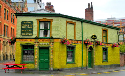
The Peveril of the Peak public house on Great Bridgewater Street
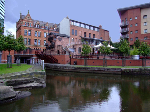
Restored section of the M & S J Canal close to the Bridgewater Hall
The Manchester and Salford Junction Canal has been restored from its junction with the Rochdale Canal, beneath Great Bridgewater Street close to the Peveril of the Peak public house (the green tiled building) to a basin adjacent to the Bridgewater Hall. From here it headed through a tunnel (now a pedestrian underpass beneath Whitworth Street leading to the Bridgewater Hall) through which the M&SJ Canal once flowed. The towpath and edging stones can be readily seen.
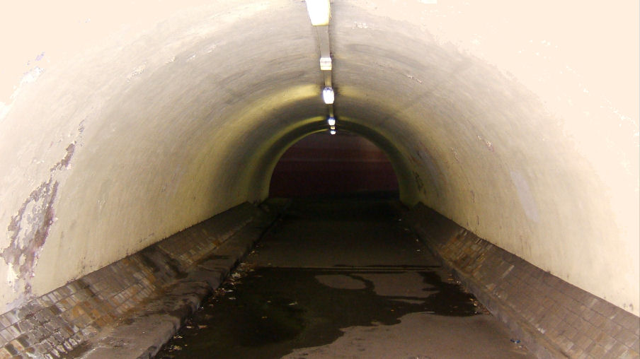
Pedestrian underpass once the line of the canal now leads to the Bridgewater Hall with the canal towpath on the left
The line of the canal beneath what was Manchester Central Station looking towards Watson Street...
... and in the opposite direction looking towards the Great Northern Railway Company's Warehouse
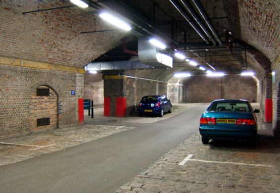
The line of the canal emerges from beneath what was Manchester Central Station...
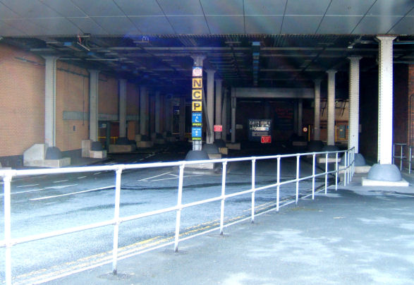
... before disappearing in the car park beneath the Great Northern Railway Company's Warehouse
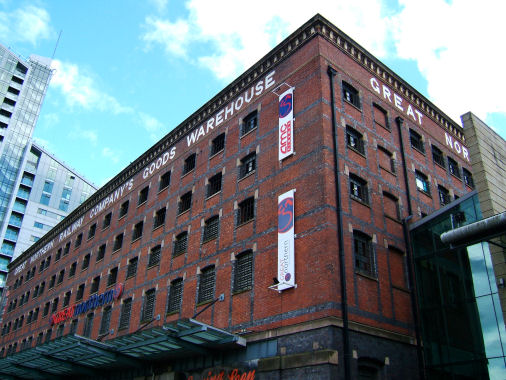
The Great Northern Railway Company's Warehouse
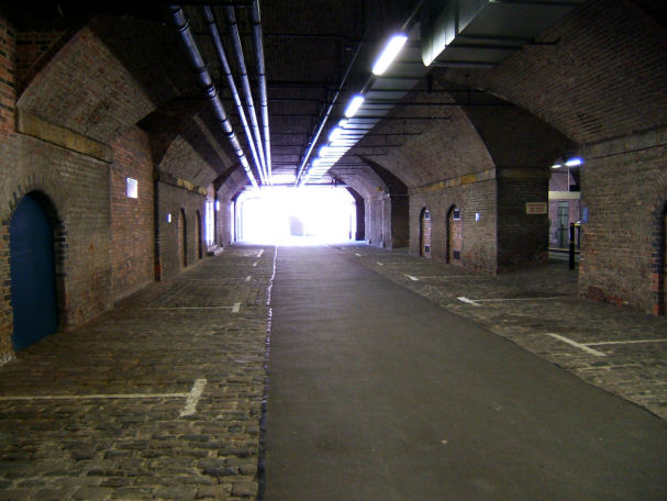
At the end of the tunnel the canal's route crosses Whitworth Street before going through the car park beneath what was the Great Northern Railway's Goods Warehouse (now housing a cinema and a leisure complex). Here the canal was lowered by a pair of twinned, two-step staircase locks located in a large subterranean chamber which lead to a six hundred yard long tunnel.
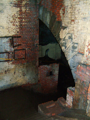
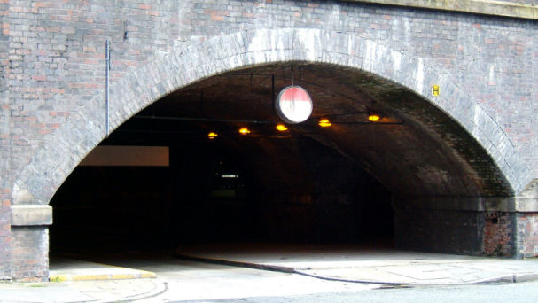
Entrance to the tunnel from the subterranean chamber containing the staircase locks
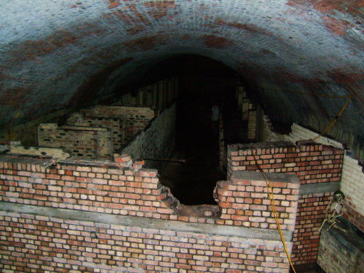
Looking down the tunnel with the toilets in the foreground
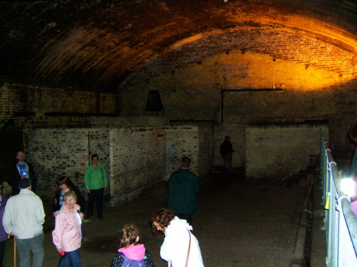
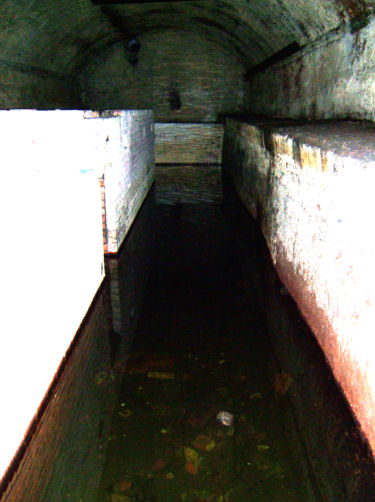
The first bay in the canal tunnel beneath the Great Northern Railway Company's Warehouse
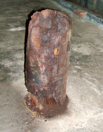
An original mooring bollard in one of the bays
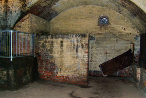
One of the bays with the towpath on the left and a blast wall straight ahead
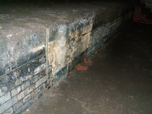
Close up of the edge of the canal and towpath
Along the length of the tunnel are a series of blast walls from when the tunnel was an air raid shelter. The invert of the tunnel was surfaced when the blast walls were constructed but the location of the towpath can easily be seen. There is an old mooring bollard still in existence in the second bay. Subsequent bays are dry but the next to last and last bays directly beneath Camp Street, St John's Gardens and Granada Television's "Coronation Street" set are partially in water. The canal emerged from beneath "Coronation Street" into a basin adjacent to the Victoria and Albert Hotel. At the end of the basin is the last lock which connects the canal to the River Irwell.
The canal in water (almost) and as far as visitors can walk
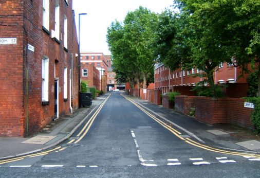
Camp Street looking towards Deansgate - directly above the location of the previous photograph
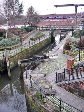
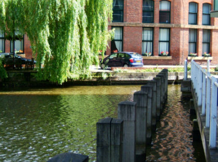
The restored lock adjacent to the Victoria and Albert Hotel connects the canal to the River Irwell
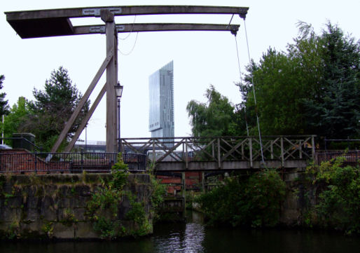
The entrance lock as seen from the River Irwell
As previously stated, recently the canal tunnel has found favour as a visitor attraction for those interested in the history of the canal and local history. The canal is a lost opportunity as it would be possible to reopen the tunnel entrance at the River Irwell end and run boat trips from the basin along a length of the tunnel for canal and local history enthusiasts alike. This would not cost a great deal of money and the benefits would be great for heritage tourism in the City of Manchester. I hope that this section of the "Canalscape" website will encourage readers to read Keith Warrender's excellent books "Underground Manchester - Secrets of the city Revealed", "Below Manchester - Going Deeper Under the City" or book a place on the Beneath Manchester guided tour which features part of the M & S J canal in its itinery.
or select another section below...
|
|
|
Introduction |
|
|
||
|
|
||
|
|
||
|
|
Book 4 - 2006 to 2007 | |
|
|
Book 5 - 2008 to 2009 | |
|
|
Book 6 - 2010 | |
|
|
Book 7 - 2011 | |
|
|
Book 8 - 2012 (In Preparation) | |
|
|
Book 9 - 2013 (In Preparation) | |
| The History of Lymm Cruising Club | ||
| The Duke's Cut - The Bridgewater Canal | ||
| The Big Ditch - Manchester's Ship Canal | ||
| Shroppie - The Shropshire Union Canal System | ||
| Mersey Connections (In Preparation) | ||
| 2011 Gardner Engine Rally Report | ||
| Foreign Forays - Canals of the World (In Preparation) | ||
| Worsley Canal Heritage Walk | ||
| Castlefield Canal Heritage Walk | ||
| The Liverpool Docks Link | ||
| Don't Call it a Barge | ||
| Canalscape Photography | ||
| Lymm Cruising Club Website | ||
| Footnote and Acknowledgements | ||
| Site Map | ||
| Return to Top | ||
| Go to the | ||
|
|
||
| Website | ||
![]()
![]()
"Canalscape" and "Diarama" names and logo are copyright
Updated 03-11-2012