A supplement to the
![]()
eBook and Website
by Cyril J Wood
![]()
![]()
My tribute to t
he Seven Wonders of the Waterways was originally tucked away at the end of "Canalscape Book Four" but I have since decided to give the updated subject its own section on the website.Within the Canal Era, certain examples of canal related civil engineering have stood out from the crowd for their ingenuity, scale, use of revolutionary design or materials. These examples were given the name “Seven Wonders of the Waterways” by Robert Aickman, one of the founders of the Inland Waterways Association, in his 1950's book “Know Your Waterways”.
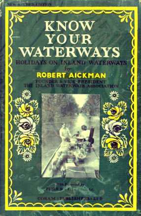
The dust jacket of Robert Aickman's book "Know Your Waterways"
Over the years there have been suggestions for additions or alterations to this list and some enthusiasts have substituted Foxton Inclined Plane for one of the other original wonders even though it no longer exists. In 2011 the canal magazine "Waterways World" published an up-dated list that replaced some of the original wonders with more recent examples. I have taken the easy option and included all of them... original and new plus a few others that I consider should be included for good measure!
|
The Original Seven Wonders of the Waterways are... |
|
|
1. |
Anderton Lift (Trent & Mersey Canal) |
|
2. |
Barton Swing Aqueduct (Bridgewater Canal) |
| 3. |
Bingley Five Rise (Leeds & Liverpool Canal) |
| 4. |
Burnley Embankment (Leeds & Liverpool Canal) |
| 5. |
Caen Hill Flight of Locks (Kennet & Avon Canal) |
| 6. |
Pontcysyllte Aqueduct (Llangollen Canal) |
| 7. |
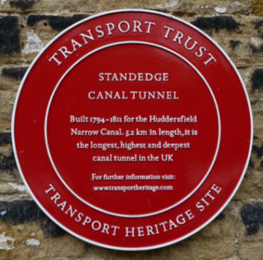
Standedge Tunnel (Huddersfield Narrow Canal) |
With this in mind I have compiled my own extended list of twenty Inland Waterways Wonders.
One of the Wonders... Foxton Inclined lane is, sadly, no longer in existence and has been dismantled although some remains can still be seen and there are plans to rebuild the inclined plane using modern technology and construction techniques.
1 - The Anderton Boat Lift
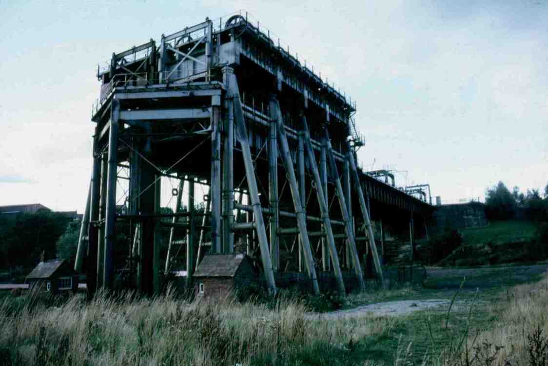
The Anderton Boat Lift in 1986 prior to restoration...
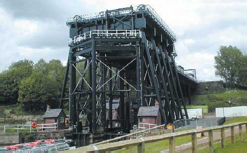
... and a more recent photograph of the rebuilt Anderton Boat Lift from virtually the same viewpoint
The Anderton Boat Lift connects the Trent & Mersey Canal with the River Weaver by means of a vertical lift that overcomes the fifty foot difference in levels between the two waterways. It was designed by James Leader Williams (later to become the engineer of the Manchester Ship Canal) and built by Edwin Clark. The lift opened in 1875 and consisted of two counterbalancing caissons each large enough to take a barge or a pair of narrowboats. Large cylinders containing hydraulic rams controlled the movement and the main force powering the movement was gravity, the descending caisson having an extra 6 inches of water added to its load to overcome any equilibrium. A ten horse-power steam pump also provided extra power for the completion of the process. In 1908 the lift was converted to electric power, 250 ton counterweights with their exposed wheels added and the two caissons were made to work independently. This conversion was a complete success and was in continual use until 1983. In that year problems with the mechanism caused the lift to close and it lay dormant for many years in varying states of disassembly. There was an on-going movement to restore and re-open the lift and British Waterways submitted various plans to this effect. A Heritage Lottery Fund Grant was applied for and granted that would allow for the full restoration of the lift.
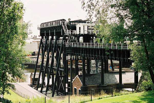
The view of the lift from the Trent and Mersey Canal showing the connection aqueduct
This restoration was completed in the autumn of 2001 and after a short period of testing and familiarisation the lift opened for regular traffic at Easter 2002. As well as the re-opening of the lift a new appreciation and visitor centre has been constructed adjacent to the lift and the surrounding area landscaped.
The Avon Aqueduct is reminiscent of Chirk Aqueduct on the Llangollen Canal
(Photograph - James Gentles)
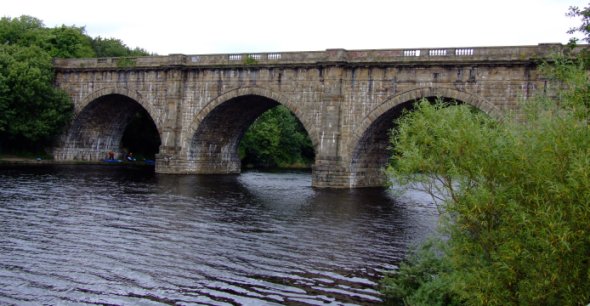
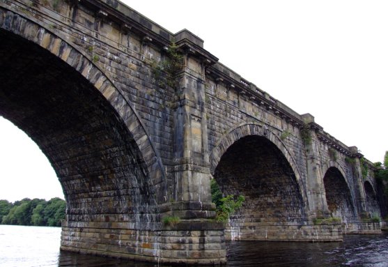
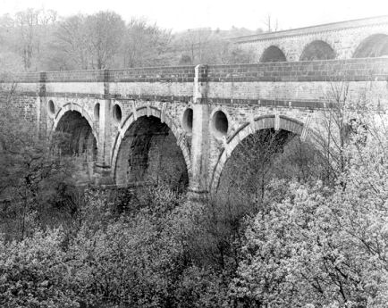
The twelve arch Avon Aqueduct
carries the Glasgow and Edinburgh Union Canal across the Scottish River Avon to the west of Linlithgow and is reminiscent of Chirk Aqueduct on the Llangollen Canal. This is not surprising as the builder Hugh Baird built it to the design of Thomas Telford (including the cast iron trough). At nine hundred feet in length and eighty five feet high at its highest point it is second only to Telford's mighty Pontcysyllte Aqueduct on the Llangollen Canal. There is another similar but smaller aqueduct on this canal in the shape of the Almond Aqueduct at Ratho near Edinburgh. This aqueduct is 430 feet (130 mtrs) long and carries the canal 78 feet (23 mtrs) above the River Almond on five arches.
An aerial view of the Avon Aqueduct
(Photograph - Canal and River Trust)
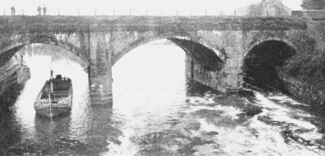
Brindley's original Barton Aqueduct
(Photograph - Manchester Ship Canal Archive)
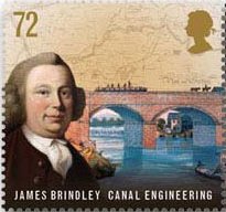
A postage stamp depicting James Brindley and the original Barton Aqueduct
The original Barton Aqueduct was built by James Brindley in 1761 to take the Duke of Bridgewater's revolutionary canal across the Mersey and Irwell Navigation. This early aqueduct was considered a marvel at the time of its opening although its design was often surpassed by later aqueducts. It was the very first Wonder of the Waterways. Hawthorn Lane Aqueduct at Stretford (adjacent to Watchouse Cruising Club) also on the Bridgewater Canal is similar in design to the original Barton Aqueduct but built on a smaller scale and is well worth inspection as is the 1793 Prestolee Aqueduct (even though it has four arches) which carries the Manchester, Bolton and Bury Canal over the River Irwell further upstream near Bolton.
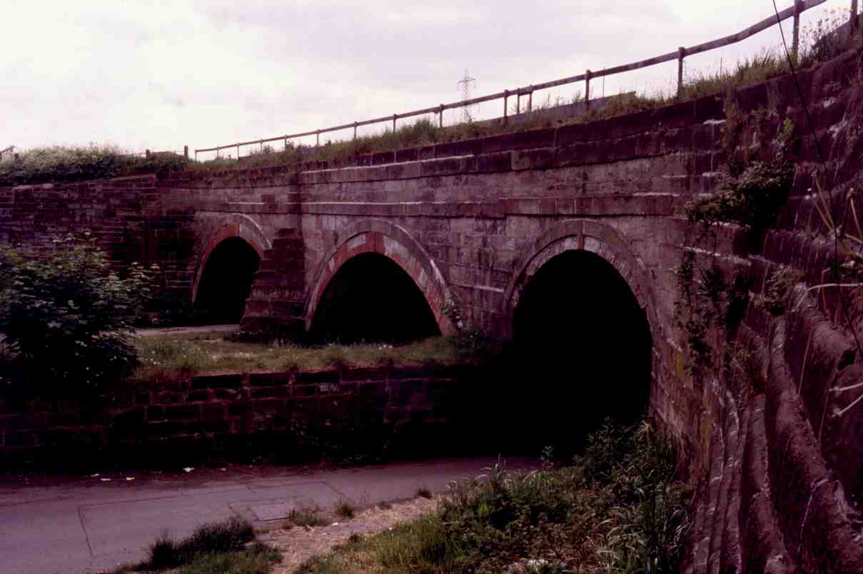
Hawthorn Lane Aqueduct - a miniature version of Brindley's original Barton Aqueduct
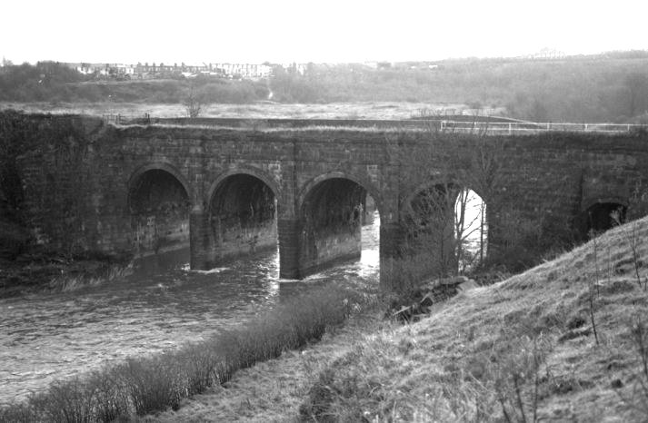
Prestolee Aqueduct on the Manchester, Bolton and Bury Canal is also similar in construction
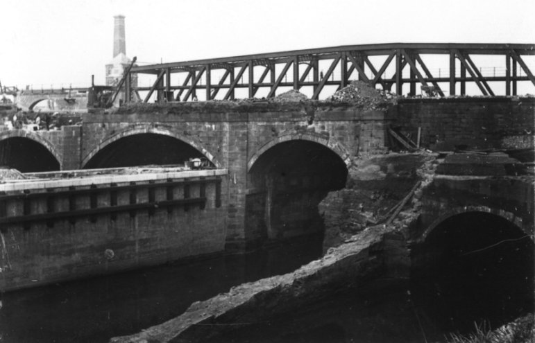
Both aqueducts during construction of the Manchester Ship Canal
(Photograph - Manchester Ship Canal Archive)
When the Manchester Ship Canal was constructed it used the course of the old Mersey and Irwell Navigation at Barton as part of their proposed channel and it was therefore necessary to demolish Brindley's original aqueduct and replace it with a structure even more marvellous... Barton Swing Aqueduct.
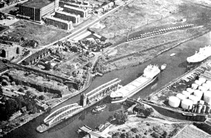
An aerial photograph of Barton Aqueduct swung for a large tanker...
(Photograph - Manchester Ship Canal Archive)
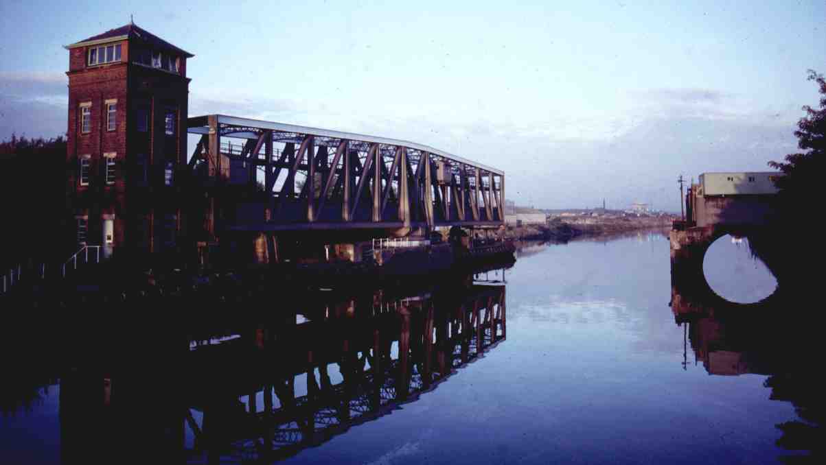
... and at ground level
The aqueduct in 1987 with an unusual red and white paint scheme
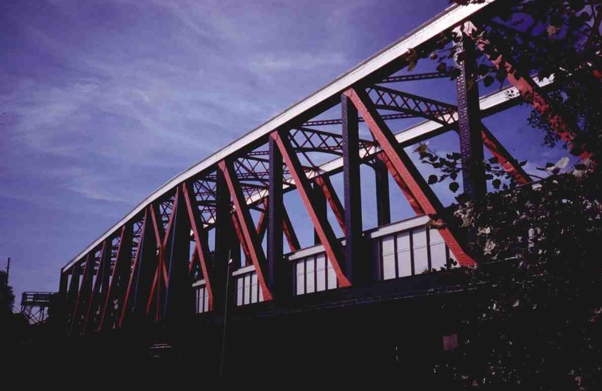
The replacement... the Barton Swing Aqueduct was designed by Edward Leader Williams (of Anderton Lift fame) and was completed in 1893, the year before the Manchester Ship Canal was completed and open for traffic. The location of the original aqueduct can still be traced as well as the original line of the canal (whilst the Swing Aqueduct was being built the original was kept in use for as long as possible to maintain through traffic on the Bridgewater Canal). The aqueduct swings open, full of water, to allow the passage of ships along the Manchester Ship Canal. The swinging span is 235 feet long and weighs 1,450 tons (800 tons of which are water). Hydraulic rams are used to move swinging gates with rubber seals into each end of the moveable tank to keep water leakage whilst the aqueduct is being swung to a minimum.
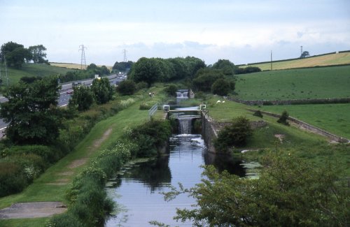
4 - Bingley Five Rise Staircase Locks
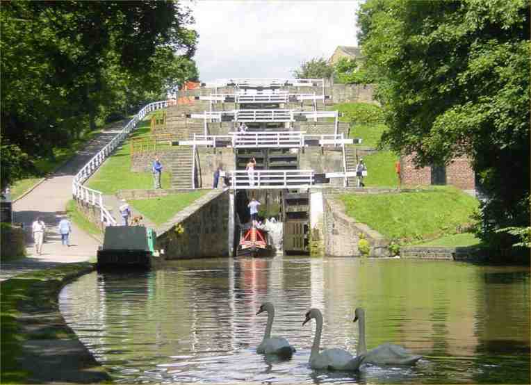
Looking up the staircase from the east
When the Leeds and Liverpool canal was being constructed, a large change of level (sixty feet) in a short distance had to be overcome at Bingley in West Yorkshire. The engineers decided to overcome this change in level by constructing a staircase lock or “riser” consisting of five chambers with a rise of twelve feet per chamber. In a staircase lock, the lower gates of one chamber forms the upper gates of the next chamber and so on throughout the flight. Bingley wasn’t the first staircase lock constructed but it is certainly the largest remaining example on the connected canal system (“Neptune’s Staircase” at Fort William on the Caledonian Canal being the largest in the United Kingdom with eight chambers). Chester’s Northgate Three-step Staircase was originally built as a five-step but was downsized to a three-step when the Wirral Line of the Chester and Ellesmere Canal was constructed. At Bingley, another nearby staircase lock consisting of three chambers is overshadowed by the grandeur of its larger brother. At the top of the locks is over sixteen miles of lock free cruising through the beautiful Yorkshire Dales until well after Skipton.
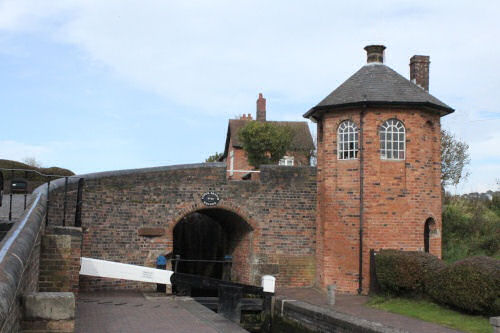
Bratch Locks overlooked by the octagonal Lock House
At Bratch on the Staffordshire and Worcestershire Canal is an unusual flight of locks that is a cross between normal locks and a staircase lock. When James Brindley was building the canal and a change of level was required in a short distance he came up with the idea of grouping the three locks together in a staircase. When he came to build the locks for some reason the locks were of the conventional type separated by about a metre and the pounds that hold the water to supply the locks were constructed alongside the chambers. These are known as side ponds and unlike the side ponds found in later locks do not require extra paddles. Another unusual feature of Bratch Locks is the octagonal Lock House that also acted as a look-out for the lock keeper to ready the locks when boats came into view. It is interesting to note that the next locks at Botterham are of a conventional staircase type.
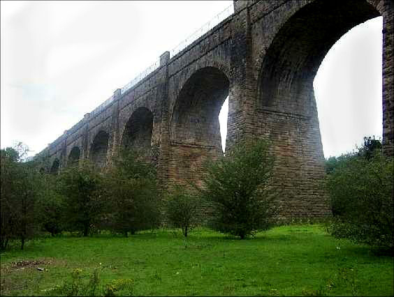
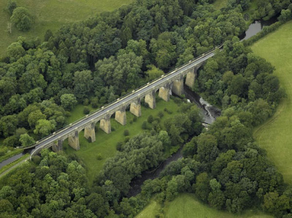
Looking along the embankment from the Blackburn direction
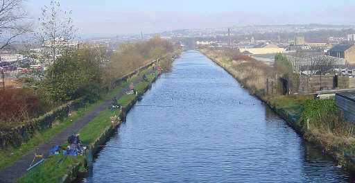
As the Leeds and Liverpool Canal is the longest canal in Great Britain it is not surprising that it has its fair share of engineering accomplishments along its length. At almost a mile long, the Burnley Embankment carries the canal through the centre of Burnley, high above the roofs of the buildings below, effectively cutting the town in half. Designed by Robert Whitworth, the Leeds & Liverpool Canal Company Engineer, and started in 1795 this embankment is nearly a mile in length and eighty feet high at its highest point. It was finished well before the nearby Gannow Tunnel, which was completed in early 1801.
Looking down the Caen Hill flight of locks
Caen Hill Locks undergoing weed clearing in 1955
(Photograph - Hungerford Virtual Museum)
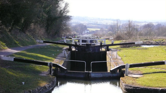
The flight of twenty nine locks at Caen Hill, Devizes in Wiltshire is on the Kennet and Avon Canal. John Rennie, the engineer of the canal, decided to take the canal up the side of this very steep hill where the locks are so close together that the normal arrangement of pounds between locks would not have provided sufficient water storage for the operation of the locks. Rennie's solution to this problem was to provide long side pounds beside the locks which can be seen between locks 29 and 44. The towpath alongside the locks is unusually wide due to accommodating a narrow gauge railway during construction of the flight in the early 1800's. Today the width of the towpath helps the Canal and River Trust's Lock Keepers who use quad bikes to transport themselves and maintenance materials up and down the flight. After the Canal Transport Act of 1944 (this Act was to the canals what Doctor Beeching was to the railways), the Kennet and Avon Canal was closed and the locks (as well as the rest of the canal) became derelict. In 1962 the Kennet and Avon Canal Trust was formed to restore the canal to its former glory and allow through navigation... a gigantic task that culminated in the canal being completely reopened in 1990 by Queen Elizabeth the Second with the restoration work finally completed in 2003.
The bridges along the flight have twin arches to accommodate the canal and the narrow gauge railway
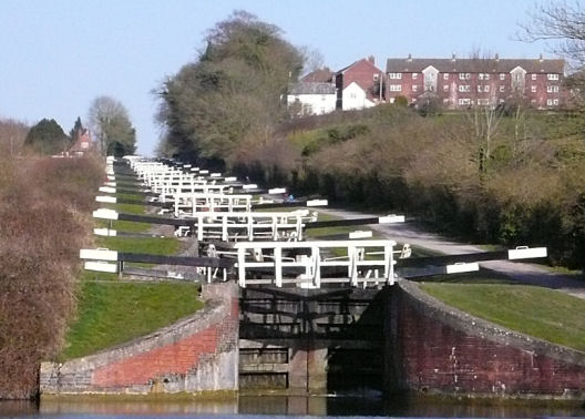
Looking up the Caen Hill Flight on the Kennet and Avon Canal
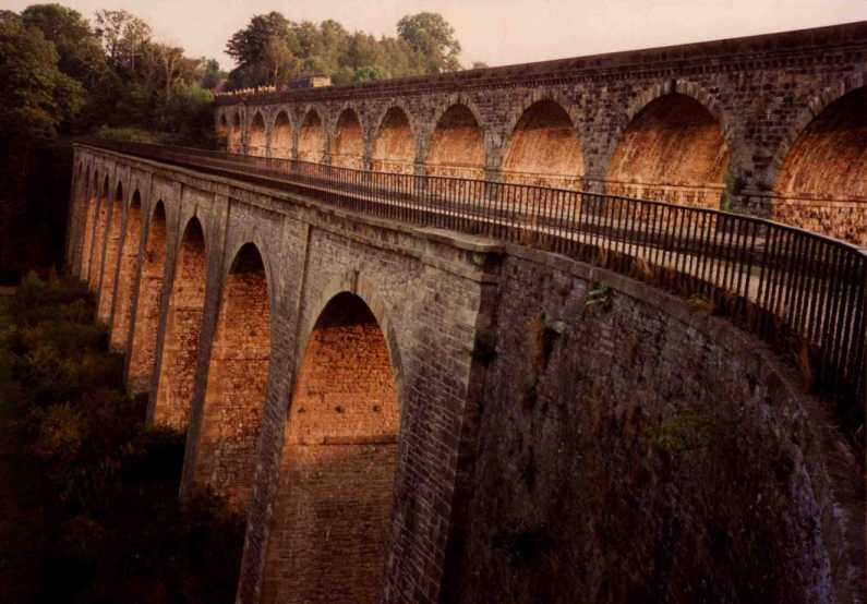
Chirk Aqueduct at sunset overshadowed by the much later railway viaduct
Chirk Aqueduct is one of Thomas Telford's masterpieces. He described it as being "so very, very perfect". It is well proportioned at 700 foot long and 70 foot high Chirk Aqueduct. Telford was aware of the effect that puddled clay had on aqueduct design, making them extremely heavy and prone to sagging and decided to lighten the weigh at Chirk by constructing partially hollow arches and providing the masonry trough with a waterproof cast iron lining. It was not however constructed with a completely cast iron trough... only the bottom of the trough was made from cast iron. There may have been many reasons for this but the two most likely ones are as follows... 1. Chirk was required to be completed before Pontcysyllte due to the the trade already using the lower reaches of the canal, hence, the trough was only partially cast iron with plans to make it fully cast iron in the future. 2. Telford was not totally convinced as to the suitability of the material as the aqueduct at Longdon on Tern had not yet proved itself. Whatever the reasons, after completion in 1801 leakage proved to be a problem but it was not until 1869 that Chirk received a trough that was one hundred percent cast iron. The underside of the trough can be inspected with the canal in water as there are access holes situated in each of the hollow arches specifically for this function.
A close-up of the top of the cast iron trough that lines Chirk Aqueduct
The River Avon and the building housing the water wheel and pumps
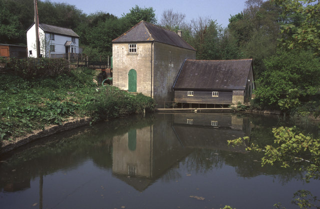
The next of my wonders is Claverton Pumping Station on the Kennet and Avon Canal. Built to provide water from the River Avon to the canal, John Rennie actually used the flow of water on the River Avon to drive a twenty four foot wide water wheel which drives two Boulton and Watt beams connected to reciprocating water pumps. Water is then lifted forty eight feet (15 mtrs) from the river to the canal with zero emissions and no costs apart from maintenance.
The giant water wheel that drives the pump at Claverton
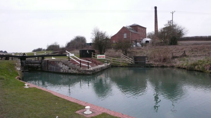
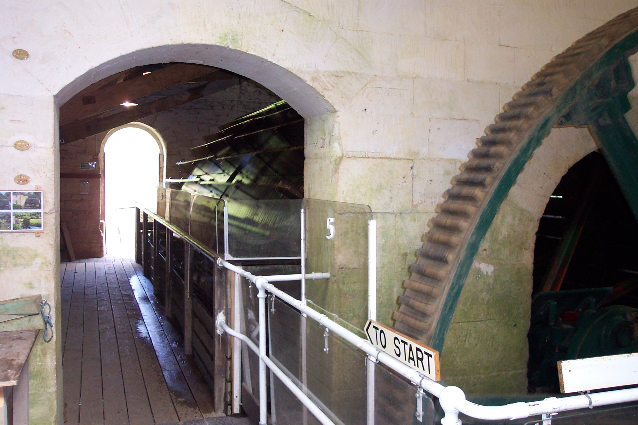
Crofton Lock and Pumping Station
Staying on the Kennet and Avon Canal, Crofton Pumping Station is located just below the summit level of the canal. The station houses a pair of beautifully maintained steam beam engines dating from 1812 for the Boulton and Watt engine and 1846 for the Harvey engine. This makes them the oldest working steam engines in the World that are in their original location and performing the task that they were constructed to fulfil. On walking into the pumping station the first thing that greets you is the enormous Lancashire Boiler that provides steam for the engines. As well as the pumping engines themselves there is an exhibition of smaller steam engines all in steam and operating. These range from a small, high-speed generator to larger, slower revving engines. After seeing the small engine display the visitor climbs a flight of stairs to view the main engines. There are three viewing levels... the first for the pumps and linkages, the second for steam engine cylinders and the third for the engine beams. When in operation each engine is capable lifting a ton of water from the River Dun, which has been dammed to create the Wilton Water artificial lake on the south bank of the canal, forty feet (12 mtrs) the summit level of the canal with every stroke.
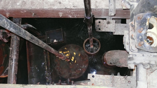
Top of the pump in the well fed by the River Dun
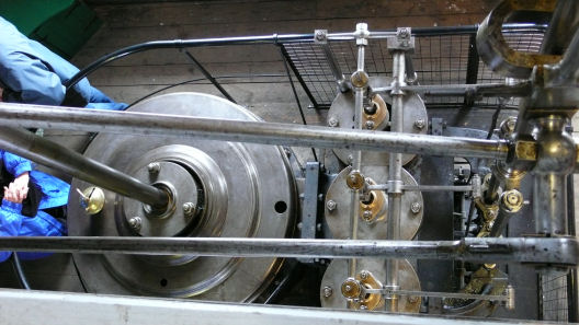
Cylinder head of the Boulton and Watt engine seen from above
The end result... a ton of water at a time pumped into the leat leading to the Kennet and Avon Canal's Summit Level
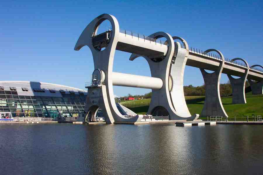
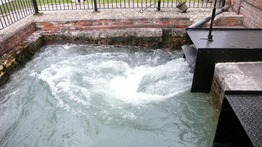
The Falkirk Wheel and aqueduct leading to the Roughcastle Tunnel
When the Glasgow and Edinburgh Union Canal was being restored in the 1990's one obstacle to through navigation was on the Union Canal section where the Falkirk flight of eleven locks, which had been in-filled after the canal fell into disuse and the route lay buried beneath a housing estate. This obstacle was overcome in the shape of the Millennium Link. The Millennium Link uses a new route circumnavigating the housing estate and instead of eleven locks, two new locks (the upper of which is a two-step staircase lock) and the Falkirk Wheel were constructed to overcome the difference in levels. Approaching the Wheel from the west, a junction is made with the Union Canal via the Millennium Link which leaves to the south.
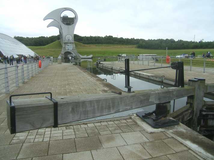
Falkirk Junction Lock with the Wheel in the background
The Millennium Link consists of a new lock at the junction with the Forth and Clyde Canal which leads to a large basin giving access to the Falkirk Wheel... a revolutionary (pun intended) boat lift to overcome the 79 foot (24 mtrs) change in levels. Rotational power is by high efficiency electric motors They take just 22·5 kilowatts (30·2 hp) to power the electric motors, which consume just 1·5 kilowatt-hours of energy in four minutes, roughly the same as boiling eight kettles of water. The lift was officially opened by Queen Elizabeth II on the 24th May 2002. After the Wheel an aqueduct leads to the Roughcastle Tunnel (the second canal tunnel in Scotland) which at 168 metres long is supposedly the first canal tunnel to be constructed in Britain for over a hundred years.
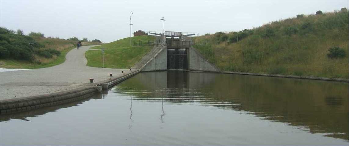
Falkirk Locks taken from the Roughcastle Tunnel entrance
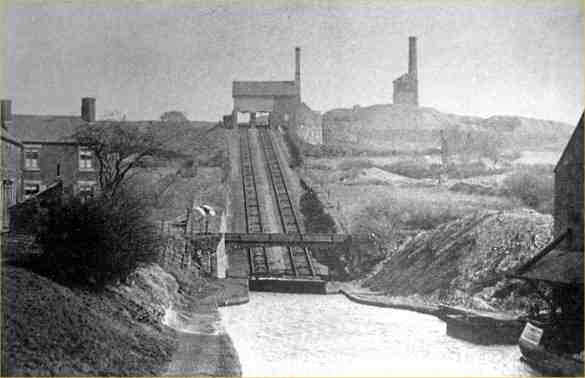
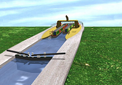
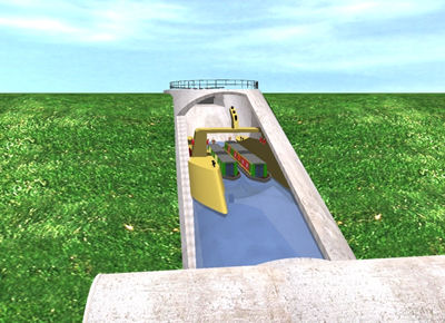
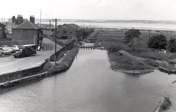
In the days of commercial carrying, the two five-step staircase locks at Foxton on the Leicester Section of the Grand Union Canal proved to be a bottleneck causing congestion and long waits for the flight. One solution to the problem was the construction of an inclined plane to carry craft up and down the 75ft change in levels required at the Watford Gap. The inclined plane was designed by Gordon Cale Thomas and constructed in 1900 by W H Gwynne of Hammersmith, London.
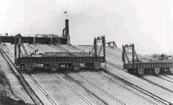
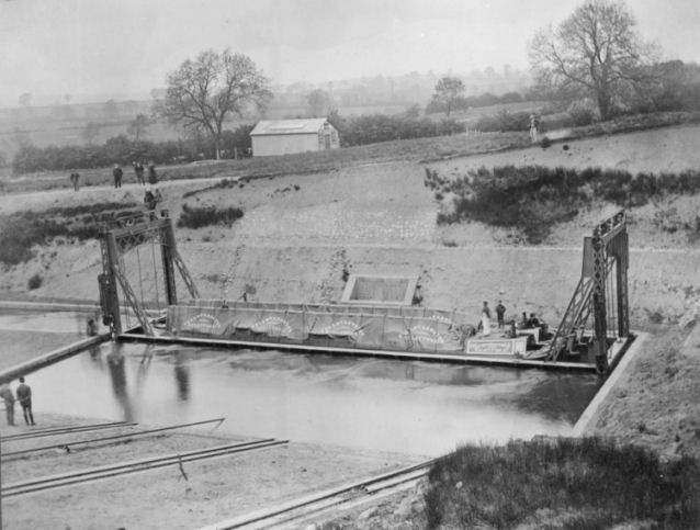
Two photographs of Foxton Inclined Plane around 1900
(Photographs - Canal and River Trust Archive)
The lift remained in continuous use until it was mothballed in 1911 due to lack of sufficient traffic to justify the high maintenance costs and to warrant the boiler being kept in steam. Subsequently, the lift was dismantled in 1928 and the equipment sold for scrap. Even though the lift has been dismantled for many years, the site of the inclined plane has been cleared of vegetation and the original position of the steel rails can be clearly seen. There was a proposal to recreate the lift on the original site using modern technology and materials which would be superior to those used in the original but the funding for the project was not forthcoming and restoration is now will not happen. However a virtual CGI reconstruction gives an idea of what the lift would have been like during the time it was in operation.
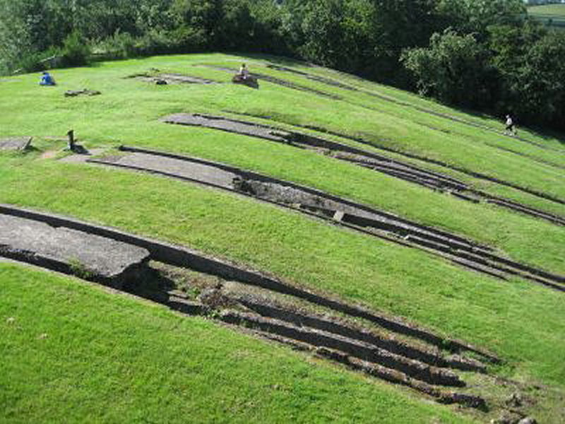
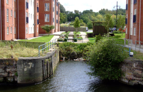
The site of the Inclined Plane today
Leamington Lift Bridge is a vertical lift bridge originally located at Fountainbridge on the Edinburgh Union Canal near the Edinburgh terminal basin of the canal. It was built by Armstrong and Whitworth of Newcastle in 1906 to replace a conventional brick bridge and is constructed from riveted mild steel. When the canal was shortened the bridge was relocated to its present location where the canal enters Lochrin Basin in 1922... the current Edinburgh terminus and replaced an earlier draw-type bridge. Originally the bridge was raised and lowered by an electric motor winching steel ropes over pulleys located at each corner of the bridge platform. After refurbishment in 2005 the electric motor was replaced with a pair of hydraulic rams which act on steel ropes and lift the bridge platform in the same way as when it was electrically raised.
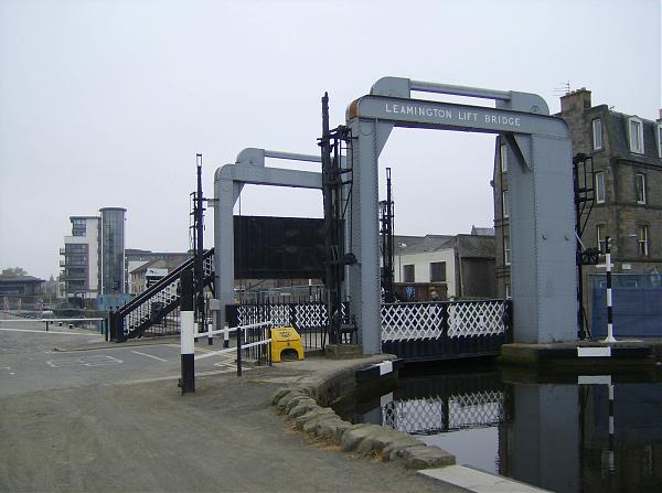
The refurbished Leamington Lift Bridge in its new location
(Photograph - James Gentles)
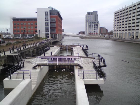
The entrance lock to the Pier Head Section
In the Nineteenth Century there was a navigable link between Liverpool's North and South Docks but the need for building land at the Pier Head necessitated the in-filling of George's Dock and Basin which contained this navigable connection. Consequently, in 1898 George's Dock and Basin were in-filled and the land reclaimed to accommodate construction of the Mersey Docks and Harbour Board building with the Cunard and Liver buildings following within the next ten years, thus completely severing the navigable link between the North and South Docks.
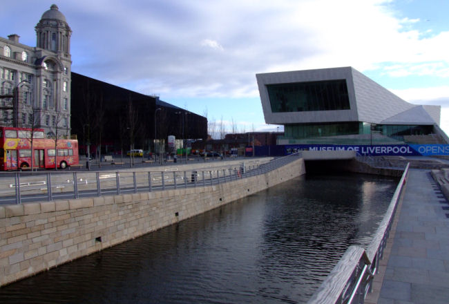
Two photographs of the Liverpool Docks Link at Liverpool's Pier Head
The full story of how the Liverpool Docks Link came about is documented in the Liverpool Link section of this website dedicated to it. Construction work on the Link commenced in 2006 and was opened in April 2009. Today it is a popular destination for canal boaters and its construction confirmed British Waterways confidence in extending the Leeds and Liverpool Canal to the Albert Dock.
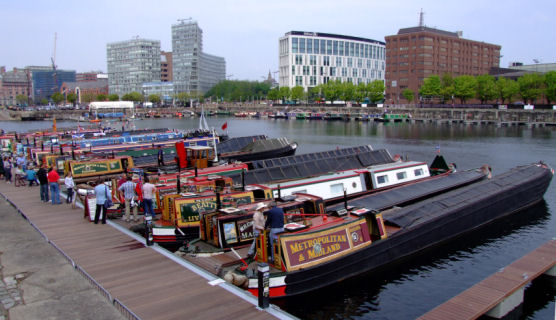
Narrowboats moored in Salthouse Dock - the Liverpool moorings for the Link
15 - Locomotive (aka Turnbridge) Bridge
Turnbridge Lift Bridge (also known as a Locomotive lift bridge) is a lift bridge which spans the Huddersfield Broad Canal at Turnbridge, Kirklees, West Yorkshire. Officially known as Turnbridge, it is bridge it is bridge number 17 on the Huddersfield Broad Canal. The bridge carries Quay Street over the canal close to the town centre and was built in 1865 to replace an earlier swing bridge. Boatmen used a windlass to wind a combination of wheels, chains and counter-weights to lift the deck of the bridge vertically out of the way of passing canal boats. The bridge was refurbished in 2002 and converted to electrical power at that time.
%20Bridge.jpg)
(Photograph - rmweb.co.uk)
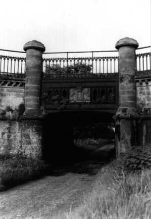
When John Rennie was building the Lancaster Canal one of the biggest obstacles he encountered was the River Lune near Lancaster. The river was crossed in 1797 by an impressive five arch stone aqueduct that at 202 mtrs (664 ft) in length and 18·6 mtrs (61 ft) above the River Lune even Thomas Telford would not be ashamed to call his own. Within the piers, special volcanic pozzolana powder was imported to be mixed with cement, which allowed the concrete to set under water. Because of the rush to finish the initial stages, before the winter floods, the construction was carried out around the clock and the final bill for the project was over £30,000 over budget (2.6 times the original estimate). This vast overspend was the reason that the Lancaster canal was never joined to the main canal network – there just wasn’t enough money for the planned aqueduct over the River Ribble at the southern end of the canal.
Foliage obscures the fourth and fifth arches on this photograph
As can be seen from the photographs not all of the spans can be seen at once due to tree and vegetation growth. When British Waterways undertook maintenance work on the aqueduct in 2011/2012 as well as removing graffiti, repairing the water channel and masonry some of the trees were removed to offer a better view of the structure (all five arches can now be seen from the riverside viewpoints) in addition to improving public access to the aqueduct..
Four of the arches of the Lune Aqueduct can be seen in this photograph
Marple Aqueduct carries the Lower Peak Forest Canal across the valley of the River Goyt a couple of hundred metres below the Marple Flight of Locks. It is 96 mtrs (315 feet) in length and the waterway is 27.4 mtrs (90 feet) above the level of the River Goyt. Designed by Benjamin Outram it features three semicircular solid masonry arches of spans 18.2m, 18m and 17.7m. Each arch has two rings of voussoirs, the lower on edge and the upper on flat. There are circular holes of 2.7 mtrs in diameter approximately through the spandrels either side of the upper parts of the piers, which feature narrow pilasters, the lower parts of which are in rough stone with rounded ends. Severe damage was caused during the hard winters of 1961/2 and 1962/3 when ice formed in the trough, expanding and causing the parapet wall to collapse. Public pressure saved the structure from demolition, however. Five steel braces composed of steel plates and tie bars were added to each arch as strengthening. The aqueduct is now a Scheduled Ancient Monument and due to vegetation and tree growth in the valley beneath it is notoriously difficult to photograph unless on a train passing over the adjacent railway viaduct.
(Photograph Stockport Photographic Archive)
When surveying the line of the Ellesmere Canal (now known as the Llangollen Canal) a major obstacle that faced William Jessop and Thomas Telford was the Vale of Llangollen through which flowed the River Dee. The engineers considered a flight of locks at each side of the valley with a small aqueduct to cross the river. Eventually it was decided to construct a high-level aqueduct across the valley. Telford, who worked under Jessop's directions, has taken all the credit for the construction of this remarkable feat of engineering possibly due to his designing and constructing the Longdon on Tern Aqueduct on the Shrewsbury Canal which, along with the smaller and earlier Chirk Aqueduct, acted as prototypes for Pontcysyllte.
The prototype for Pontcysyllte Aqueduct at Longdon on Tern
Construction began on the aqueduct on 17th July 1795. Opened in 1805 this 1007 foot aqueduct rises 121 feet above the River Dee as it takes the Llangollen Canal across the valley. A cast iron trough carries the channel over eighteen partially hollow masonry columns and includes a towpath cantilevered over the water channel in order to minimise the amount of water resistance to craft. On the towpath side, a railing separates pedestrians from the considerable drop but, on the opposite side, boaters look out on an uninterrupted view of the Dee Valley as the iron trough only extends a few inches above the waterline.
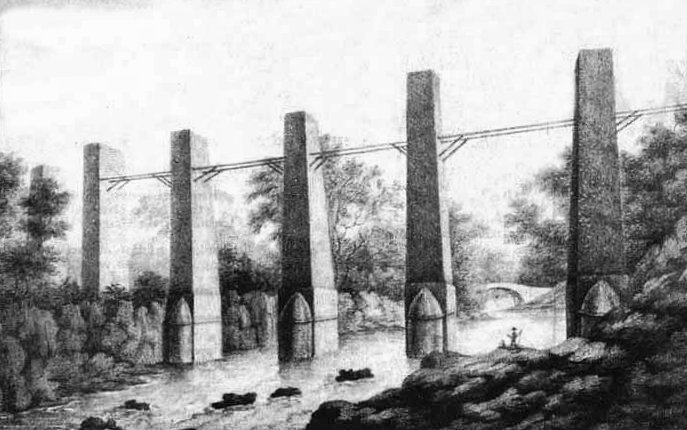
The partly constructed Pontcysyllte Aqueduct in 1797
(Illustration - Froncysyllte Village Website)
The image above shows the partially constructed aqueduct in 1797 when the uncompleted piers were only 84 ft high. A certain amount of artistic licence has been exercised by the artist as there should only be one pier in the river (unless it has shrunk over the last 200 years) also, the bridge in the distance is the hump-backed Pontcysyllte Bridge built in 1697 and is quite different to the existing bridge at this location which was constructed in the mid-1700’s. It is this bridge which gave the later aqueduct its name and literally translated means “the bridge that connects the river”.
A few years later with completed piers and arches showing the trough under construction
(Illustration - Canal and River Trust Archive)
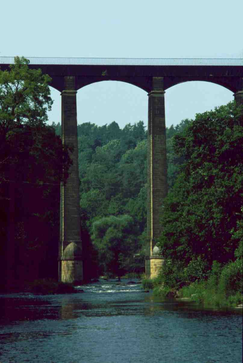
The two tallest (126 feet) columns of Pontcysyllte straddling the River Dee
On the opposite side to the towpath there are square holes in the top of the trough, possibly for a handrail similar to the one on the towpath side. The aqueduct crosses a fault line in the surrounding strata, movement of which has caused remedial work to be undertaken on a few occasions. Often, in the winter, the aqueduct is emptied of water for inspection and cleaning. When the water is drained, it empties into the River Dee below in a large plume, drenching anyone standing below.
![]()
Someone has pulled the plug out! Pontcysyllte Aqueduct being emptied for maintenance
From the onset of its construction, the aqueduct was under threat of being converted into a railway viaduct, a threat that was, thankfully, never realised. In September of 2009 the aqueduct along with the length of the Llangollen Canal from Chirk to Llantisilio (the Horseshoe Falls) was awarded World Heritage status (along with the Taj Mahal, the Great Wall of China and Liverpool's Historic Waterfront (Pier Head).
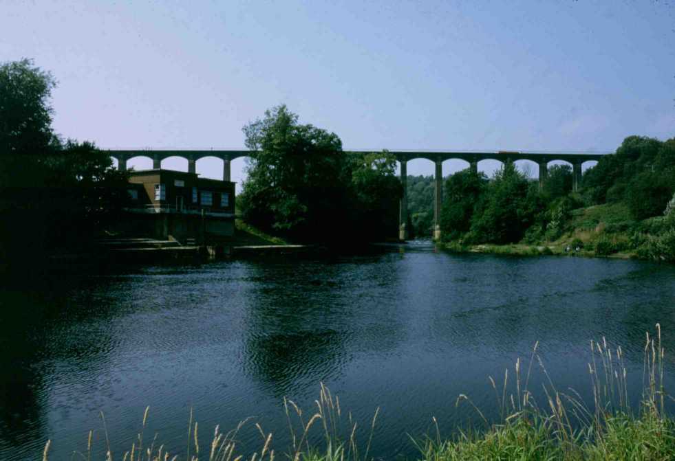
Pontcysyllte Aqueduct viewed from downstream with the pumping station on the left of the pool
Telford went on to construct other cast iron aqueducts... mainly on the Shropshire Union and Macclesfield Canals but none can match the Pontcysyllte Aqueduct for size and sheer scale of construction. Three of his other aqueducts of note are the Nantwich (S.U.C.), Stretton (S.U.C.) and Dog Lane (Macclesfield Canal) Aqueducts which share the same cast iron trough panels and are almost identical in design and dimensions. They were based on an earlier design first used at the Duke's Drive or Kinnersley Aqueduct on the Shrewsbury Canal which may have pre-dated Longdon on Tern and Benjamin Outram's Holmes Aqueduct on the Derby Canal. The Holmes Aqueduct is generally believed to have been the World's first cast iron aqueduct pre-dating Longdon on Tern by a matter of weeks and as Duke's Drive may have pre-dated Longdon on Tern it could have actually been the first cast iron aqueduct. Duke's Drive Aqueduct was demolished in the mid-1960s.
Duke's Drive (or Kynnersley) Aqueduct on the Shrewsbury Canal, sadly now demolished
(Photograph - Canal & River Trust)
Nantwich Aqueduct on the Shropshire Union Canal Main Line
Stretton Aqueduct near Brewood on the Shropshire Union Canal Main Line
Dog Lane Aqueduct in Congleton on the Macclesfield Canal
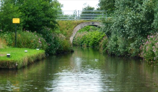
Another of British Waterways “Millennium Projects" is the Ribble Millennium Link. The link connects the previously isolated Lancaster Canal at Preston to the Leeds and Liverpool Canal Rufford Branch via the tidal Rivers Douglas and Ribble. Historically, the part of the Leeds and Liverpool Canal from the top of the Wigan Twenty One Locks to the foot of Johnson’s Hillock Locks was part of the Lancaster Canal. At the bottom of the Johnson’s Hillock Locks can be seen the remains of the canal that heads away to the north and was intended to lead to a massive aqueduct across the River Ribble valley. This would have connected the Lancaster Canal to the main canal network directly but due to financial constraints this aqueduct was never constructed and the Lancaster Canal has remained an isolated waterway. However, in place of an aqueduct a tramway was constructed which crossed the Ribble on a slender viaduct that has since been demolished.
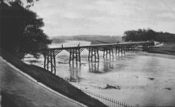
The trestle bridge that carried the Lancaster Canal Tramway across the River Ribble
Canal enthusiasts have been campaigning many years for a waterway to connect the “Lanc” to the rest of the canal system and proposed making navigable the Savick Brook which runs into the River Ribble between the confluence of the River Douglas and Preston Docks entrance. The Brook forms a major part of a new stretch of waterway containing eight locks, one of which is a three-step staircase lock leading to a holding basin and the junction with the Lancaster Canal near Preston. Their dreams finally came true in July 2002 when the first craft navigated the first new stretch of canal to be built in this country for nearly one hundred years (since the Manchester Ship Canal was opened in 1894). This 6·4 km (2·5 mile) stretch of canal features eight locks and was constructed at a cost of £5·4M. The total cost of construction was funded by a range of public, private and voluntary organizations.
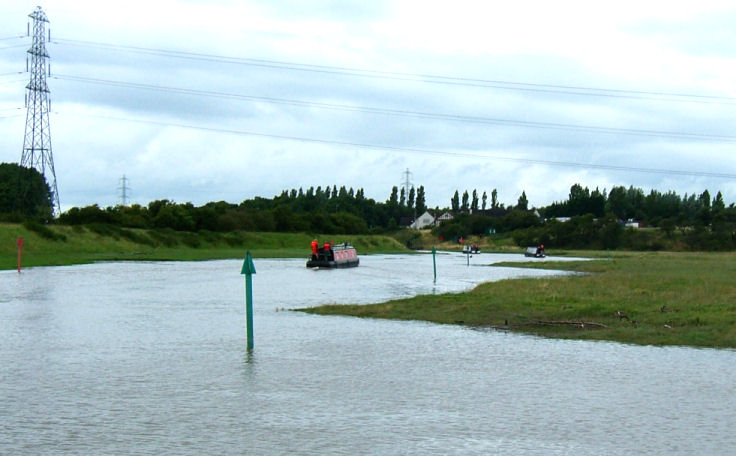
Entering the Savick Brook aka Ribble Link from the tidal River Ribble
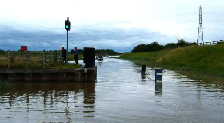
The rotary "rising sector" gate at the start of the Savick Brook
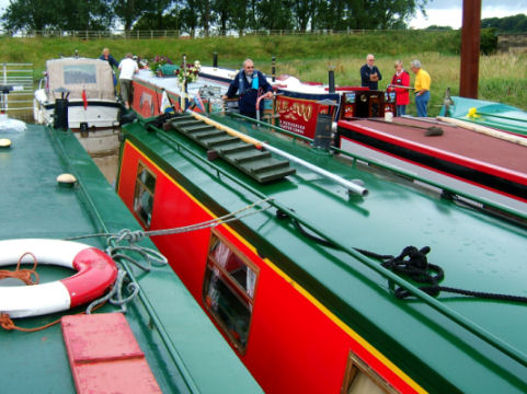
Boats moored at the holding point awaiting the right tidal conditions to preceed
One of the lock landings and new bridges along the Ribble Link
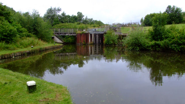
The Ribble Link Staircase Lock and turning basin
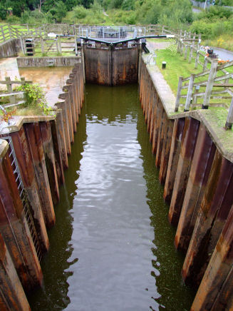
Looking down the staircase lock at the top of the Ribble Link
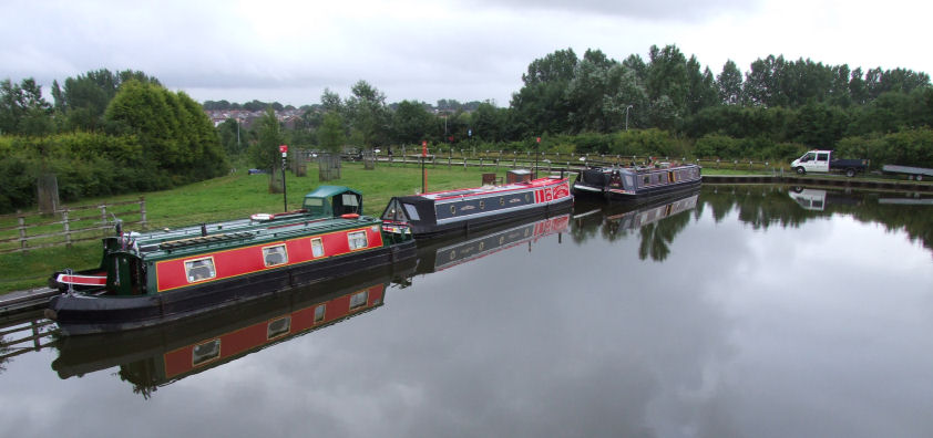
Craft moored in the holding basin at the top of the Ribble Link
The new length of canal is reached from the River Ribble via the Savick Brook where a rotary "rising sector" gate (similar in principle to the Thames Barrier but on a much smaller scale) allows access prior to high tide. Craft then wait until high tide in a holding area before proceeding along the link which contains new bridges and locks and is very narrow in parts. The last lock is a three-step staircase lock and craft are recommended to reverse into it due to there not being sufficient room or depth of water to turn the sharp bend immediately before it. Prior arrangements have to be made with the Canal and River Trust to coincide with tides, weather conditions, other boat movements, etc. If you would like to read about our adventures on the Rivers Douglas and Ribble, Preston Docks, Ribble Link and Lancaster Canal go to Canalscape Book Five - Lancaster Loiter.
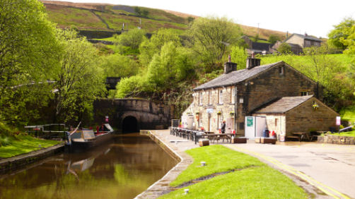
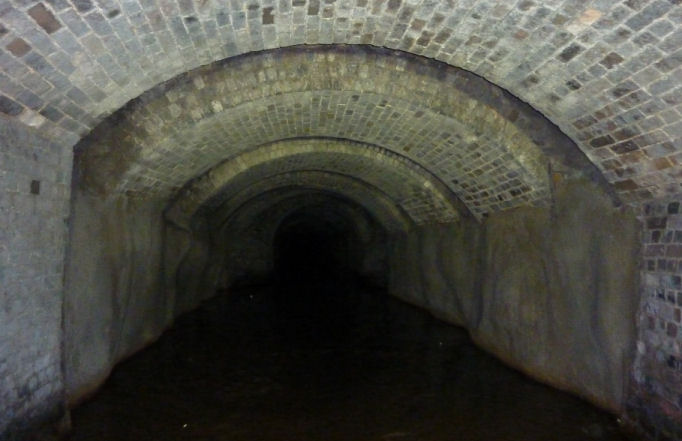
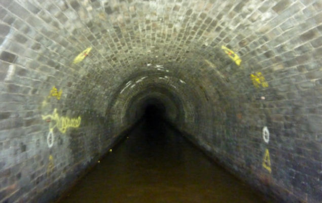
The eastern portal of Standedge Tunnel at Marsden, West Yorkshire and the adjacent café
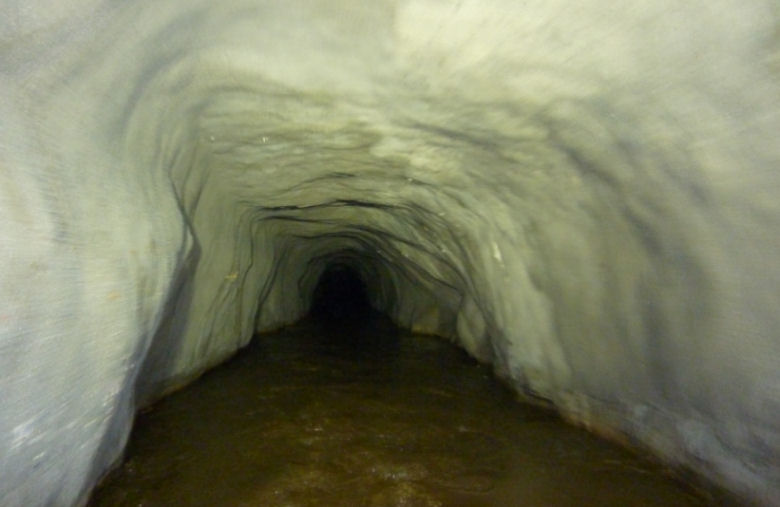
Britain's longest and highest canal tunnel is the Standedge Tunnel located on the Huddersfield Narrow Canal where the route passes through Standedge Hill in the Pennines between Diggle in the west and Marsden in the east. The tunnel is 5029 metres (5500 yards - 3·1 miles) in length and is 196 mtrs (643 ft) above sea level. Construction of the canal was fraught with financial and engineering problems. Consequently, construction work came to a standstill leaving Standedge Tunnel unfinished. More capital was raised and repairs carried out, but the company desperately needed the revenue from carrying goods, so a system was set up of transporting cargo by horse between Marsden and Dobcross on the two completed sections of canal. Following the canal's engineer... Benjamin Outram's resignation, Thomas Telford was called in to advise on the tunnel's completion. Excavation had been taking place, not only from each end, but also from the bottom of the air shafts (the spoil was hoisted up the shafts and dumped nearby, where it can still be seen). This led to the tunnel being somewhat crooked and Telford discovered that, at one point, the two excavations were not going to meet and that if they were not careful they were going to end up with two tunnels! Correcting this has resulted in the tunnel having noticeable bends near to the centre!
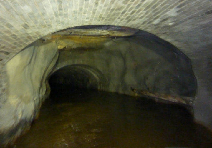
One of the "S" bends within the tunnel
Craft can pass in this wide section
The tunnel was eventually opened in 1811 and the canal became a through route 17 years after work began. The first boat through Standedge Tunnel, "Lively Lady" emerged to the sound of church bells and a band playing "Rule Britannia". Using the tunnel wasn't an easy option for the boatmen, however. To keep costs down, the tunnel was built without a towpath. While the horses were led over the hill, the boatmen had to “leg” the boat through the tunnel by lying on boards across the front of the boat and walking along the walls or roof of the tunnel, which took up to four hours.
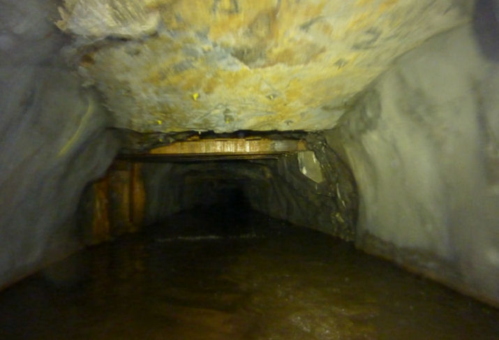
An engineering brick lined gallery section
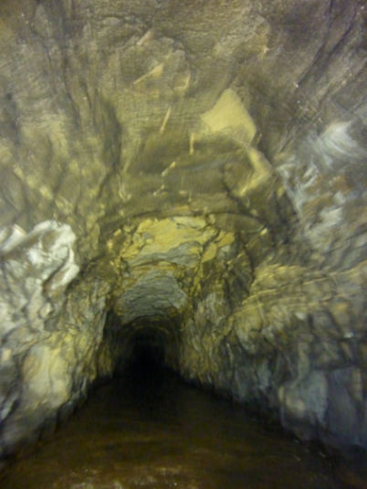
A bare rock section
Sprayed concrete covers loose rock at several locations
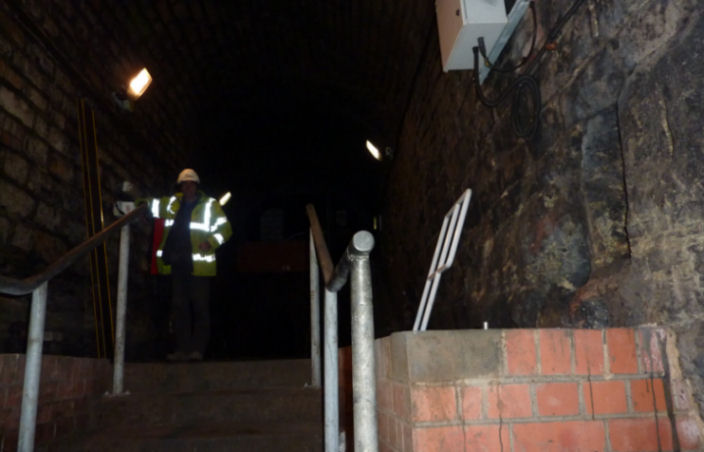
Canal and River Trust employees check on the progress of craft from a side gallery
Yorkshire stone bricks line this section
The western portal at Diggle in Lancashire
Along with a large proportion of our canal system, the 1944 Canal Transportation Act closed the canal and in 1948 Robert Aickman and Tom Rolt (both co-founders of The Inland Waterways Association) made what was probably the last official transit of the whole length of the canal, including the three miles through the tunnel. From that time the canal was un-navigable and was subject to a long-term restoration programme which ended with the reopening of the waterway in May 2001 complete with through navigation of Standedge Tunnel. A new visitor centre was established in the disused warehouses at the Marsden (eastern) end of the tunnel and was opened by Lily Turner whose father... Davis Whitehead was the fastest legger through the tunnel in 1914.
The Visitor Centre
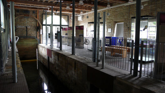
Inside the Visitor Centre
Originally, leisure craft were not allowed to pass through the tunnel under their own power and were towed by an electrically propelled tug in a convoy of up to four boats plus a passenger module for crew and visitors but this practice has now ended and boats negotiate the tunnel under their own power but with a Canal and River Trust employee on board. Progress of craft is monitored by Canal and River Trust personnel travelling along the disused single track railway tunnel that is adjacent to the canal tunnel and connected by side galleries. For further information visit the Canal and River Trust Standedge Tunnel Web Page. Our passage through Standedge Tunnel is documented in Canalscape Book 10.
Conclusion
In addition to the new Wonders of the Waterways there are likely to be more wonders on the way. A revolutionary inclined plane is rumoured for the Northern Reaches of the Lancaster Canal to replace Tewitfield Locks which were decimated when the M6 motorway was constructed, plus another connecting the Middlewich Arm of the Shropshire Union Canal with Winsford Top Flash on the River Weaver and possibly yet another at the start of the Newport Branch of the Shropshire Union Canal near Norbury (the plans of which are currently under review). The Foxton Inclined Plane is another possibility if it is rebuilt but, it is more likely to be rebuilt in a modified form of its original design using a single counterbalanced caisson mounted on railway lines… not unlike the Anderton Lift running at an angle.
Tewitfield Locks decimated by the construction of the M6 motorway
There has long been the need for a waterway connecting the Bedford River Ouse with the Grand Union Canal near what is today Milton Keynes and it now looks as though the Bedford-Milton Keynes Link may well be constructed. One revolutionary (literally) solution to overcoming a change of levels on this canal without resorting to locks or a boat lift is the "Brogborough Whirl". Basically similar to an inclined plane such as at Foxton, Trench or Ketley with boats floating in caissons ascending the change in levels but designed as a 360° spiral rather than a straight slope. When completed this structure would be as innovative as the Falkirk Wheel and as popular as the Anderton Lift. Consequently it would attract visitors from all over the country and (hopefully) all over the world as well.
A model of the "revolutionary" Brogborough Whirl
(Photograph - Bedford-Milton Keynes Waterways Trust)
Trench Inclined Plane on the Shrewsbury Canal
(Photograph - Canal and River Trust)
Another revolutionary device for raising and lowering boats without the need for conventional locks is the Diagonal Lock. It is a cross between an inclined plane (basically a funicular railway for boats) and a water slope (as used on the Canal du Midi) and could be the answer to canal restorers' prayers when a stretch of canal has to be realigned and a steep change of height is required. Boats would be raised or lowered through a diagonal tube that is filled or emptied of water depending upon the direction of travel. The brainchild of Terry Fogarty it has the support of the Canal and River Trust, was featured in the "Waterworld" TV series and could be an attraction on restored waterways in the future. For more information and an excellent animated demonstration go to go to http://www.diagonallock.org.
Montech Water Slope on the Canal du Midi
(Photograph - Barging in France)
 |
 |
Artist's impression of how a Diagonal Lock may look
(CGI - Diagonal Lock Advisory Group)
There has long been a plan to reinstate the locks on the Bridgewater Canal at Runcorn that ran from Waterloo Bridge (the current terminus) to the Manchester Ship Canal adjacent to Bridgewater House. There were originally two lines of locks... the Old Line and the New Line, both of which were in-filled around 1966. The proposal is to reinstate the Old Line of Locks which would create a through route to the River Weaver via the Manchester Ship Canal without the need to use the Anderton Boat Lift and create a small circular cruising route that includes the under used Runcorn Arm of the Bridgewater Canal, the Manchester Ship Canal, River Weaver Navigation and the River Weaver itself. This plan is a distinct possibility with the formation of the Runcorn Locks Restoration Society and a pledge from Peel Holdings and Halton Borough Council that when the River Mersey Second Crossing is completed in 2016, changes made to the approach roads to the existing Jubilee Runcorn Suspension Bridge will allow reinstatement of one flight of locks on the Bridgewater Canal leading to the Manchester Ship Canal. The buried locks and the route of the canal between Top Locks at Waterloo Bridge and the Manchester Ship Canal is protected, ready to be reinstated when the time comes. There is a more modest plan to excavate the top lock to illustrate what might take place in the not too distant future.
Looking down the New Line of Locks at Runcorn in the mid-1960s prior to in-filling
The protected route of Runcorn Locks as seen from the Manchester Ship Canal
It is gratifying to note that most of the original wonders and the most of the later ones are located in the North of Britain. No doubt, there will be other ventures worthy of being added to this list in the not too distant future. I wait with baited breath and can't wait to see what the future holds for us on this subject.
or select another book below...
|
Contents Click here for the latest entries or on the required section in the Contents below to follow links |
|
|
|
Introduction |
|
|
|
|
|
|
|
|
|
|
|
|
|
|
|
|
|
|
|
|
Book 7 - 2011 |
|
|
|
|
|
|
|
|
Book 10 - 2014 |
| The Manchester and Salford Junction Canal | |
| Mersey Connections | |
| NB Squirrel | |
| NB Total Eclipse | |
| Don't Call it a Barge | |
| Canalscape Photography | |
| Lymm Cruising Club Website | |
| Footnote and Acknowledgements | |
| Return to Top | |
| Go to the | |
|
|
|
| Website | |
|
|
|
"Canalscape" and "Diarama" names and logo are copyright |
Updated 06-06-2014