A Local History of the Wirral Peninsula
An eBook by Cyril J Wood
![]()
Multi-Media
![]()
Disclaimer
Author cannot be held responsible for any disputes caused by information included within this eBook. While all attempts have been made to verify information provided, the Author does not assume any responsibility for errors, omissions or contrary interpretation of the subject matter herein. Any perceived slights of specific people or organizations are unintentional. Information contained within this eBook is provided solely for the user's information and, while thought to be accurate, is provided strictly "as is" and without warranty of any kind, either expressed or implied. The Author will not be liable to the readers for any damages, direct or indirect, arising out of use of information provided within this eBook. Proceeding beyond this page acknowledges acceptance of this disclaimer.
|
Chapter 15 |
|
Click on Chapter or Title to follow links
The Wirral Peninsula is a piece of land surrounded by water on three sides. To the west is the River Mersey, to the east is the River Dee and to the north is part of the Irish Sea known as Liverpool Bay. On the southern side the peninsula is connected to the Cheshire Plain. The Peninsula was formed during after the last Ice Age when water from the melting glaciers scoured the routes through the Cheshire Plain for what are today the rivers Dee and Mersey.
|
Map of the Wirral Peninsula |
Key |
|
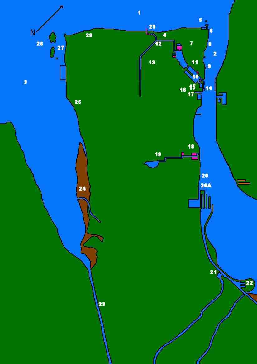 |
1 | Liverpool Bay |
| 2 | River Mersey | |
| 3 | River Dee | |
| 4 | Leasowe Embankment Sea Defences | |
| 5 | Perch (Black) Rock Lighthouse and Battary | |
| 6 | Mersey Ferries - Location of New Brighton Pier and Ferry | |
| 7 | Withens Lane College, Mariners and Central Parks | |
| 8 | Mersey Ferries - Location of Egremont Ferry | |
| 9 | Mersey Ferries - Seacombe | |
| 10 | Wallasey Pool and Docks | |
| 11 | Mersey Tunnel - Wallasey | |
| 12 | Rivers Birkett and Fender | |
| 13 | Bidston Hill, Village Bidston and Observatory | |
| 14 | Mersey Ferries - Woodside | |
| 15 | Hamilton Square and Birkenhead Tramway | |
| 16 | Mersey Tunnel - Birkenhead | |
| 17 | Birkenhead Priory | |
| 18 | Port Sunlight Factory and Dock | |
| 19 | Raby Mere and River Dibbins | |
| 20 | Mersey Ferries - Location of Eastham Ferry and Carlett Park College | |
| 20A | Manchester Ship Canal Entrance Locks | |
| 21 | Telford's Lighthouse, Boat Museum and Shropshire Union Canal | |
| 22 | River Gowy - Stanlow Island | |
| 23 | Canalised River Dee - Queensferry | |
| 24 | Burton Marshes | |
| 25 | Thurstaston Hill & Cliffs | |
| 26 | Hilbre Islands | |
| 27 | West Kirby Lighthouse | |
| 28 | Hoylake Lighthouse | |
| 29 | Leasowe Lighthouse and Lingham Lane | |
The name Wirral is derived from the Gaelic meaning “Wyre Heal” or “Myrtle Corner”. This is because of the peninsula being heavily forested in the past. The area was populated by large amounts of deer and other game, so much so that in Medieval times kings and noblemen used the area for hunting. The emblem of Wirral is the Wirral Horn. The Horn is a brass tipped hunting horn used by the foresters of Wirral and is portrayed in many of the Coats of Arms associated with the peninsula. The horn was given to Alan Sylvester... the first Forrester of Wirral and has passed through thirty generations to the present owner... the Honourable Vivian Baring who has leant it to Wirral Museums where it has been on display.
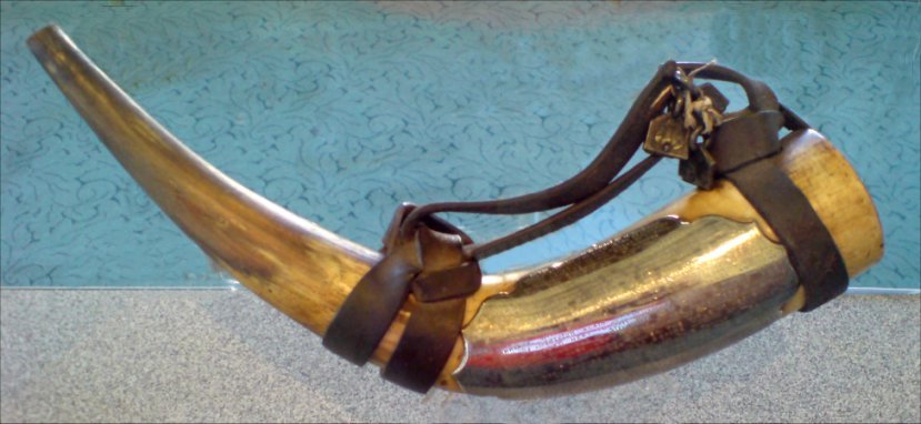
The Wirral Horn
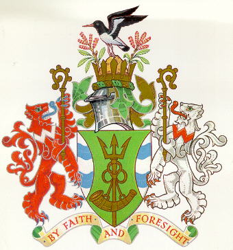
The Wirral Coat of Arms featuring the Wirral Horn attached to the trident on the green shield
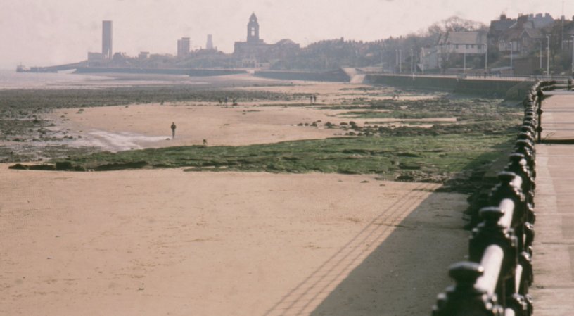
Looking towards Egremont and Seacombe from Magazines Promenade near Vale Park, New Brighton
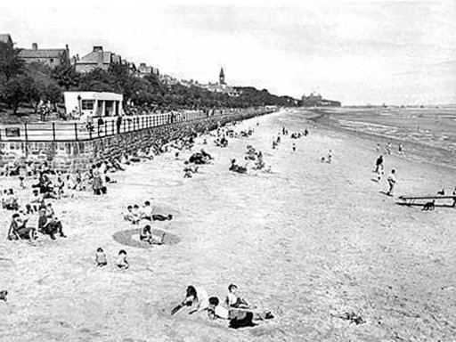
Egremont Promenade looking towards New Brighton from Egremont Ferry in the 1950's...
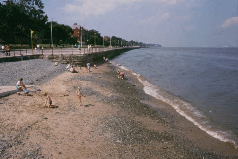
... and the same location as it was in 2003. Many changes have been made
Geographically speaking, the Wirral Peninsula was always situated in Cheshire, in fact, Hilbre Islands are also known as "The Cheshire Islands". But the boundary reforms of 1974 created the new county of Merseyside into which, the Wirral Peninsula was absorbed. Many residents mourned the leaving of Cheshire but they were placated in 1999 when the postal codes and postal county changed to Chester codes (e.g. from L44 to CH44) and the formation of Wirral as a new “Postal County”, however, there are plans to re-integrate Wirral into Cheshire from a political standpoint.
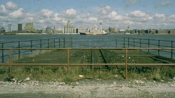
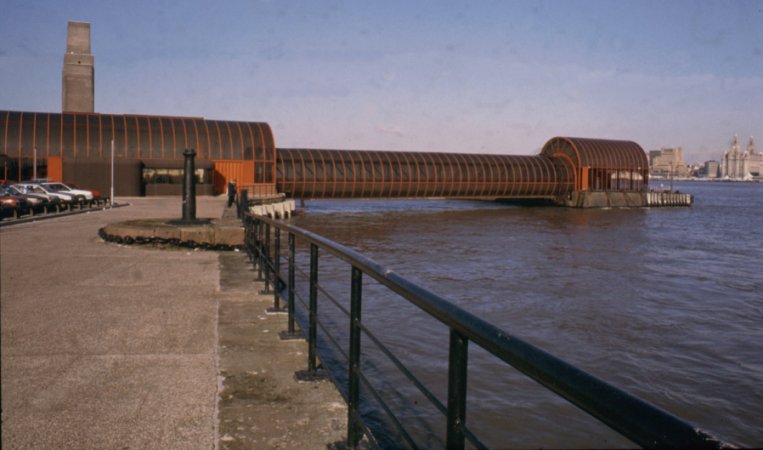
Liverpool's Pier Head as seen from the old Wallasey Landing Stage behind Wallasey Dock in 1992
The Irish Roll-On-Roll-Off Ferry Terminal is located at what was once Wallasey Landing Stage
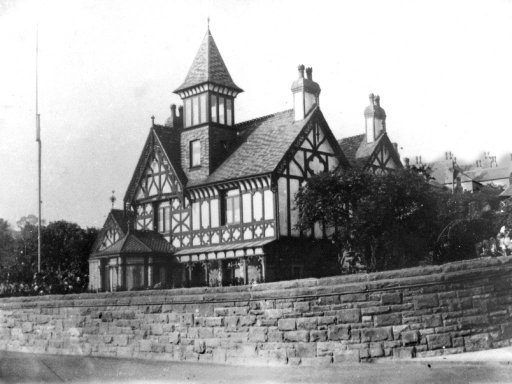
Birkenhead's Woodside Ferry Terminus
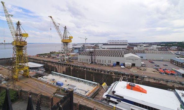
Cammell Lairds Shipyard as seen from St Mary's Tower in Birkenhead Priory
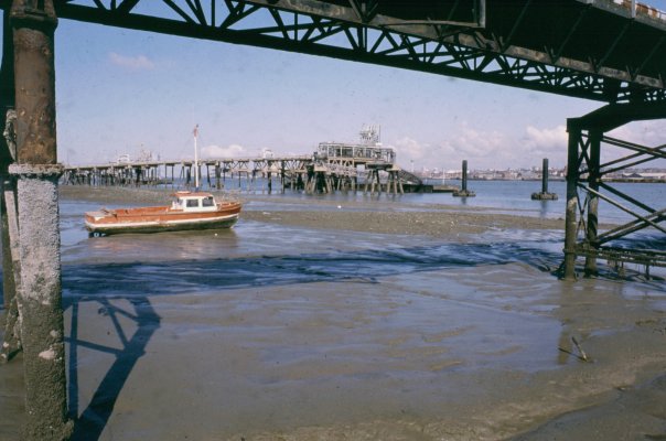
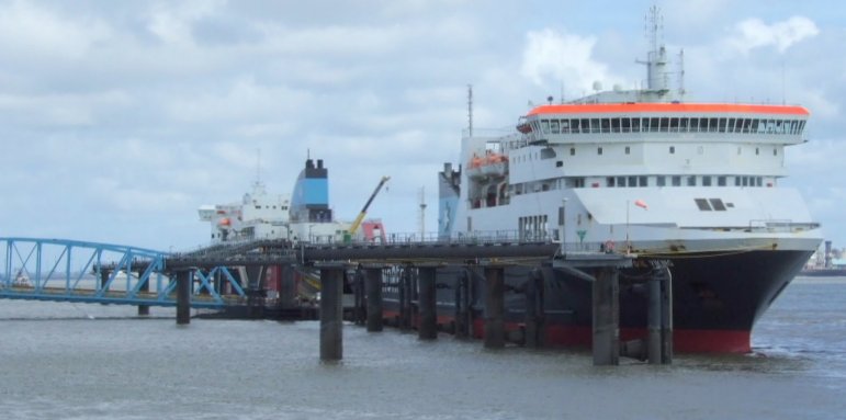
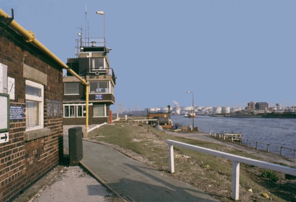
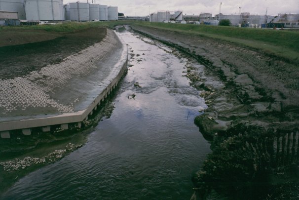
Tranmere Oil Terminal from beneath the old Rock Ferry Pier
Today, the peninsula possesses many contrasts. The River Mersey shoreline is heavily industrialised with the remains of the Cammell Lairds shipyard, Port Sunlight (responsible for producing many of our well known detergents and edible oil-based products), Stanlow Oil Refinery, the start of the Manchester Ship Canal, Vauxhall Motors (the home of the “Astra” and GM compact V6 Engine”), Bowater’s Paper Mills and many other factories producing products with familiar household names. But this does not prevent industry and areas of natural beauty from co-existing. An example of this is Stanlow Island, an island that is only accessible by boat and situated adjacent to the oil refinery. In years gone by there was a monastery on the Island but was dissolved and relocated in Whalley near Blackburn due to the buildings being ravaged by storms and the encroachment of the River Mersey.
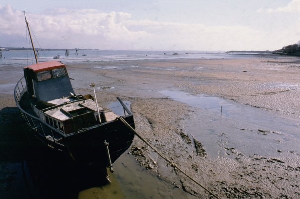
Rock Ferry Shore where Isambard Kingdom Brunel's Great Eastern was dismantled
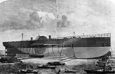
Isambard Kingdom Brunel's Great Eastern being dismantled
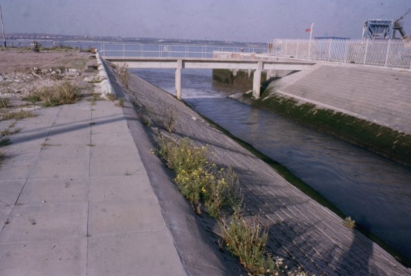
The entrance to Bromborough Pool from the River Mersey
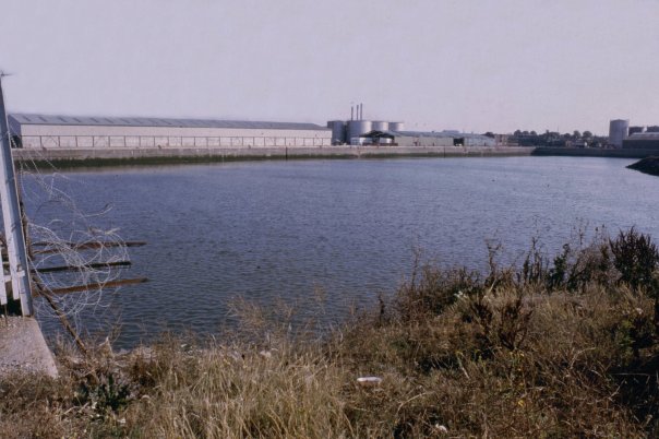
Bromborough Pool prior to infilling in 1988
Looking towards Job's Ferry from Eastham Ferry
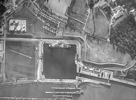
An aerial view of Eastham Locks in the 1970s
The sluice controlling the River Rivacre after it siphons beneath the Manchester Ship Canal
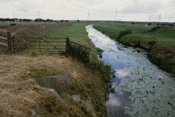
On the southern side of the Island, the River Gowy is siphoned beneath the Manchester Ship Canal after winding its way through rural Cheshire and the oil refinery. This small river, which rises on the Cheshire Plain close to Beeston Castle, forms part of the Wirral Peninsula’s southern geographical boundary.
Stanlow Island
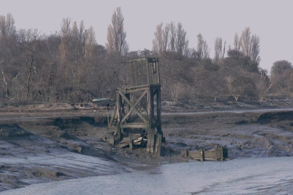
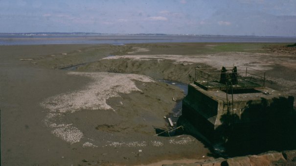
A tidal refuge on the River Gowy adjacent to Stanlow Island
The semi-tidal River Gowy flows through the centre of Stanlow Oil Refinery
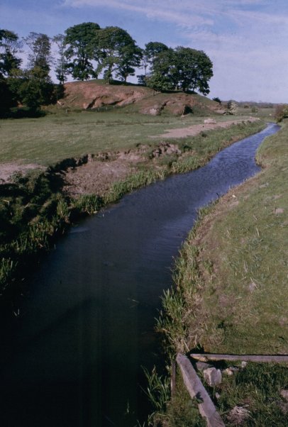
The now non-tidal River Gowy forms part of the southern boundary of the Wirral Peninsula near Stoak Picton
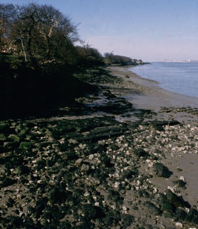
The River Dee shoreline of the Peninsula is more rural with little or no industry to taint its natural beauty. Nestling in this area are the picturesque villages of Burton, Gayton and Parkgate. Neston once had a coalmine, which ran beneath the River Dee estuary towards the Welsh shoreline. The mine was running at a loss and was closed in 1927. The mine’s slag tip still exists and can be seen close to Denhall Quay, one of the disused quays along the River Dee shoreline.
The Shotwick Brook winds it's way onto the marshes lining the River Dee Estuary
Denhall Quay near Neston where boats once docked is now literally miles away from the river across the marshes
The Neston Mine slag tip overlooking the marshes
Parkgate Promenade only sees high tide a couple of times every year
Thurstaston Cliffs between Heswall and West Kirby
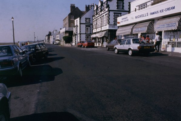
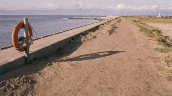
The Northern shoreline has many large residential areas such as West Kirby, Hoylake, Meols and Moreton. Moreton was home to the Premier Brands factory. Formerly known as Cadbury’s, the factory produces Burtons biscuits and cakes as well as tea under many well-known household brand names. There was also a quarry and brick making plant opposite the Cadbury’s factory but this closed down in the early 1970’s (see Chapter Six… Lingham Lane, Moreton). The quarries are now part of a Wirral Coastal Park nature reserve. There is an old disused lighthouse at Moreton… Leasowe Lighthouse, built in 1763 and said to have it’s foundations on bales of cotton rescued from a ship that foundered close by (see Chapter Five… Wirral Lighthouses).
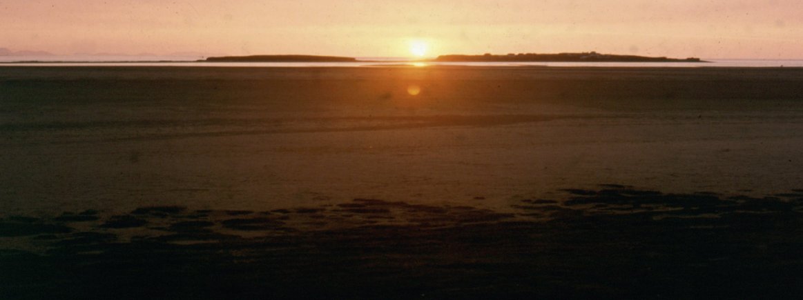
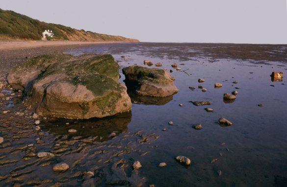
Sunset over Hilbre Islands
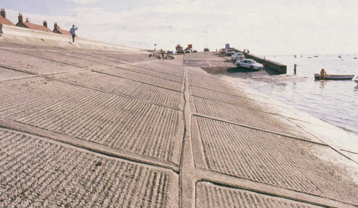
The Embankment at Meols...
... and approaching Leasowe
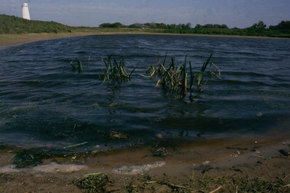
The lake behind Leasowe Lighthouse close to the source of the River Birkett
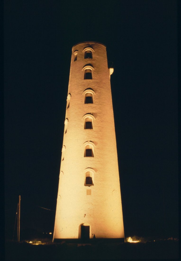
Leasowe Lighthouse illuminated at night
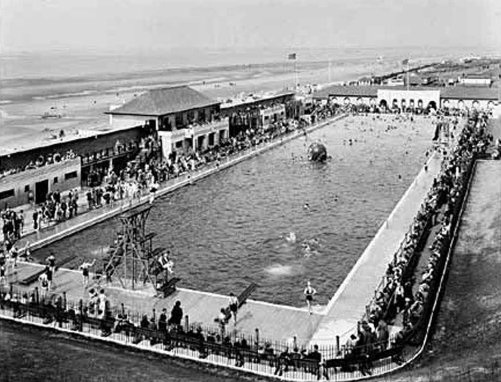
Derby Pool in it's heyday...
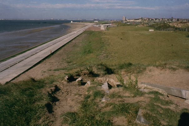
... and from almost the same viewpoint today looking towards New Brighton
In the 1600’s, 1700’s and 1800’s, the Wirral was renowned for smuggling and wrecking. There are many places that were retreats for smugglers and wreckers such as “Old Mother Redcap’s” and the “Rednoses” in what is now New Brighton, Wallasey Pool (now Wallasey and Birkenhead Docks, Hilbre Island, Thurstaston. Each of these locations has numerous tales of skirmishes with the local Contraband Officers (forerunners of the Customs and Excise) and the press gangs, which would force the unwary into maritime service against their will.
The area between the Red Noses and Perch Rock is currently undergoing a change. Construction work commenced in March 2010 on the Neptune Project. This prestigious development includes three main buildings one of which will house a pioneering six screen, 1000 seat digital cinema. Also in the development is an indoor children's play area, a sixty six Travelodge hotel, Grosvenor Casino, Home and Bargain store and a Morrison's supermarket. There is also be a large pedestrian street separating this from a crescent shaped second building which contains restaurants and bars fronting the existing Marine Lake which provides the focus for leisure use. The Western end of the site will see a new public lido and a car par providing 750 spaces to cater for the amount of visitors that the development is expected to encourage. Thereis also a water sports training facility with its own purpose built pontoon in the adjacent marine lake.
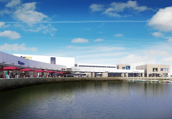
The Neptune Development in New Brighton
(CGI - Neptune Developments)
Also in New Brighton, is situated the Perch Rock Battary and Lighthouse. The Battary was constructed to ward off any unwanted Napoleonic visitors but was never used in anger (see Chapter Ten - The Black Rock). Opposite Perch Rock is the rebuilt Floral Pavilion theatre.
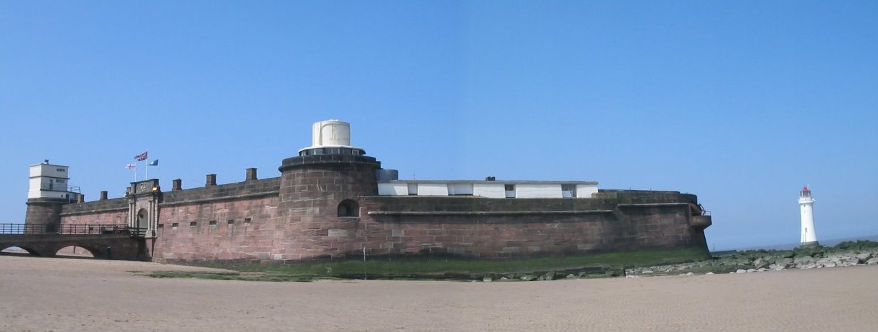
Fort Perch Rock and Lighthouse in New Brighton
Old Mother Redcap's was located at the bottom of Caithness Drive
Old Mother Redcap's was a building dating back to 1595 and was located on Egremont Promenade at the bottom of Caithness Drive. It was once home to one of Wallasey's notorious characters... Old Mother Redcap... the story of whom is related in Chapter Three - Wealas Eye.
Wallasey’s name is derived from the Gaelic “Wealas Eye”, which roughly translated means Welshman’s or Stranger’s Isle. Wallasey was an island at high tide, being cut-off from the surrounding land by Wallasey Pool and Moreton Marshes which were drained in the 1800’s with the building of a sea wall along the Liverpool Bay coastline. Today it is still impossible to enter or leave Wallasey without crossing water of some description whether it be the River Birkett, Wallasey and Birkenhead Docks or the River Mersey. Wallasey may well be one of the longest established dwelling places on the Wirral. When excavations on Saint Hilary’s Brow (the highest point in the town) were taking place in the last century, artefacts dating from the Stone and Iron Ages were discovered indicating the existence of ancient dwellings.
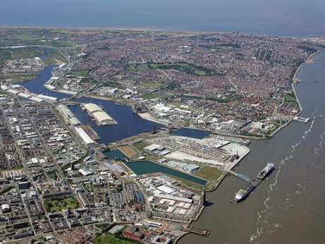
An aerial photograph illustrating the geography of Wallasey
Wallasey Pool better known as Wallasey and Birkenhead Docks
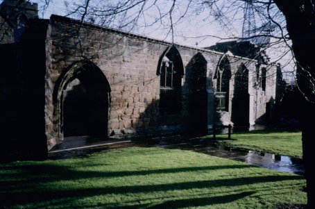
Birkenhead, the largest town on the peninsula, has its roots in an ancient priory (see Chapter Nine - Birkenhead Priory) that was built on a headland jutting out into the Mersey boarded by Wallasey and Tranmere Pools. It was referred to as the “Headland of the Birches” (due to the large number of Birch trees that grew there), which, over the years, was shortened to “Birchen Head” and then Birkenhead.
Birkenhead Priory adjacent to Cammell Lairds Ship Yard
In the late 1800’s, John Laird developed his shipyard, reclaimed land from the river that formed the headland and also designed the town plan that still exists today. Some of the Victorian architecture from his plans are amongst the finest examples of the era surviving in this country. Birkenhead also has the distinction of possessing the first public tramway in Great Britain and was conceived by the visiting American, George Train. The town also possessed the world’s first traffic lights. Birkenhead has a grand park... Birkenhead Park. The park was an integral part of William Laird’s great vision for Birkenhead and was designed by William Paxton, the plans for which were the inspiration for New York’s Central Park.
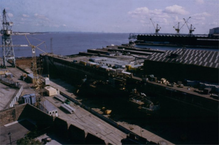
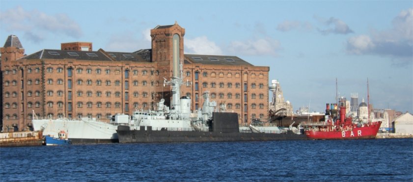
St Mary's Clock Tower in Birkenhead Priory gives good views of Cammell Lairds Shipyard
(Note the submarine H.M.S. Unseen in the dry dock)
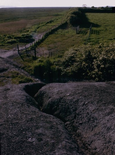
The interior of the Wirral has vast area of natural beauty punctuated by small picturesque villages. These villages have names like Thingwall… home to the “Thing” or “Hundred of Wirral” which was the medieval administration of the peninsula as mentioned in the Doomsday Book. Willaston is the home of the “Wirral Stone”, a large granite boulder deposited during the retreating glaciers of the Ice Age. Thurstaston… named after “Thor’s Stone” up on Thurstaston Hill overlooking the Dee estuary and tucked away between the cliffs on the River Dee and the hill is the village of Thurstaston itself. There are many more places of interest within the Peninsula but lack of space precludes their mention.
The chapters listed in the Contents deal with individual aspects of the Peninsula’s history and geography
or click on the required section below to follow links on the Diarama website
| Introduction |
| Wheels and Props |
| Diarama Photography |
| Audio and Hi-Fi |
| Transporter Bridges |
| Half Term Adventure |
| Footnote and About the Author |
|
|
![]()
![]()
Multi-Media
Updated 11-12-2013